Jalisco Ranch- Tecomate La Perla
$4,535,310|Last Updated: Oct 2, 2025
MLS#1077240
San Ygnacio, Zapata County, Texas
Status:Active


Property Type
- Ranch
- Acreage
- Recreational Land
- Hunting Land
- Fishing Land
Acreage
802 acres
County
Zapata
Format
Sale
Features
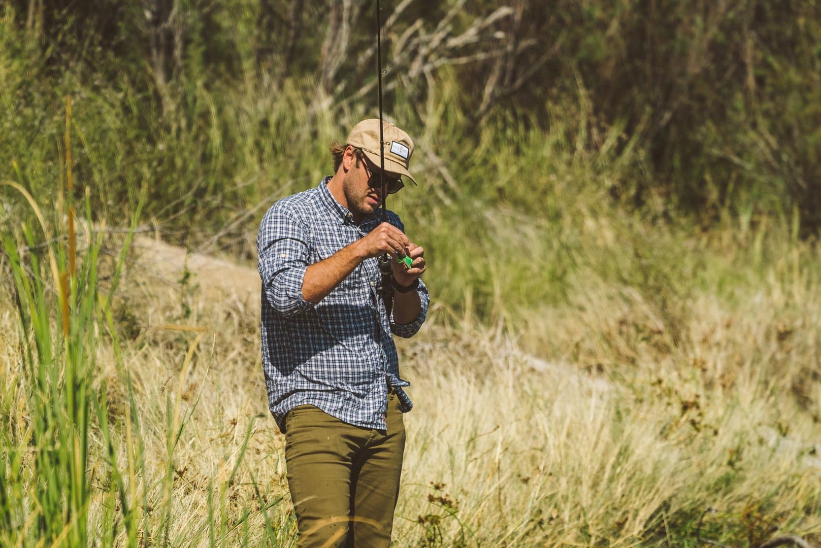
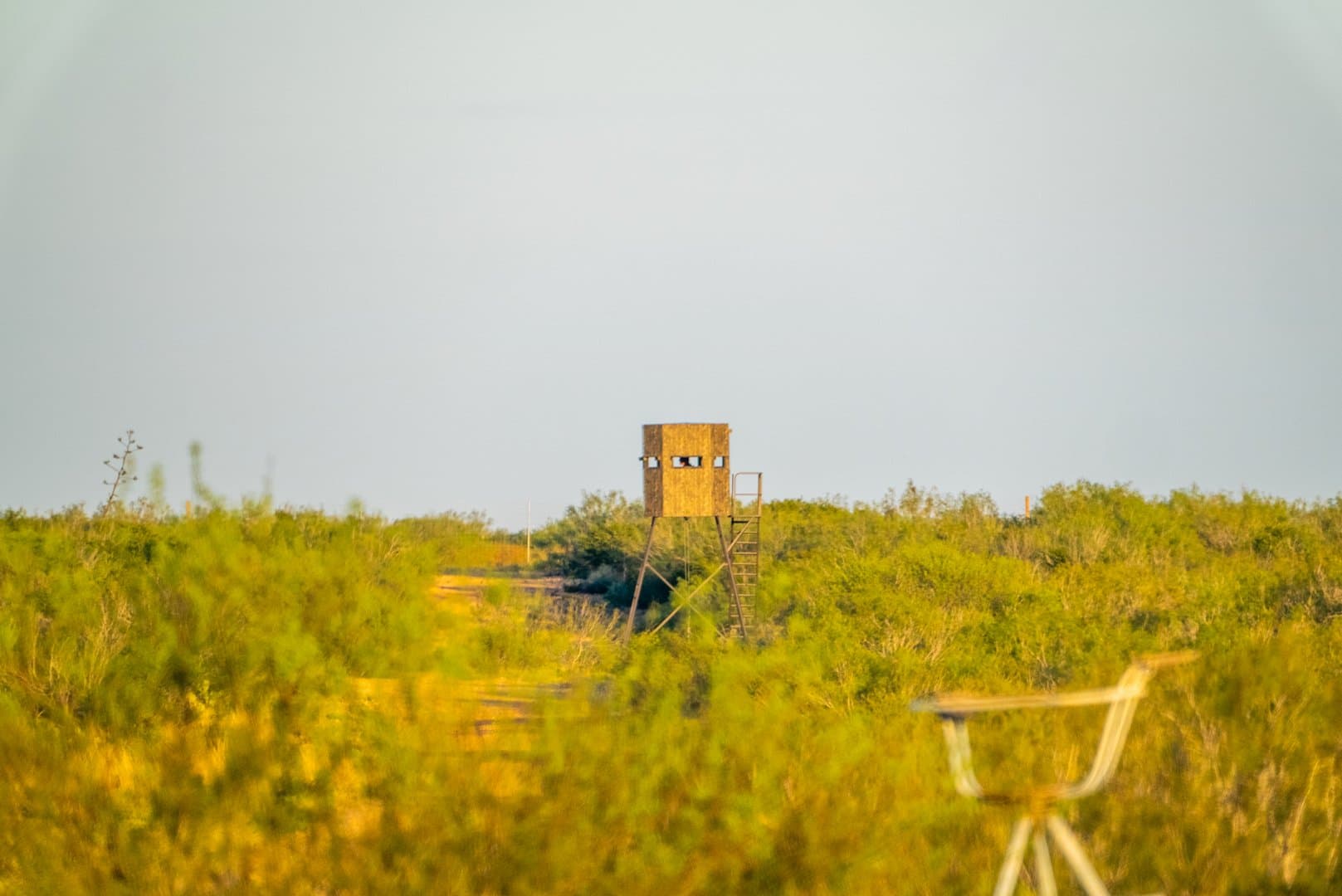
- Hunting
- Electricity
- Lake
- Pond
- Fishing
Description
PROPERTY DESCRIPTION:
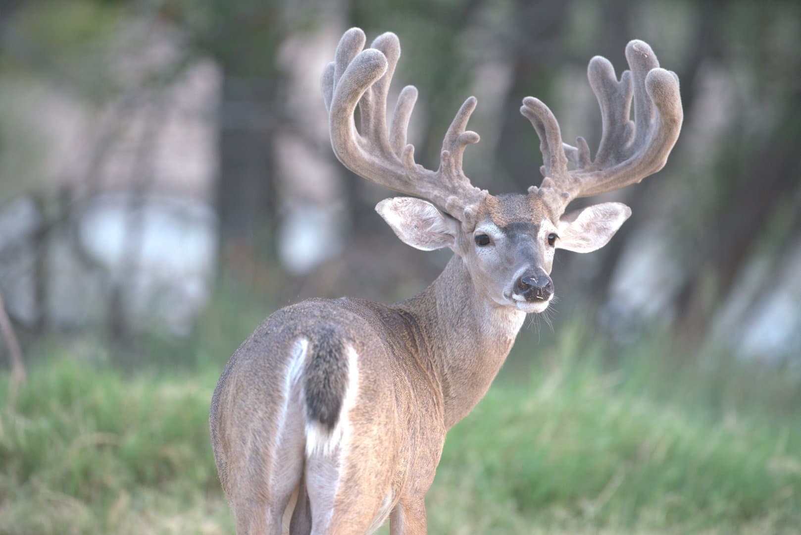
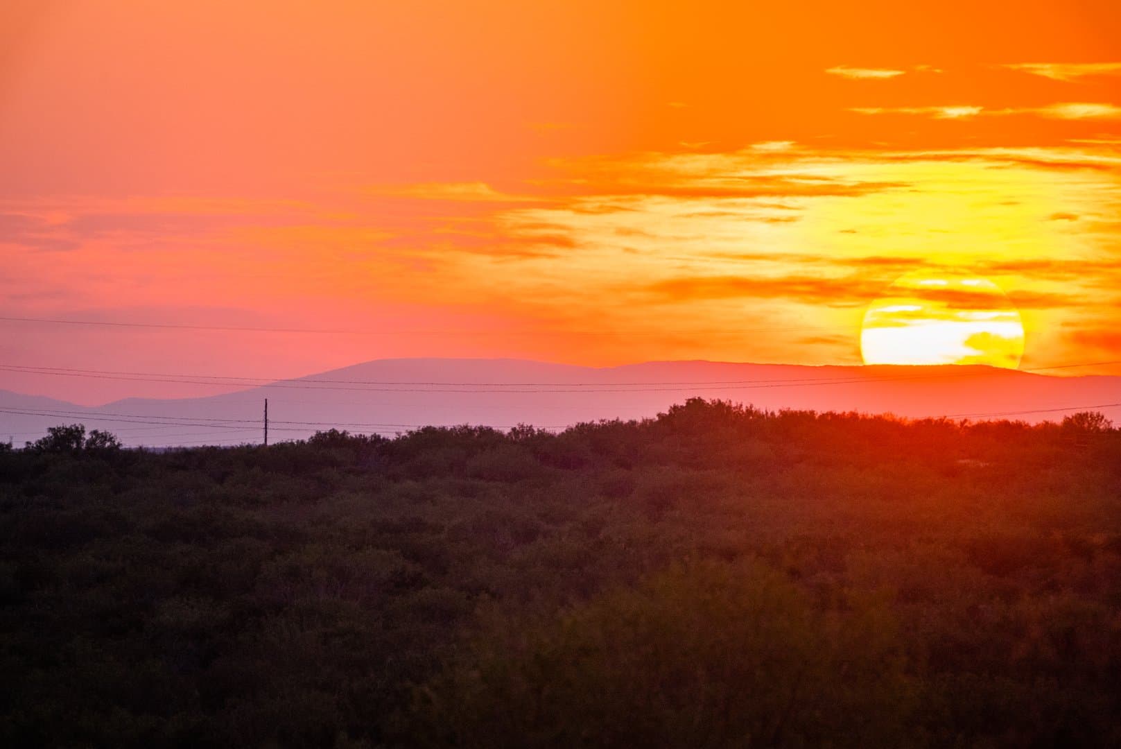
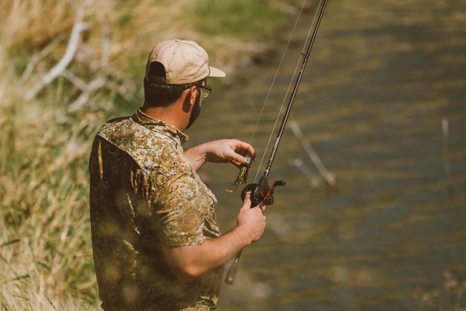
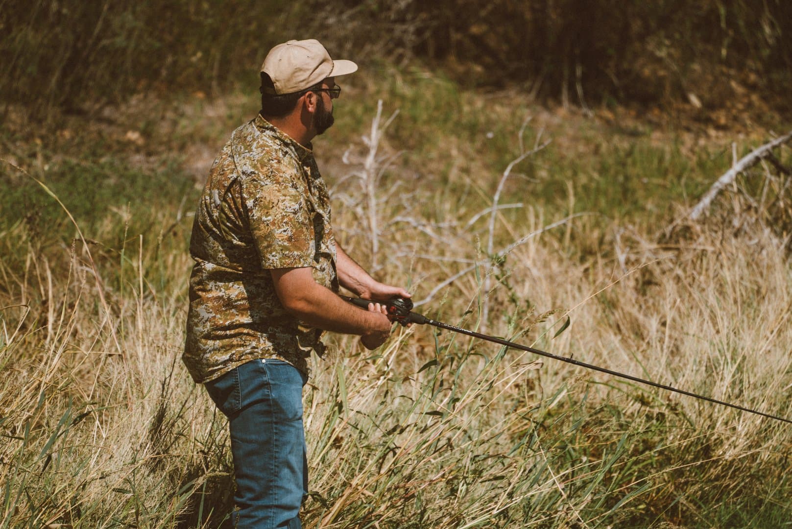
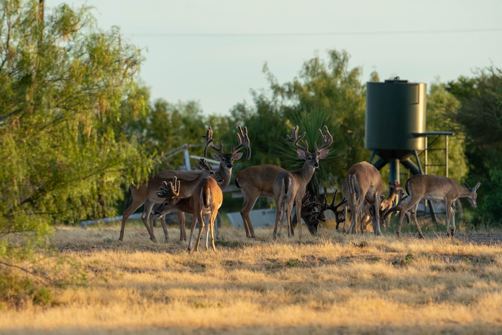
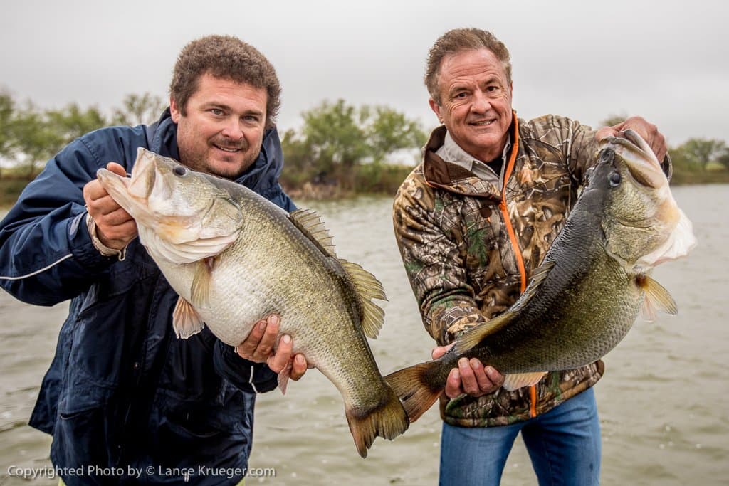
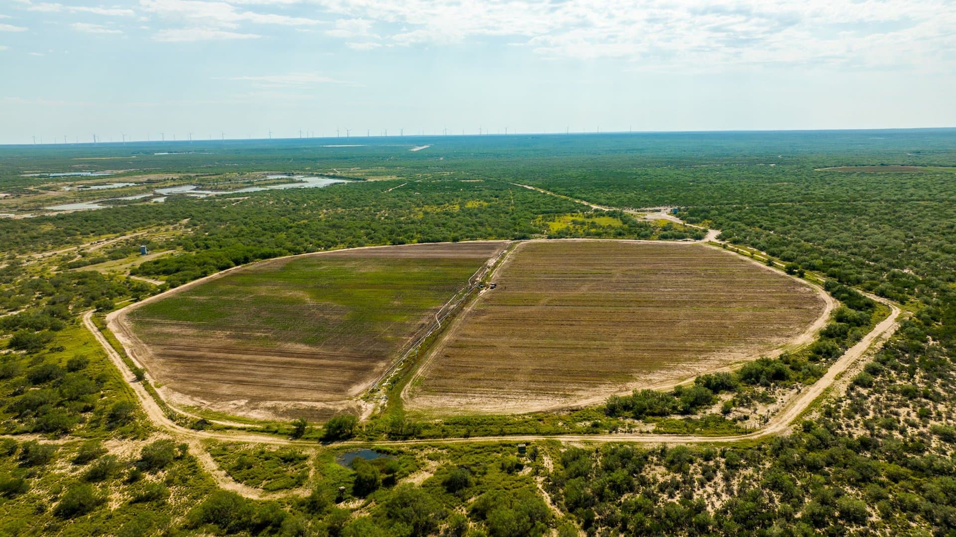
Jalisco Ranch – Tecomate La Perla is a high fenced recreational ranch focused on game management and a managed fishery. The ranch was developed and designed as a year-round hunting, fishing, and private recreational lake property. The property has been featured in numerous publications such as Bass Magazine and outdoor television shows, such as the Bucks of Tecomate, showcasing its world class hunting and fishing experiences. Jalisco Ranch is currently owner-operated by renowned ranch developer and Tecomate founder, Dr. Gary Schwarz. Jalisco Ranch is his latest masterpiece, and he is ready to take it to market as an elite rod and gun ranch. Key features include private 85.5 +/- acre lake complex, 2 x 24 acre circle irrigated food plots, 6-acre flood irrigated food plot on an island, landscaped gardens, 200 acre feet of water rights, Tecomate Whitetail genetics, Corn/Cottonseed/Protein and fish feeders, Deer and Duck Blinds and so much more.
LOCATION:
San Ygnacio is the nearest notable community to Jalisco Ranch in the La Perla subdivision which is approximately 14.1 miles southwest along U.S. Highway 83 with Zapata being further south. Other communities in Zapata County include Ramireno, Escobas, Falcon and Lopeno. Laredo is approximately 32.0 miles to the north of Jalisco Ranch. The ranch is approximately 185 miles southwest of downtown San Antonio.
WILDLIFE:
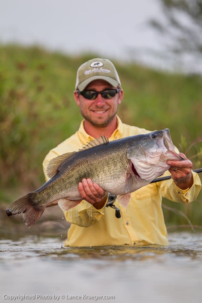
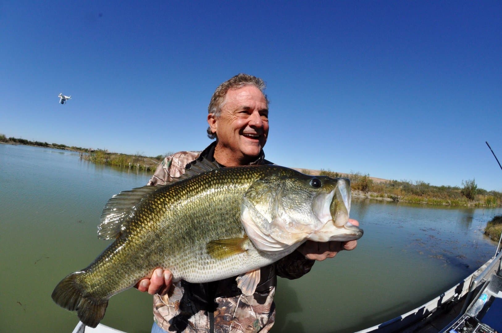
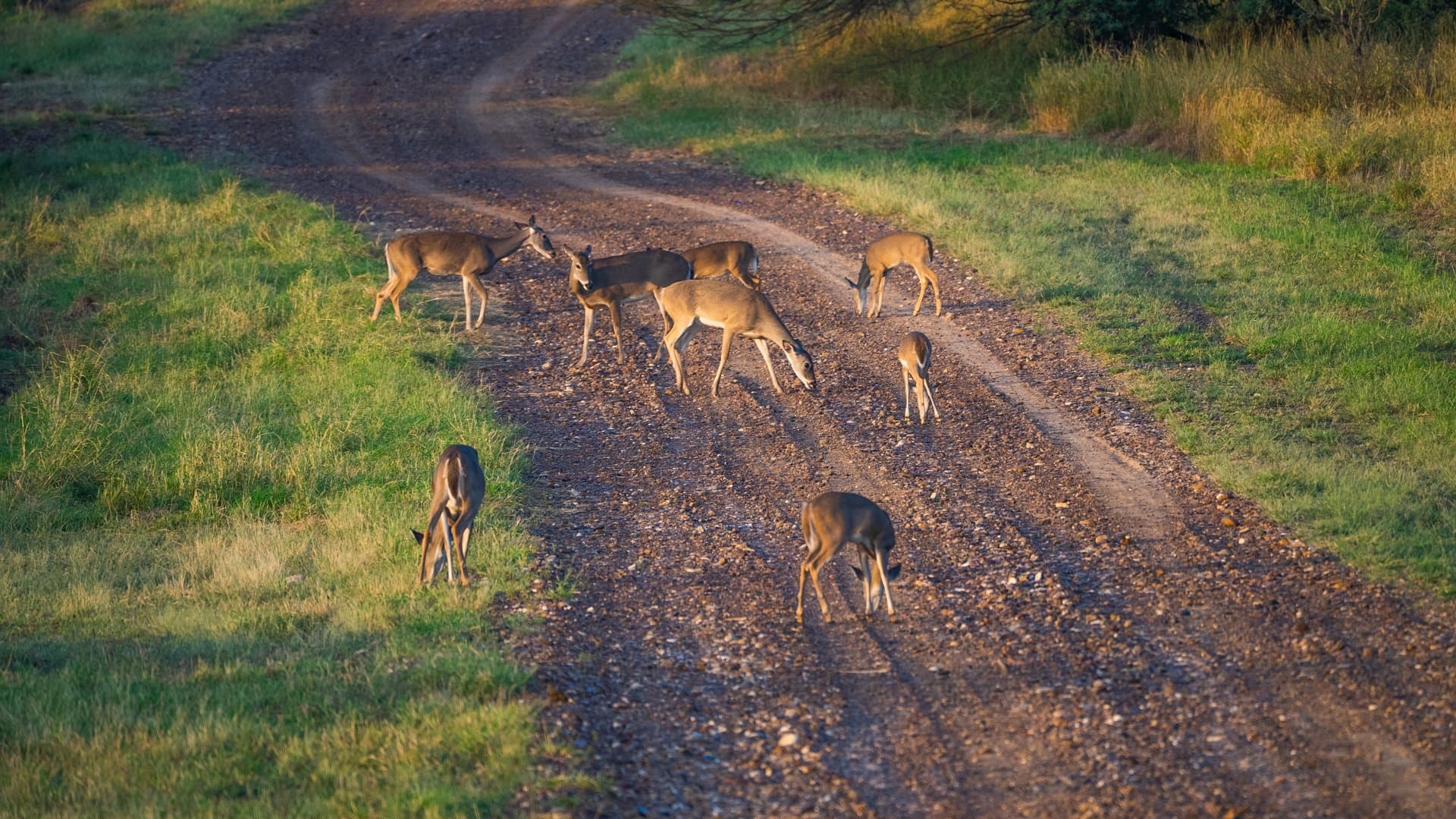
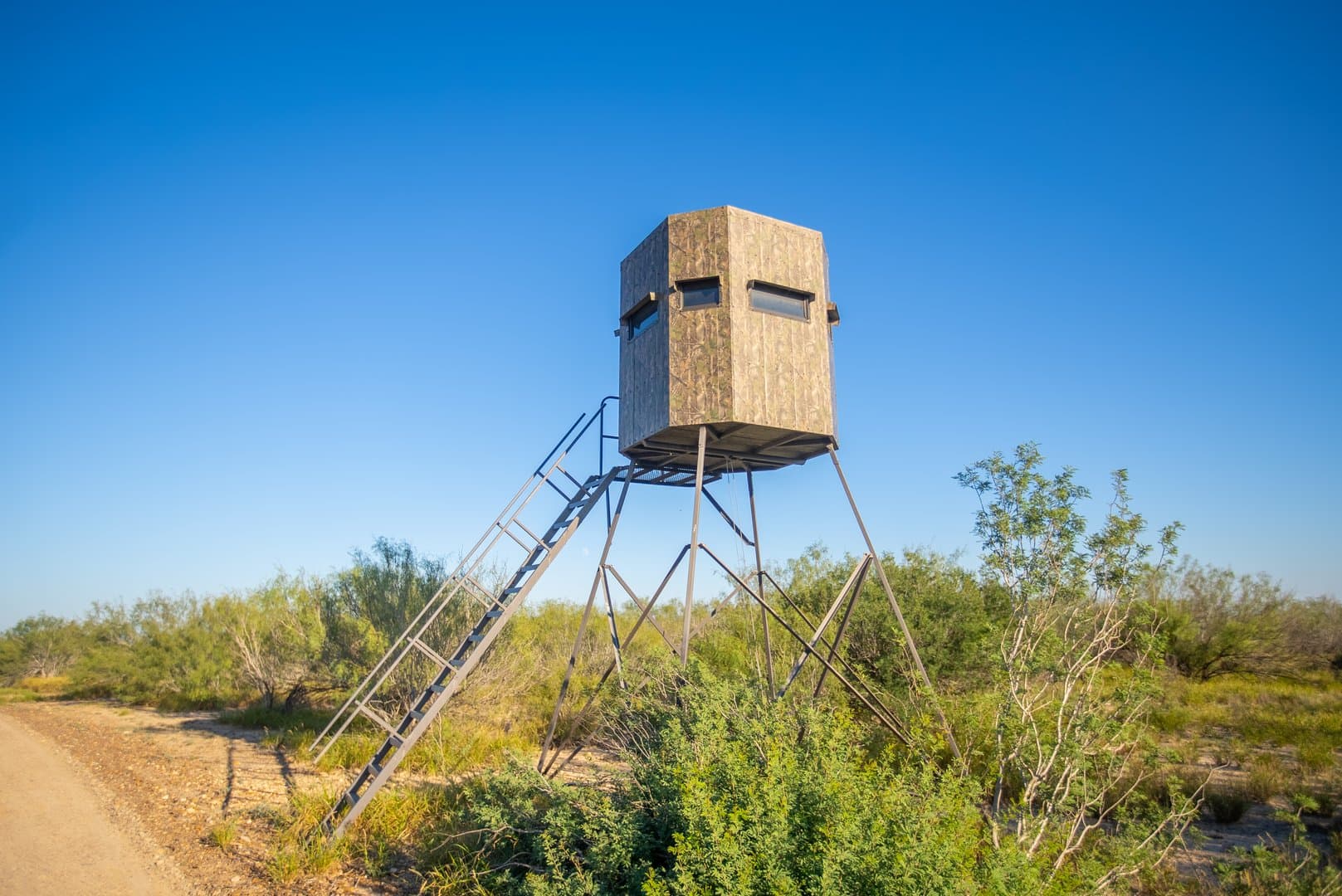
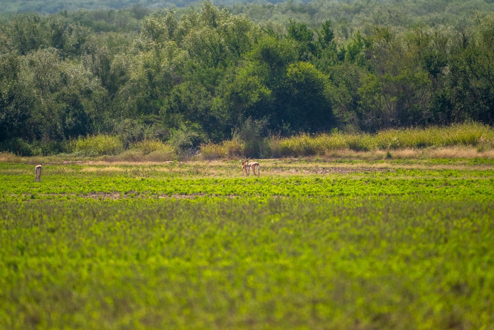
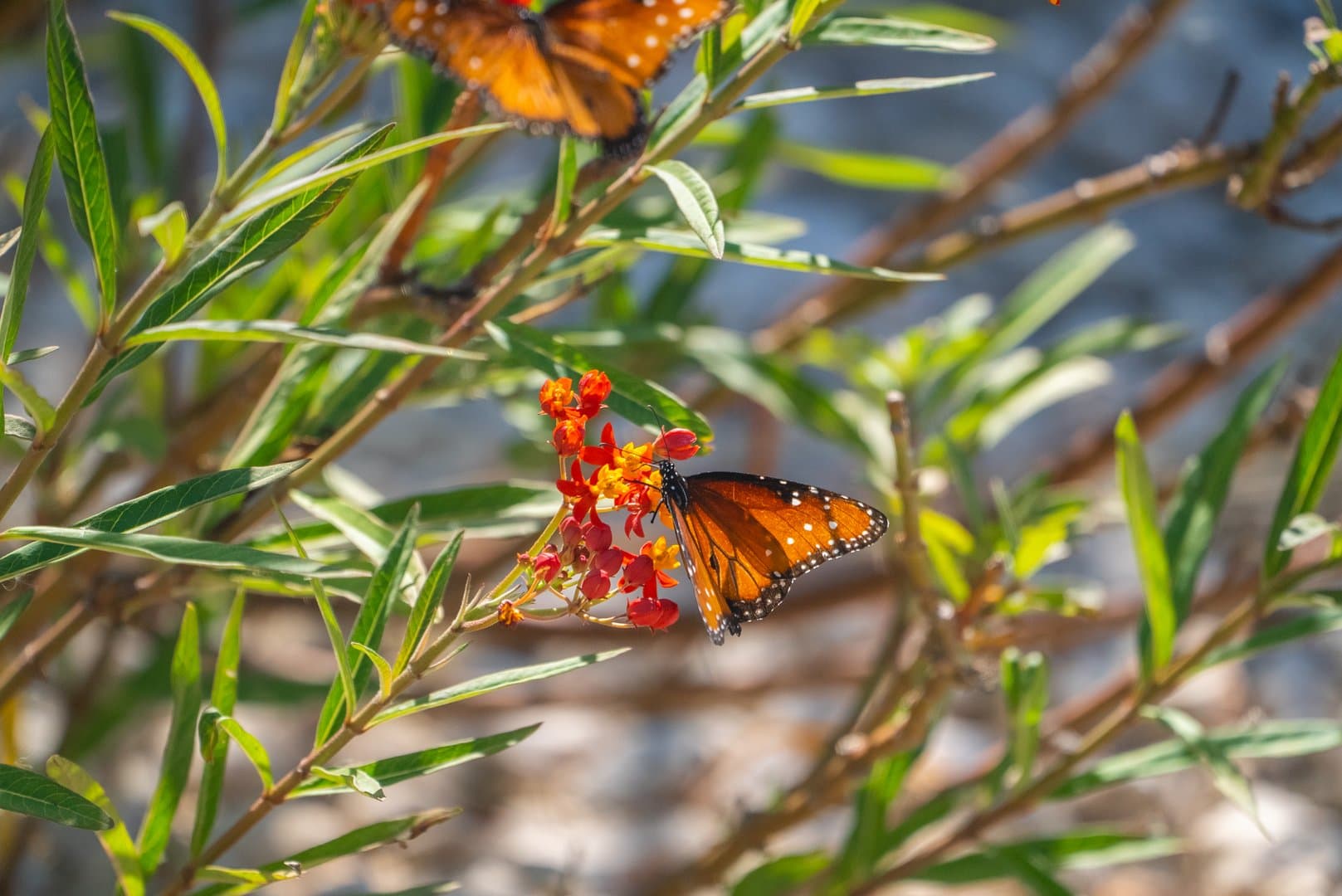
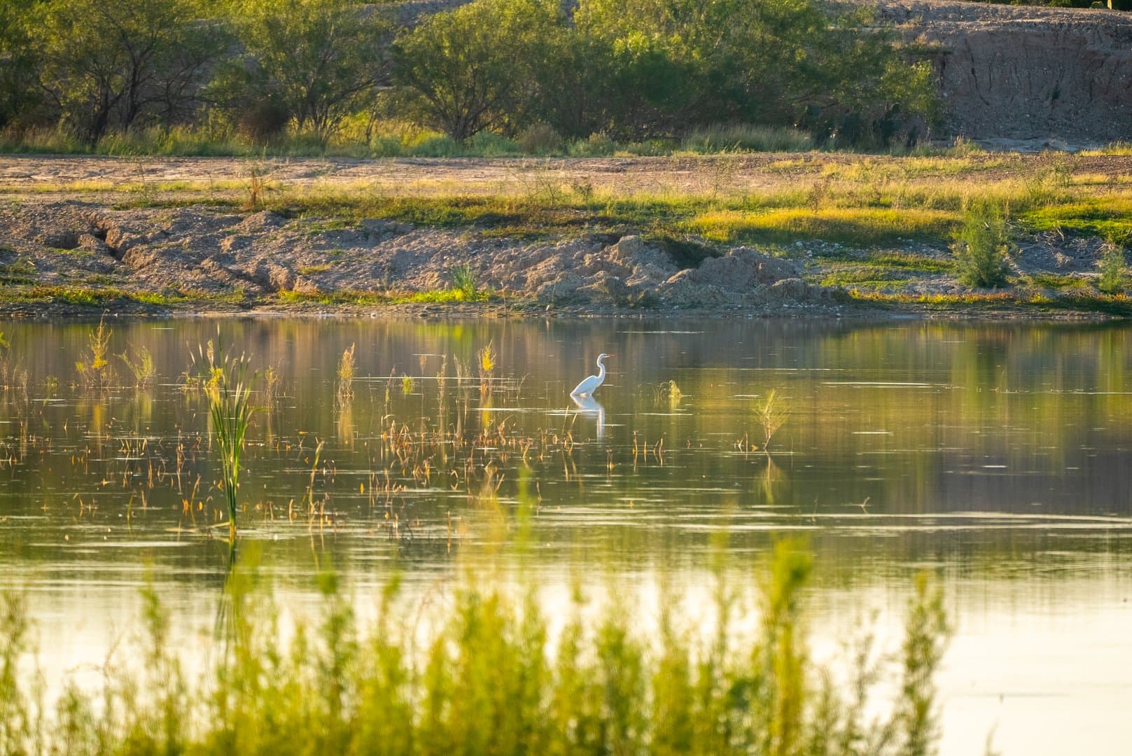
The ranch is under strict game management with an MLDP permit issued by Texas Parks and Wildlife which allows ranch management an extended hunting season to meet wildlife and harvest goals. The whitetail deer herd has been supplemented with superior genetics from various South Texas Ranches including Tecomate. Other native wildlife include dove, ducks, geese, quail, waterfowl, wild hogs, javelina, varmints, etc. In addition to the native game, the overall ranch has a good exotic game herd. Exotic game species include Nilgai and Blackbuck antelope. The ranch has another dimension to recreational appeal because of its excellent water recreation for fishing and waterfowl hunting. Jalisco Lake is under intense fishery management with participation in Operation World Record Program for bass.
TERRAIN:
Located in the La Perla Subdivision, the property has mostly level to gently rolling terrain with some rolling gravel hills and clay loam flats, typical of Zapata County. Elevations on the property range from 385 feet in the southern quadrant to 490 feet on a hilltop in the southeastern quadrant. An arroyo of Arroyo Salado bisects the property. Elevation changes are generally gradual. The property is mostly native pasture with a good cover of mid to high canopy trees and underbrush in the deeper soils, and low to mid canopy brush in the shallower soil areas. Native brush variety and height depends on soil depth, salinity and type. Mesquite is the prevalent South Texas native brush in the deeper soils along with huisache, retama, coma, hackberry and an occasional ebony tree. Underbrush varieties in these deeper soil areas include granjeno, white brush, brazil, etc. Brush varieties in the shallower, gravely areas include black brush, cenizo, guajillo, knife leaf condalia, greasewood, guayacan, Spanish Dagger, etc. The saline clay areas have saladillo, heavier prickly pear and tasajillo. It is noted, with no cattle for the past several years, curly mesquite and other grasses have grown up in the saladillo areas. The ranch has a good stand of buffel grass and native bermuda near the water sources. According to Federal Emergency Management Agency (FEMA) flood maps, approximately less than 5% of the property is located within the 100-year floodplain.
IMPROVEMENTS:
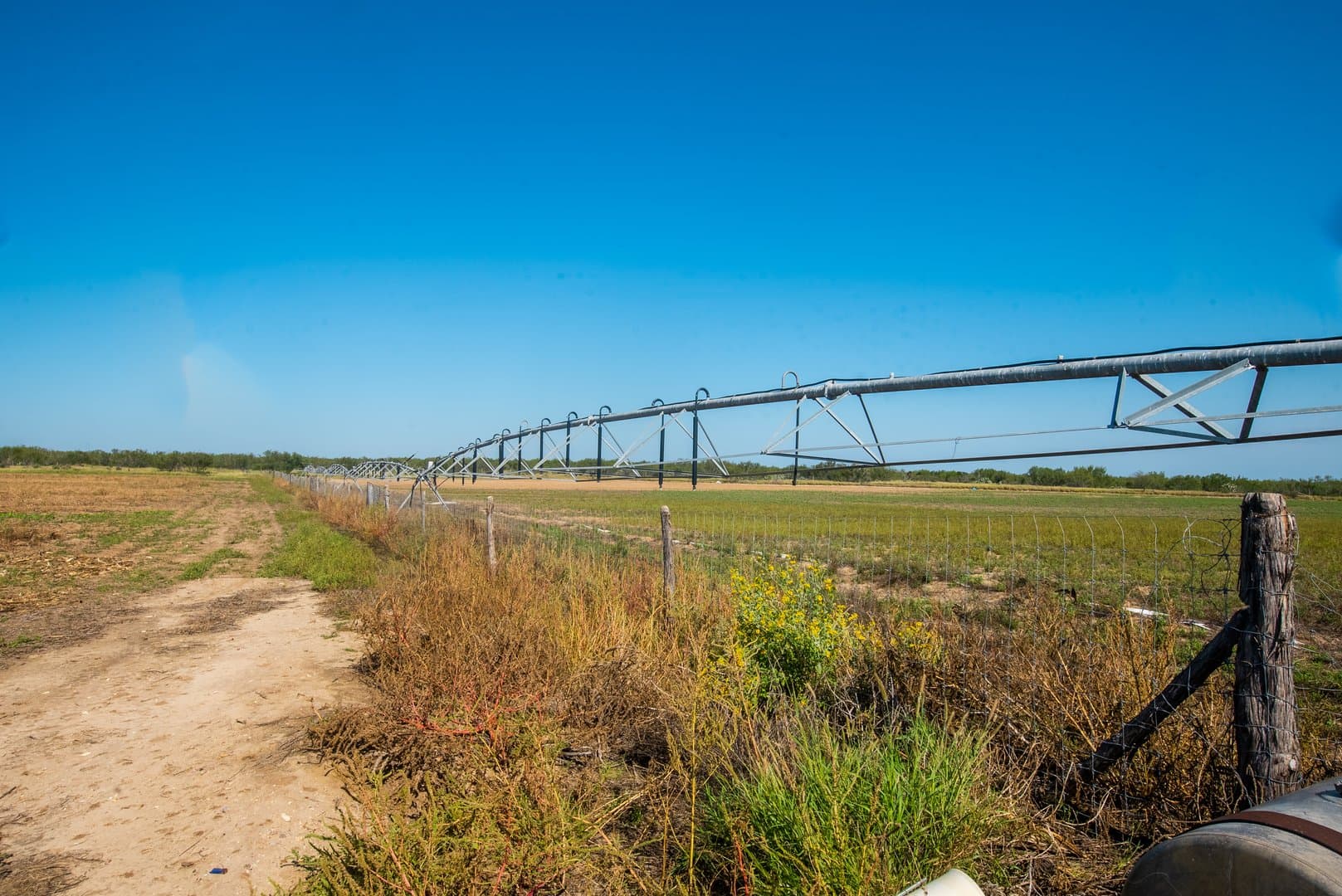
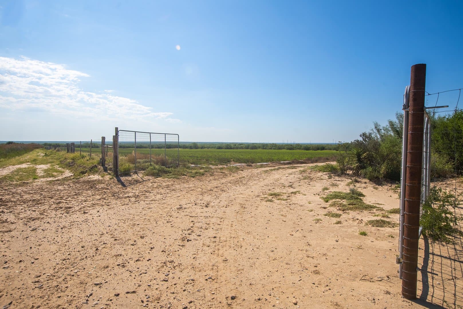
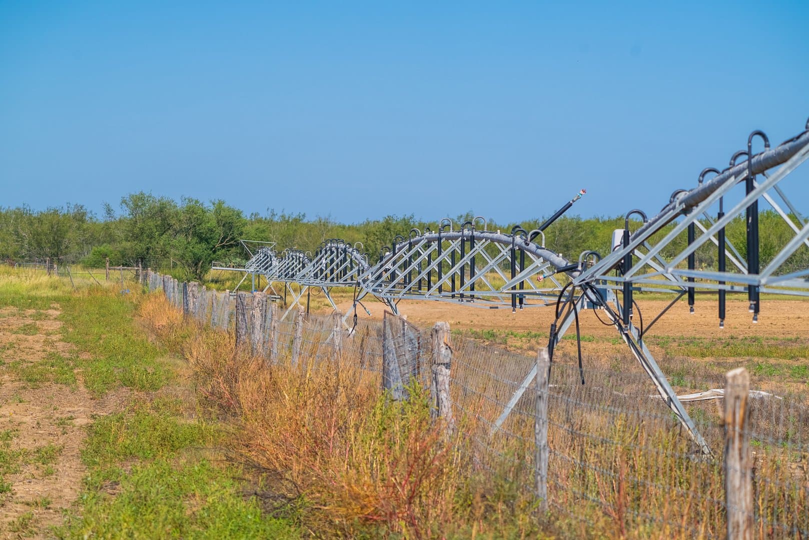
There is no house currently on the property, although there has been significant site development for a house site. There are two irrigated food plots containing 24 acres each. The food plots are high fenced, with a high cross fence with wheel gates, to allow the pivot irrigation system to travel to both sides of the food plot. The octagonal fenced food plots have gates in each section of the octagon shape to let the wildlife in when the crop is ready and to allow access by ranch personnel. There are several large double gates for farm equipment access. Corn is a staple in most of the food plots in one half of the circle. The other side of the circle is planted in Lab, Bee Wild Bundle Flower, alfalfa, etc. In addition, there is a 6-acre flood irrigated food plot on an island in the middle of Jalisco Lake. Other improvements on the ranch include Dye Farm river pumps, motors, and ponds, duck blinds, lake piers, loading piers, boat ramp, landscaping, entry way, deer and exotics program. There is a good system of all-weather and standard pasture roads. The owner has enhanced several roads with additional gravel for smoother transport.
WATER:
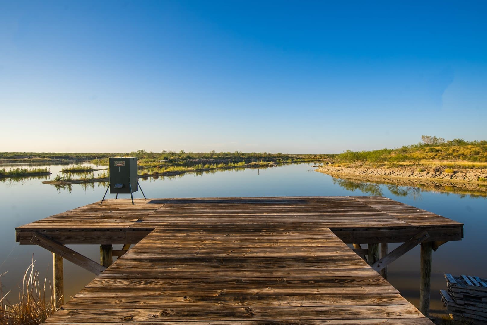
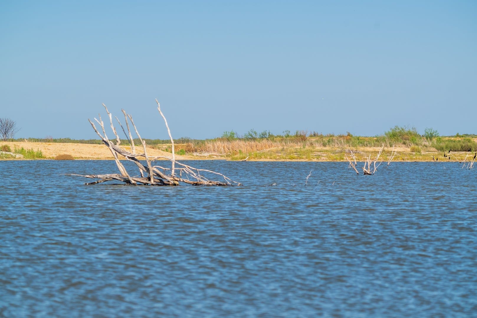
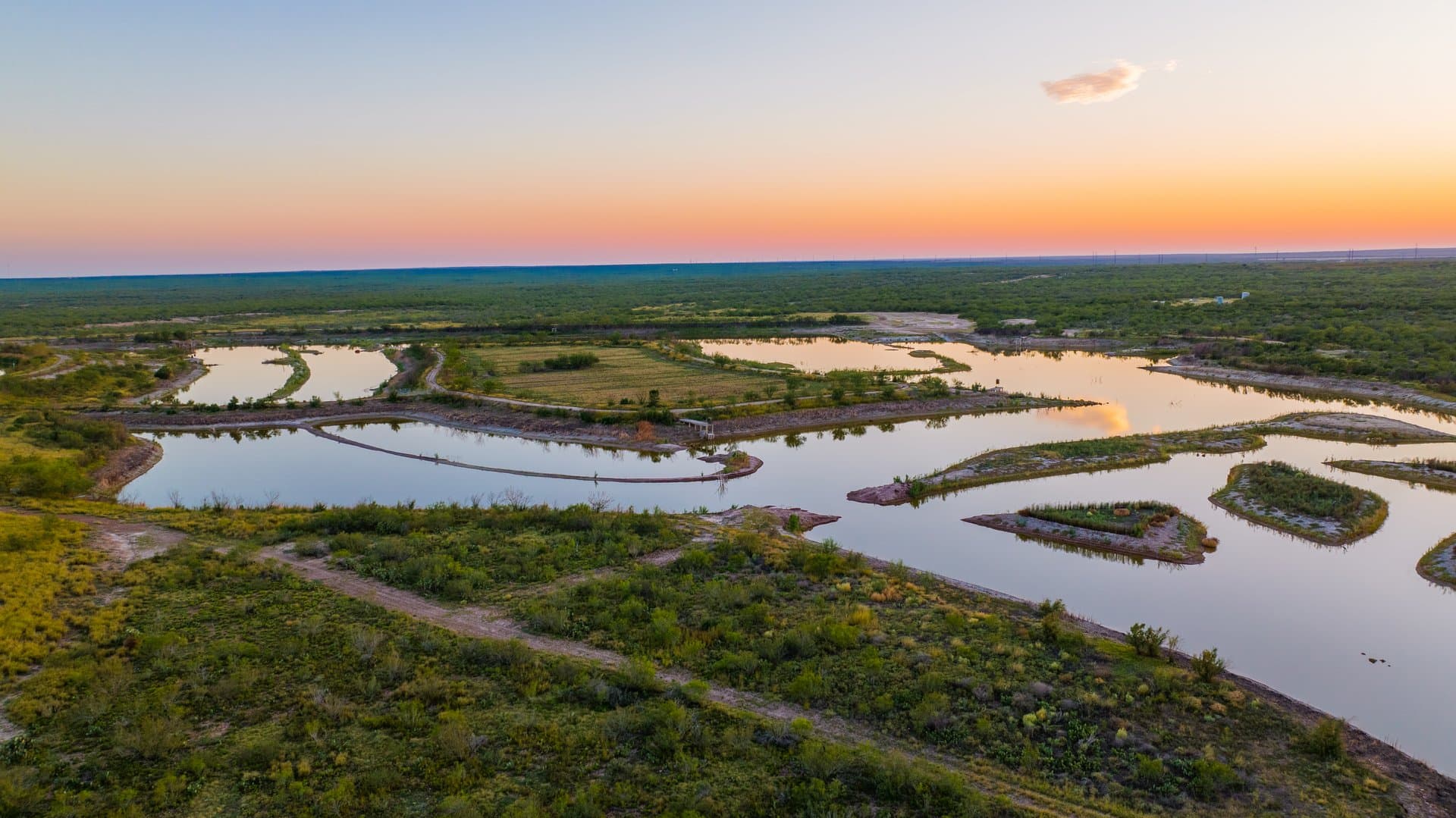
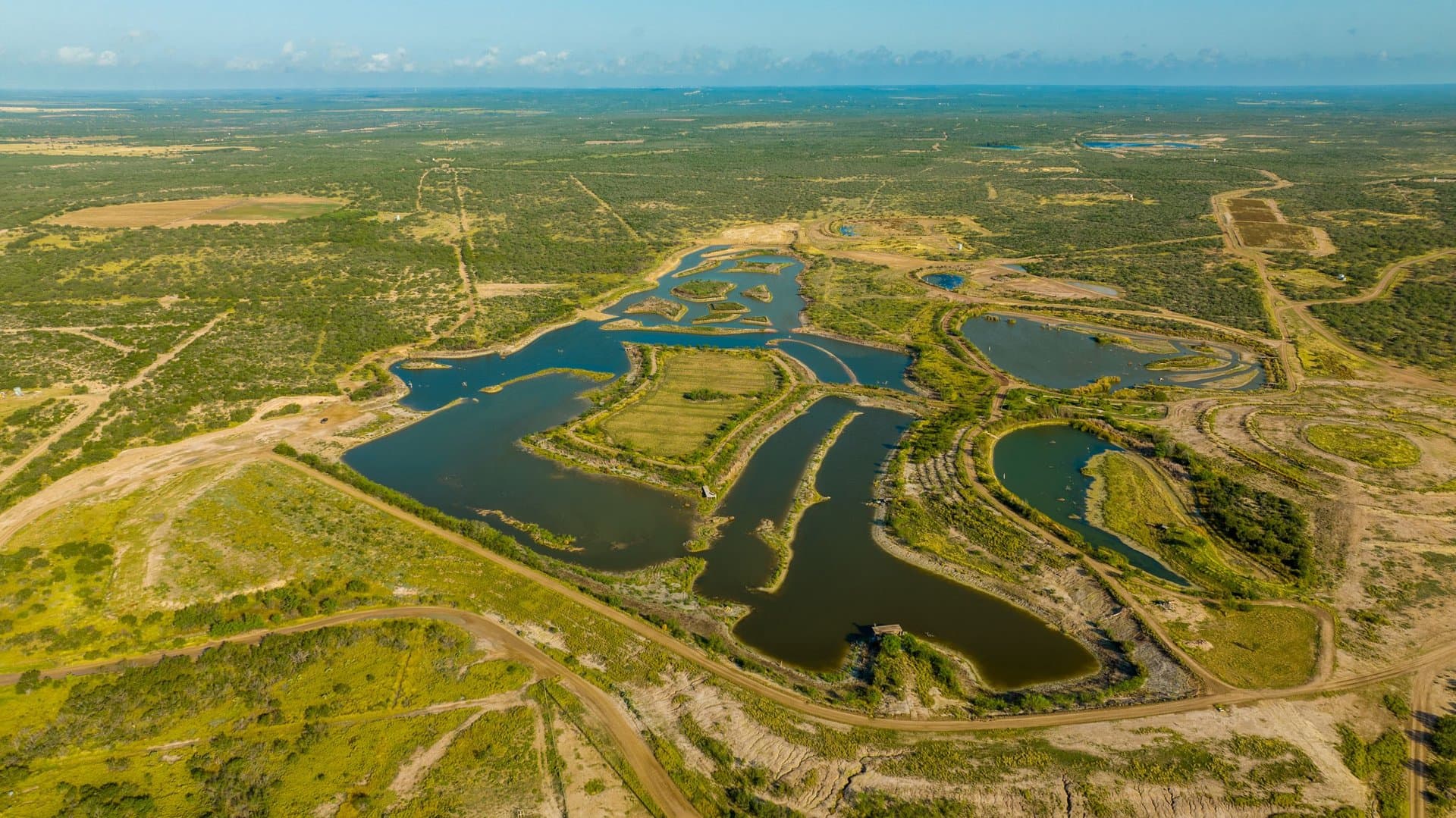
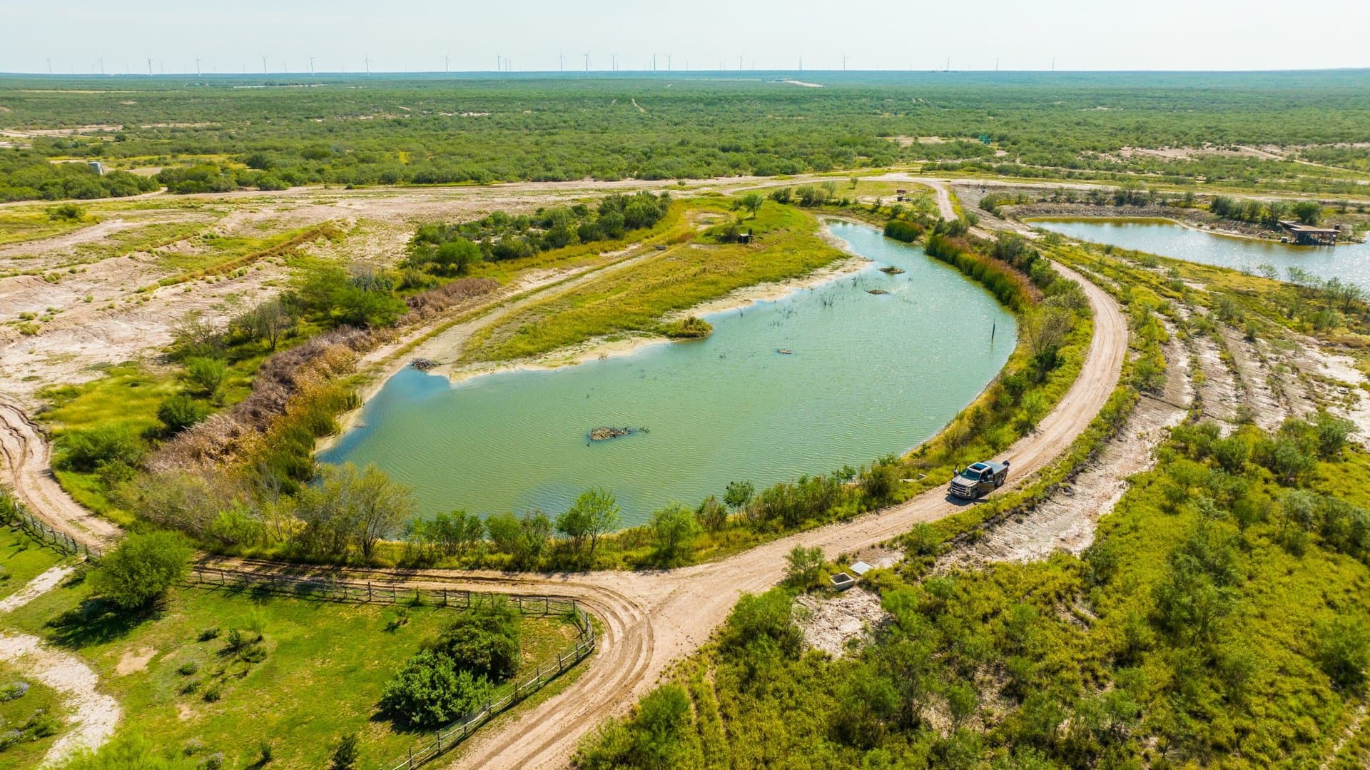
Jalisco Ranch includes 200-acre feet of Class B water rights out of the Rio Grande River for irrigation and lake supplementation. The property features Jalisco Lake which is an approximate 60+/- acre managed bass fishery lake. The large lake is then surrounded by four forage ponds above the lake. Bringing the Jalisco Lake Complex to 85.5 +/- acres.
The property has extensive surface water features for the size and is supplemented by water rights. The original lake, which was shallow except for the pit, has been expanded. The Jalisco Lake is now complete with an average depth of 8-12 feet. The lake is an engineered reservoir surveyed by Judd Gilpin of Laredo. It is estimated that 1,470,000 cubic yards were dug to create the 60-acre lake and another 624,750 cubic yards to create the forage ponds. There is a clay cored dam with spillways. The depth at the pit is 24 feet deep. Natural watershed is significant by three to four drainages, in rolling to hilly terrain, within the overall La Perla Ranch. The lake is irregular in shape with numerous fishable areas, with easily accessible banks, and 18 wooden docks (piers) with fish feeders. There is a 6-acre island in the middle of the lake bound by an elevated levee which may be shallow flooded as a waterfowl hunting area. A gravel road leads out to the island from the east bank with a road along the levee. The lake bottom has fish structure including bodark tree stumps and rocks which are positioned near the fishable areas. The lake bottom varies between deep and shallow. There are old gravel roads, which comprise some of the bottom, which produce good spawning areas for bass. The lake has extensive edge and change in bottom structure to attract fish ranging from peninsulas, levees, rocky areas and variable depth water.
MINERALS:
Surface sale only.
Agent Notes:
Easement and Access Use Agreements, Landing Strip Option, Surveys, Deed Restrictions, and Appraisal are all available upon request.
Disclaimer: To view West and Swope Ranches, LLC property listings, appointments must be scheduled with the listing agent. Participating Brokers and Agents must be identified during the initial contact and must be present during the first showing to qualify for full compensation.
Broker does not make any representations, warranties or covenants of any kind or character, whether expressed or implied, with respect to the quality or condition of the property, the suitability of the property for any and all activities and uses which Purchaser may conduct thereon, compliance by the property with any laws, rules, ordinances, or regulations of any applicable governmental authority, or habitability, merchantability, or fitness for any particular purpose, and specifically, Broker does not make any representations regarding hazardous waste, as defined by the Texas Solid Waste Disposal Act and the regulations adopted thereunder; or the United States Environmental Protection Agency regulations or disposal of any other hazardous or toxic substance in or on the property; or the Endangered Species Act of 1973; or for live oak decline, oak wilt or any other natural phenomena. All information furnished is from sources deemed reliable, but no warranty or representation, expressed or implied, is made to the accuracy thereof, and is submitted subject to prior sale, withdrawal, or other changes in price and or terms without notice.
Listing Agent

Louie Swope
West and Swope Ranches
San Antonio, Texas
By submitting, you agree to our privacy policy and terms.
Co-op Approved Lender

Want to learn more about our financing options?
Enter your email below to receive free resources and information.
By submitting, you agree to our privacy policy and terms.


More land for sale from this broker
View All
Premier Listing

Premier Listing

Premier Listing
