Search Brokers -
Columbia River Overlook
This broker is a land and rural real estate professional with Columbia River Overlook, listed on Land Broker MLS, the broker-owned co-op for farms, ranches and land for sale. Use the contact form on this page to get in touch about buying or selling rural property.
Contact
Fill in the Form below to send a message to this broker
By submitting, you agree to our privacy policy and terms.
Land for Sale from

Columbia River Overlook
$5,550,000
2,025.4 Acres
East Wenatchee, Washington, 98802
The Columbia River Overlook is a unique property and rare offering. The views are a must see from this 2025 acres consisting of 5 separate parcels. The property has incredible views the Columbia River and the mouth of the Wenatchee River. In the background is the city of Wenatchee and a mountain backdrop that's a must see. This property is just minutes to all of the city of Wenatchee amenities and prime for future development.Land This property consists of 5 parcels totaling 2025 acres with rolling topography and incredible views. Currently over 1,000 acres in wheat production.Recreation The Wenatchee Valley is widely recognized as a mecca for outdoor recreation, offering one of the country’s most diverse natural year-round playgrounds. With abundant sunshine and four distinct seasons, our sports and recreational venues are as plentiful as our orchards.The Wenatchee Valley offers direct access to a variety of options that match virtually all interests, fitness levels, flairs for adventure and technical skills. With limitless options like sweeping foothills, a network of ball fields, a ski resort, and the mighty Columbia River, you won’t run out of ways to enjoy our 300 days of sunshine each year.Agriculture Property is currently in wheat production of over 1,000 acresRegion & Climate In general the summers are hot, dry, and mostly clear and the winters are very cold, snowy, and partly cloudy. Over the course of the year, the temperature typically varies from 25°F to 90°F and is rarely below 13°F or above 98°F.History By the late 1890s, the stage was set for Wenatchee’s economic and population boom. The Wenatchee Valley’s arid climate, rich volcanic soil, and proximity to the Columbia and Wenatchee Rivers proved to be an excellent combination for agricultural success.Within a few years, the Valley was covered with row upon row of young fruit trees. Apples were shipped to all parts of the world, and more and more people, learning of ‘the valley of the apples,’ came here to stay. Within 25 years, Wenatchee became the center of the greatest apple-producing region in the world.Location Situated in a fertile valley in Central Washington at the confluence of the Wenatchee and Columbia Rivers, Wenatchee is the second most populous city in the central part of the state and serves as the Chelan County seat. To the south and west, mountains provide a dramatic backdrop for the City. The nearest airport to Wenatchee is Wenatchee (EAT) Airport which is 4.9 miles away. Other nearby airports include Seattle (SEA) (93.6 miles), Everett (PAE) (98.6 miles) and Pasco (PSC) (98.9 miles).

Lockman Ridge Lookout
$998,990
960 Acres
Riverside, Washington, 98849
960 Acres are already subdivided into 20-acre parcels that border state land. Perfect property for hunting, hiking, or trail riding multiple roads throughout the property make it a fun place to explore. Many wildlife, including deer, Elk, and Moose, frequent the property. There are fantastic views across the valley and numerous places to build a home or cabin. And have access to thousands of acres of DNR land. (Owner Financing Now Available)Land The 960 acres has already been subdivided into 20 acre parcelsRecreation Okanogan County in North-Central Washington State has the best family vacations! Scenic byways, tours, hikes, and family adventures await you in every corner of Okanogan Country: from the Northern Okanogan Region, to the Methow Valley, across the Columbia River Basin, and into the Heart of the Okanogan. An affordable family vacation with endless outdoor adventure awaits you in our breath taking snow-capped North Cascade Mountains and gorgeous winding river basins. Experience a Washington State getaway with horse riding, miniature golf, swimming, fresh wholesome food, blue skies, and starry nights – a vacation that will keep you coming back for more!Region & Climate Okanogan, Washington gets 13 inches of rain, on average, per year. The US average is 38 inches of rain per year.Okanogan averages 33 inches of snow per year. The US average is 28 inches of snow per year.On average, there are 192 sunny days per year in Okanogan. The US average is 205 sunny days.Okanogan gets some kind of precipitation, on average, 67 days per year. Precipitation is rain, snow, sleet, or hail that falls to the ground. In order for precipitation to be counted you have to get at least .01 inches on the ground to measure.History Uriah Ward is given credit for settling Riverside in the 1880s. It was and still is located at the mouth of Johnson Creek, south of Janis Bridge and about 7 miles north of Omak on the Okanogan River. Riverside’s name came from its location next to the Okanogan River. Riverside is outside OBHS area but was very important to the north area. When steamboat travel started on the river Riverside became the head of navigation and a mayor distribution center especially during high water.Riverside was originally known as “Republic Landing”, was platted by James E. Forde in 1902 and officially incorporated December 22, 1913.Location Located within minutes of the town of Riverside with a small store or Omak is just 20 minutes away with all primary services Walmart, Home Deport, or Mid Valley Hospital.Spokane International airport is 110 miles awayBellingham International airport is 139 miles awaySeattle International airport is 149 miles away

Brewster Ridge Ranch
$995,000
708.98 Acres
Brewster, Washington, 98812
Brewster Ridge Ranch consists of 37 parcels total with 2 parcels totaling 103.5 acres zoned R1 and fronting on Old Hwy 97 allowing for future development. With development you get access to the Silver Spur amenities which includes access to the lodge, pool, spa, gym, tennis courts, playground and riverfront beach access. There are 3 drilled wells and currently 6 RV sites with plenty of room for expansion. Land Seize the opportunity to own 708.98 acres of prime land at Silver Spur North, consisting of 35 parcels with incredible development potential. This expansive property includes two parcels totaling 103.5 acres zoned R1 Rural 1, fronting Old Hwy 97, perfect for future development projects.Property Highlights:Development Potential: With R1 Rural 1 zoning, these 103.5 acres are primed for residential development, providing a fantastic investment opportunity.Silver Spur Amenities: Gain access to exclusive Silver Spur amenities, including a lodge, pool, spa, gym, tennis courts, playground, and riverfront beach access.Infrastructure in Place: The property features 3 drilled wells and 6 RV sites, offering ample room for expansion. Additionally, an onsite gravel pit facilitates road building.Year-Round Recreation: Enjoy 300 days of sunshine annually, with proximity to Lone Point Cellars, Loup Loup Ski Bowl, Gamble Sands Golf Course, and numerous lakes and rivers for fishing.Stunning Views: The higher elevations of the property provide breathtaking views, a must-see for anyone looking to develop in a picturesque setting.Don’t miss this rare chance to invest in a versatile and scenic property with endless possibilities for development and recreation. Explore the potential of Silver Spur North today!Improvements Large Metal Shop 40×100 with concrete floor and power doors open at both ends. 6 full hookup RV spaces with room for expansion.Recreation Developer Alert! Prime 708.98 Acres at Silver Spur NorthSeize the opportunity to own 708.98 acres of prime land at Silver Spur North, consisting of 35 parcels with incredible development potential. This expansive property includes two parcels totaling 103.5 acres zoned R1 Rural 1, fronting Old Hwy 97, perfect for future development projects.Property Highlights:Development Potential: With R1 Rural 1 zoning, these 103.5 acres are primed for residential development, providing a fantastic investment opportunity.Silver Spur Amenities: Gain access to exclusive Silver Spur amenities, including a lodge, pool, spa, gym, tennis courts, playground, and riverfront beach access.Infrastructure in Place: The property features 3 drilled wells and 6 RV sites, offering ample room for expansion. Additionally, an onsite gravel pit facilitates road building.Year-Round Recreation: Enjoy 300 days of sunshine annually, with proximity to Lone Point Cellars, Loup Loup Ski Bowl, Gamble Sands Golf Course, and numerous lakes and rivers for fishing.Stunning Views: The higher elevations of the property provide breathtaking views, a must-see for anyone looking to develop in a picturesque setting.Don’t miss this rare chance to invest in a versatile and scenic property with endless possibilities for development and recreation. Explore the potential of Silver Spur North today!Agriculture There is approximately 100 + acres of pasture / hay groundGeneral Operations There is potential for instant income from renting the six RV spots that have water and power to each of them. There is an opportunity grow some hay or lease out the 100 plus acre hay field that produces some great hay. The hay field was farmed for may years and just needs a little work to get it back in production and producing income.Region & Climate Brewster, WA, experiences a pretty distinct climate with hot, dry summers and cold, snowy winters. Here’s a bit more detail:– **Summers:** Expect clear skies with temperatures usually ranging between 70°F to 90°F. It’s rare for the mercury to hit 99°F, but it can happen during a heatwave.– **Winters:** It gets quite cold, with temperatures often dropping to around 23°F. The coldest days can see temperatures plummet to about 10°F. Snowfall is common, and the skies are often partly cloudy.– **Year-Round Temperature Range:** The annual temperature swing is from about 23°F to 90°F, providing a significant contrast between the seasons.This variation offers a nice mix for those who enjoy both warm, sunny weather and the crispness of a snowy winter. If you’re into outdoor activities like hunting and fishing, Brewster’s climate gives you a full range of seasonal experiences.History Brewster has an interesting history and a steady, agriculture-based economy:– **Location:** Situated in Okanogan County, Brewster lies at the confluence of the Columbia and Okanogan Rivers, which provides both scenic views and practical benefits for agriculture.– **Origins:** The town was originally called Bruster, named after its founder John W. Bruster, who platted it in 1896. The name was changed to Brewster when the post office opened in 1898.– **Incorporation:** Brewster officially became an incorporated town on April 29, 1910.– **Railway:** The completion of the Great Northern Railway’s Oroville-Wenatchee Branch Line in 1914 was a significant development, likely boosting local commerce and connectivity.– **Economy:** The local economy thrives on agriculture, particularly fruit orchards. This has supported gradual population growth, reaching nearly 2,500 residents.The combination of historical charm, agricultural prosperity, and natural beauty makes Brewster a unique and appealing small town in Washington State.Location Brewster, Washington, is beautifully situated at the meeting point of the Columbia, Okanogan, and Methow Rivers, providing it with a unique and picturesque setting. Here are some highlights:– **Geography:** The town benefits from its location at the confluence of three rivers, which not only offers stunning views but also fertile land for agriculture.– **Scenic Backdrop:** To the west, the snow-capped peaks of the Cascade Range create a breathtaking backdrop, with their foothills rolling down to meet the riverbanks.– **Agriculture:** The dramatic topography, with steep hills descending towards the rivers, creates an ideal microclimate for growing apples and cherries. Orchards thrive in this environment, surrounding the town and contributing to its economy.– **Natural Beauty:** The combination of river confluence, mountainous terrain, and lush orchards makes Brewster a visually striking location with a rich agricultural heritage.This blend of natural beauty and agricultural productivity makes Brewster a special place, perfect for those who appreciate both the outdoors and a strong community tied to the land.

Lake Roosevelt Retreat
$650,000
247.73 Acres
Keller, Washington, 99740
Opportunity knocks on this large Columbia River waterfront property! 247 acres in 4 parcels with amazing views of the Columbia River and Sanpoil River confluence. Enjoy the peace and quiet while watching the Keller ferry crossing the Columbia River right from your front porch. Large 4640 sq ft home is solid but needs some TLC. Bring your tool belt and turn this property into your private oasis. Kuehne Rd dead ends at the propertyRecreation The ancient geologic landscape of the upper Columbia River cradles Lake Roosevelt in walls of stone carved by massive ice age floods. Come explore the shorelines and learn the stories of American Indians, traders and trappers, settlers and dam builders who called this place home. Swim, boat, hike, camp, and fish at this hidden gem in Northeast Washington, created by the Grand Coulee Dam.Region & Climate Lake Roosevelt sees dramatic changes in weather throughout the year. In the summer months, temperatures can range from 75ºF to 113ºF during the day, and from 50ºF to 80ºF at night. Spring and fall serve as the transitional periods between hot and cold. Winter sees light to heavy snowfall in all districts and can severly impact roads and access to certain parts of the lake. In addition, the northern reaches of the lake are cooler and wetter, while the southern portion is hotter and drier. The weather combined with lake level changes produces a variety of beautiful landscapes year round.History Grand Coulee Dam was the key to the development of power on the Columbia River — the greatest potential source of hydroelectric energy in the United States. Original plans considered ten dams on the Columbia River between the Canadian border and the mouth of the river.Grand Coulee Dam forms Lake Roosevelt, extending 151 miles upstream to the Canadian border. It has a 600-mile shoreline and a surface area of 82,000 acres. In 1948, Congress designated Lake Roosevelt National Recreation Area, which is operated by the National Park Service.Grand Coulee Dam provides water to irrigate approximately 600,000 acres in the Columbia Basin Project. In addition to its irrigation and power functions, Grand Coulee Dam is a primary factor in controlling the floods on the Columbia River.Location Lake Roosevelt, also known as Lake Franklin D. Roosevelt, is located in the state of Washington in the United States. It is a large reservoir that was created by the construction of the Grand Coulee Dam on the Columbia River. The lake stretches from the Canada-U.S. border to just above the town of Coulee City. It offers ample opportunities for visitors to explore its serene waters, including hiking, fishing, boating, and more.

Connell Industrial Tract
$3,995,000
219.43 Acres
Connell, Washington, 99326
219.43 acres bordering the City of Connell. The property consists of a 2 acre parcel in the city limits of Connell and the remaining 217.43 acres are located within the city's Urban Growth Boundary and is currently zoned 1-2 General Industrial Zone which also allows for all of the C-3 General Business Zone uses. The property is fairly level allowing for easier development. Land Phase 1 environmental completed with no issues noted on subject property.Recreation The City of Connell owns and maintains an excellent system of parks,and recreational facilities for the benefit of residents who live in the City and surrounding rural communities. These facilities contribute greatly to the overall quality of life and are well loved and used by residents of all ages.There are many places to hunt waterfowl near Connell, Washington, including: WDFW-managed areas: The Windmill Ranch Unit, Mesa Lake Unit, and Bailie Memorial Youth Ranch all have small ponds and lakes for hunting. The Sunnyside Snake River Wildlife Area has several units that are managed for waterfowl hunting. Waterfowl Habitat & Access Program (WHAP): This program provides public access to duck and goose hunting in the North Puget Sound area. Toppenish National Wildlife Refuge: This refuge allows waterfowl hunting in public areas during the regular Washington State hunting seasons. North Potholes: This area is located on the Potholes Wildlife Area west of Moses Lake. Winchester Ponds: This area is located on the Desert Wildlife Area west of Moses Lake. Eagle Lakes Ranch Lodge: This lodge offers duck hunting with open water and a variety of blinds. Region & Climate Connell, Washington has an annual average high temperature of 64°F and an annual average low temperature of 39°F. The average annual precipitation is 8.7 inchesHistory Connell is a vibrant rural community in Eastern Washington that was established in 1883 as a railroad stop called Palouse Junction. The community later became known as Connell, named after Northern Pacific Station Agent, Joseph Connell. The Connell Post Office was authorized in January 1887.Location The City of Connell is located in Franklin County, about 35 miles north of Pasco. Connell is known for its parks, school district, corrections center, and neighborhoods. The town, originally called Palouse Junction, developed from a railroad station and homestead settlement in the late 1800s and early 1900s. Completion of the transcontinental rail line through the area in 1883 brought growth to the tiny settlement. The Connell post office opened in 1887. The area was platted in 1903. Connell incorporated as a city in 1910. By the 1930s new businesses flourished. By 2020, the population had increased to more than 6,000. Throughout its history, Connell has maintained its strong sense of community in a small-town setting.

Lincoln Creek Mallard Crossing
$750,000
105.33 Acres
Rochester, Washington, 98579
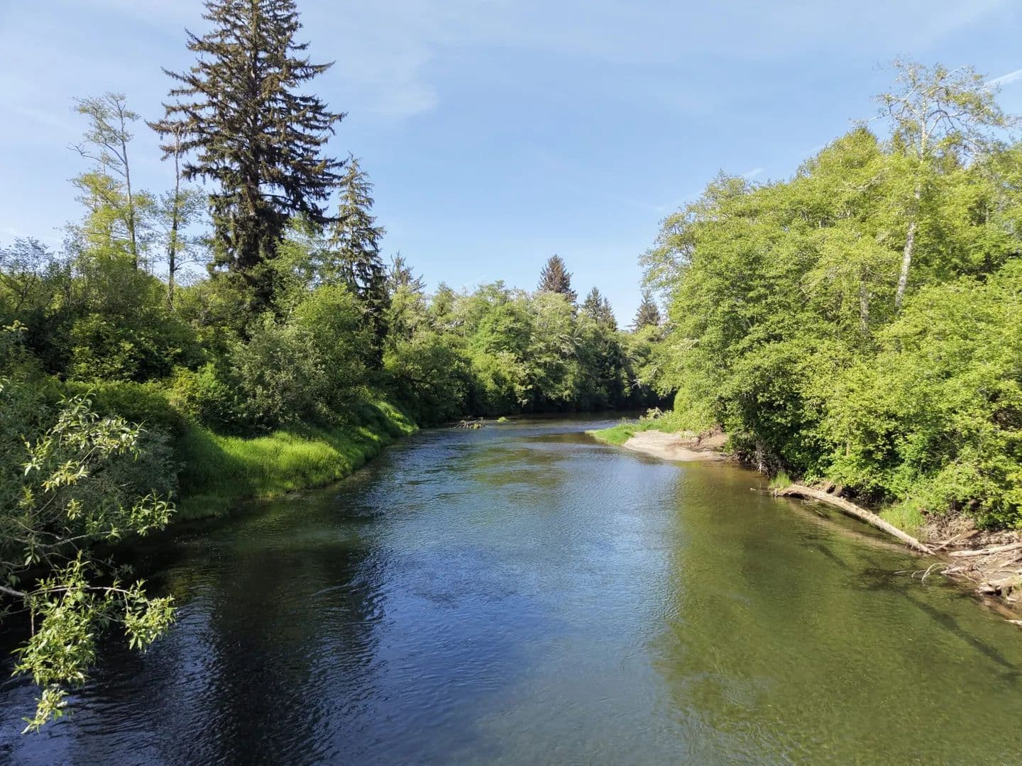
The Lincoln Creek Mallard Crossing features year-round Lincoln Creek running through the property and about a 5 acre pond to keep it accessible to waterfowl throughout the year. There are big game hunting opportunities as well. Commercial grade timber adds to the privacy and provides a revenue opportunity in the future. Paved Lincoln Creek Rd runs through the property for easy access and allowing a short commute to the local amenities.Land The property lies in the Lincoln Creek Valley in Lewis County Washington which is a well known waterfowl flyway with numerous species of ducks as well as geese and swans frequenting the property. You may see Roosevelt elk, Blacktail deer, and an occasional black bear while out admiring the many waterfowl species.Recreation Ride on a steam train. Hike the Goat’s Rock Wilderness. Fly fish on the Cowlitz. Antique shop. Celebrate a festival. Explore the White Pass Scenic Byway. Lewis County boasts the best that the rural and wild Northwest has to offer.Region & Climate In Chehalis, the summers are short, warm, dry, and partly cloudy and the winters are very cold, wet, and overcast. Over the course of the year, the temperature typically varies from 35°F to 81°F and is rarely below 24°F or above 92°F.Based on the tourism score, the best time of year to visit Chehalis for warm-weather activities is from mid July to late August.History Lewis County has a rich history of exploration and discovery. Like its namesake, Meriwether Lewis, LewisCounty has maintained a spirit of adventure since its creation in 1845. Located halfway between Seattleand Portland, Lewis County offers a unique convenience to residents while remaining a gateway to thegreat outdoors of Western Washington. Thanks to its countless hunting and fishing locations and hikingand biking trails, Lewis County is the ideal destination for residents and visitors looking to enjoy outdoorrecreation. Mount Rainier and Mount St. Helens offer majestic views and opportunities for those searchingto connect with nature. When someone imagines the beauty to be experienced in the Pacific Northwest,the sites – and sights – throughout Lewis County help make those dreams a realityLocation Lewis County is located in the southwest portion of Washington State. It is bordered on the west by Pacific County, the northwest by Thurston County, the northeast by Pierce County, the east by Yakima County, the southeast by Skamania County and the southwest by Cowlitz County. As of the 2010 U.S. Census, Lewis County had a total land area of 2,402.80 square miles and a population of 75,455. Centralia is the largest city with a population of 16,336
Humptulips River Retreat
$950,000
66 Acres
Hoquiam, Washington, 98550
Humptulips River Retreat is a recreational dream on one of Washington’s premier salmon and steelhead rivers. Watch elk wander through the property while enjoying easy access to world-class fishing and coastal adventures. A permitted 10' home lift created 1,000± sq. ft. of garage space for boats and toys, while a 550± sq. ft. entertainment deck offers the perfect place to relax after a day on the river. Minutes from Seabrook and ocean beachesImprovements The current owners invested two years in planning and working with local contractors to execute the ambitious 10’ House Lift. This project successfully preserved the home’s historic charm while adding a 1,000 sq ft, highly functional garage beneath. Crucially, leveraging one homeowner’s expertise as an environmental scientist, the lift was engineered to incorporate features that make the entire home 100% flood-resilient against the changing behavior of the Humptulips River. All work was properly permitted.10’ Lift: The home was lifted a full 10’ to provide the ability to add 8’ garage doors allowing for any sort of vehicle to be parked under the home.Pass through Garage Doors: Due to the scale of the property, having “toys” like ATVs or UTVs is pretty common. To make it easier to access these vehicles, a “pass through” garage door system was installed allowing you to drive from the driveway through the home and onto the property with ease.550 sq ft Deck: Allowing for large gatherings or a quiet moment to survey the land, the expansive deck completely changed the experience of taking advantage of the summertime sun. Outdoor wifi access as well as outdoor speakers were added to enhance the ambiance of the deck. A new staircase was built connecting the deck to the ground level. Underdecking with proper drainage was installed to make the lower level area usable all year round.100sq ft Sauna/Hot tub Deck Pad: A 10’x10’ section was reinforced to support the additional weight of a sauna or hot tub. Additionally, a dedicated 50 amp circuit was run to this area as well.8” Stem Walls and “Flood Vents”: Working with the structural engineer allowed the homeowners to completely mitigate any risks of flooding should the Humptulips River get impacted by changing climate. The stem walls are over-engineered to withstand any amount of hydrostatic force and the flood vents allow the water proofed garage to purposely let water in and drain, ensuring the hydrostatic force would never damage the home. This two pronged solution makes the home able to withstand anything.Dog Wash Station: The current homeowners installed a commercial grade dog wash station (with dryer) to make it easy to clean 4 legged family members allowing them to also fully utilize the property and surrounding areas without the worry of them getting “too dirty”, cleaning them up before returning to city life.Razer Clam and Fish cleaning station: The current homeowners and their guests fully utilized the region’s unique clamming and fishing features and added the dedicated station to simplify cleaning their catches before moving them into the main home.Dedicated Full Lower Bathroom: As the homeowners and their guests spent most of their days outside, the current homeowners added a full bathroom downstairs in order to add convenience as well as the ability to “clean up” regardless of how messy the day’s activities were.50 Amp Generate Hookup: As the home relies solely on electricity for services, a 50 amp hookup was added to the home allowing for a backup should the power go out in the region.Dedicated outdoor RV Hookups: Taking advantage of the extensive remodel, a dedicated 50 amp connection, septic cleanout and water bib was installed to support any guests who visit with their RV. Additionally, the new bathroom was also added with RV guests in mind.High Tech Infrastructure: A dedicated Structural Media Panel was installed as well as additional Cat6a ethernet lines were routed to the home’s rooms and key external locations for outdoor wifi access points. This Panel connects the home’s infrastructure to the gigabit speed cable connection from Coast Communication resulting in a highly reliable internet connection. Additionally, outdoor speaker lines were run in order to provide entertainment and ambiance with the new deck. A Tesla charger is also located downstairs.High Tech Remote Management and Automation: To make it easier to manage the home remotely, all lights switches use Lutron Caseta switches, all door locks are Z-Wave enabled and are currently remotely managed through Amazon’s Ring Alarm system and both Heat Pumps are wifi enabled enabling remote management as well.Upgraded Water System: The water supply well pressure tank, hot water heater, and filtration system was upgraded during the remodel ensuring worry free operation for decades to come. Note that the filtration system utilizes an automatic backflush process so no salts or other chemicals need to be added to the system.Upstairs Heatpump Unit: Shortly after the house lift, a dedicated mini-split HVAC system was installed for the upstairs bedroom allowing full control over the temperature of that room regardless of the rest of the home’s temperature.Upgraded siding and doors: All siding was removed and Hardy Plank was reinstalled around the entire home. Additionally all doors were replaced with composite doors ensuring decades of zero maintenance. Recreation Locally known as “The Hump”, the Humptulips River is a cornerstone of the Pacific Northwest’slegendary aquatic heritage. Flowing from the southern foothills of the Olympic Mountain range into the Grays Harbor estuary, it serves as a critical artery for wild and hatchery supplemented fish runs. For the elite angler, the1,000 feet of direct river frontage at 1518 Ocean Beach Road is not just a scenicboundary but a “front-row seat” to one of the most productive river systems in Washington State.Situated approximately 10 miles downstream from a major WDFW salmon hatchery, the property is positioned at the terminal end of a premier drift. An angler can launch close to the hatchery-level at the Humptulips Old 101 rampand enjoy a comprehensive 10-mile float through some of the river’s most productive “holes” and “runs,” finishing the day at their own private riverfront. For a shorter day, drop in at Reynvaan Bar gravel bank. Adding to this unmatched ease is a public pull-out ramp just 0.1 miles from the estate’s driveway (Thorberg). This allows the owner to recover a drift boat or jet sled and return it home in under five minutes, ready to filet the catch at the custom cleaning station in the lower garage.The current owners have built over 2 miles of trails across the 65-acres, that lead to their favorite spotslike the day-use campsite (also where the river toys are launched, hammocks are positioned, and the120-ft zip-line is located), the fishing site, Very Beary Loop’s abundant salmonberries andthimbleberries, and Marsh Trail’s bird life. The full extent of the trails provide ample space for hiking,mountain biking, and ATV’ing, while the Inner Loop is a daily favorite great for shorter walks.The retreat’s proximity to the beaches of Copalis and Moclips provides direct access to one ofWashington’s most unique cultural traditions: razor clamming. The Pacific razor clam (Siliqua patula) isa seasonal delicacy found only on these sandy, surf-swept beaches.Region & Climate ️ TemperatureSummer highs: typically 65–72°FSummer lows: 50–55°FWinter highs: 45–50°FWinter lows: 33–38°FTemperatures above 80°F are uncommon, and significant snow is rare.️ RainfallThe area receives roughly 90–100 inches of precipitation annually, with most rainfall occurring from October through March.July and August are generally dry, making them the most popular months for beach activities and outdoor recreation.☀️ Best WeatherJune through September offers the warmest temperatures, the most sunshine, and the fewest rainy days. September is often considered one of the nicest months on the Washington Coast. Lifestyle BenefitsMild temperatures year-round.Lush evergreen forests and green landscapes.Comfortable conditions for hiking, beachcombing, fishing, and outdoor recreation.Frequent wildlife sightings, including Roosevelt elk, deer, bald eagles, and migratory birds.For a real estate listing, you might say:“Enjoy Seabrook’s temperate coastal climate, where summer temperatures rarely exceed the low 70s and winters remain mild. Abundant rainfall keeps the landscape lush and green year-round, while cool ocean breezes, nearby beaches, and frequent wildlife sightings create an exceptional Pacific Northwest lifestyle.”History Hoquiam, Washington has deep roots in the Pacific Northwest timber industry and was once one of the most important lumber towns on the West Coast.Early HistoryLong before European settlement, the area was home to Indigenous peoples, including the Chehalis and Quinault tribes, who relied on the rich fisheries and forests of Grays Harbor. The name “Hoquiam” is believed to come from a Native word meaning “hungry for wood,” referring to the large amounts of driftwood that accumulated at the mouth of the Hoquiam River.Founding and Lumber BoomThe first permanent non-Native settlers arrived in the late 1850s, attracted by vast old-growth forests. In 1880, lumber entrepreneur A.M. Simpson purchased land and developed one of the area’s first major sawmills. By the 1880s and 1890s, Hoquiam had become a booming lumber town, and the city was officially incorporated on May 21, 1890.During the late 19th and early 20th centuries, Hoquiam and neighboring Aberdeen formed the heart of the Grays Harbor timber industry. Massive sawmills lined the waterfront, and millions of board feet of lumber were shipped worldwide through Grays Harbor. At its peak, the region was often referred to as part of the “lumber capital of the world.”Labor and IndustryHoquiam was also a center of labor activism. The famous 1912 Grays Harbor lumber strike involved thousands of loggers and mill workers and became an important chapter in Pacific Northwest labor history.Architectural LegacyThe wealth generated by timber produced impressive homes and buildings that still stand today. One of the best-known is Hoquiam’s Castle, a grand mansion built between 1897 and 1900 by lumber-era entrepreneur Robert Lytle.Modern HoquiamLike many timber towns, Hoquiam experienced economic challenges as logging and milling declined during the late 20th century. Today, the city remains closely tied to forestry, commercial fishing, shipping, and tourism. Its historic downtown, museums, and proximity to the Pacific Coast make it a gateway to the beaches of Grays Harbor and the Olympic Peninsula.Fun fact: At one time, the nearby Polson Lumber operation in Hoquiam was considered one of the largest lumber mills in the world.For real estate marketing, Hoquiam is often described as a community with rich logging heritage, historic architecture, deep-water port access, and easy access to world-class fishing, beaches, and the Olympic Peninsula.Location Copalis Crossing, Washington is a small rural community in northern Grays Harbor County on Washington’s scenic coast. Located along State Route 109, it serves as a gateway to the Pacific Ocean beaches, old-growth forests, and outdoor recreation of the North Beach area. The community sits approximately 5 miles east of Copalis Beach, 12 miles north of Ocean Shores, 15 miles south of Seabrook, and about 25 miles north of Aberdeen and Hoquiam.The area is known for its proximity to world-class salmon and steelhead fishing, razor clam digging, beachcombing, and abundant wildlife, including Roosevelt elk. Residents enjoy a peaceful rural setting while remaining within easy reach of coastal amenities and services.Nearby AirportsBowerman Airport in Hoquiam – approximately 20-25 minutes south and the closest public airport with a paved runway capable of handling business aircraft.Ocean Shores Municipal Airport – approximately 15-20 minutes away, serving general aviation traffic.Seattle-Tacoma International Airport (SEA) – approximately 2.5 to 3 hours by car and the region’s primary commercial airport with domestic and international service.The unique Copalis State Airport is located on the beach near the mouth of the Copalis River and is the only legal beach airport in Washington State.

Rock Creek Elk Camp
$4,995,000
4,525 Acres
Yakima, Washington, 98903
Rock Creek Elk Camp spans 1,524 deeded acres with timber rights across an additional 3,001 acres in Washington's renowned Naches region. Bordering the Ahtanum State Forest and Cowiche Wildlife Area, this exceptional property lies along a major elk migration corridor to the Oak Creek feeding grounds. Rock Creek flows year-round with trout and cutthroat, while an extensive road system provides outstanding access throughout this rare legacy ranch.Land The Rock Creek Elk Camp is 1524 acres deeded and an additional 3001 acres of timber rights. PTR-Perpetual Timber Rights.Recreation The Ahtanum State Forest is one of Central Washington’s premier year-round outdoor recreation destinations. Encompassing more than 75,000 acres of forest, meadows, ridges, and streams, it offers an exceptional variety of activities across all four seasons.Some of the most popular recreational opportunities include:World-class elk and deer hunting – The forest is renowned for Roosevelt and Rocky Mountain elk, mule deer, black bear, turkey, and upland bird hunting. It borders the Oak Creek Wildlife Area, making it one of Washington’s premier big game regions.ATV, UTV & 4×4 adventures – Hundreds of miles of Green Dot Roads provide designated routes for off-road vehicles, Jeeps, side-by-sides, and dual-sport motorcycles.Hiking & backpacking – Trails such as Grey Rock and Whites Ridge lead through forests, alpine meadows, and scenic overlooks with views of Mount Adams and the Yakima Valley.Horseback riding – The forest is a favorite among equestrians, with dedicated horse camps and extensive trail systems.Mountain biking & gravel cycling – Forest roads and non-motorized trails offer rides ranging from leisurely gravel routes to challenging climbs.Camping – Developed campgrounds, equestrian camps, cabins, and dispersed camping provide options from family outings to remote backcountry experiences.Snowmobiling – During winter, the forest features approximately 67 miles of groomed snowmobile trails, making it a popular destination for winter recreation.Wildlife viewing & photography – Elk, mule deer, black bears, wild turkeys, raptors, and numerous songbirds are regularly seen throughout the forest.Fishing – Nearby streams and rivers provide opportunities for trout fishing, though some waters within the forest have seasonal restrictions to protect native fish populations.Scenic driving & photography – Forest roads access panoramic viewpoints, wildflower meadows, and ridgelines with spectacular vistas of Mount Adams, Mount Rainier (on clear days), and the surrounding Cascade foothills.Region & Climate Nestled in the eastern foothills of Washington’s Cascade Mountains near Naches, Rock Creek Elk Camp enjoys one of the state’s most desirable four-season climates. The region offers warm, sunny summers with low humidity, colorful autumns, snowy winters, and mild, refreshing springs. Annual precipitation is greater than the nearby Yakima Valley due to the property’s higher elevation, creating healthy forests, lush meadows, and dependable year-round water sources while still providing an abundance of sunshine.Summer temperatures typically range from the mid-70s to mid-80s, making conditions ideal for hiking, horseback riding, ATV adventures, fishing, and wildlife viewing. Fall brings crisp mountain air, brilliant colors, and the arrival of Washington’s renowned elk rut and hunting season. Winter transforms the surrounding forests into a snow-covered landscape, supporting snowmobiling, snowshoeing, cross-country skiing, and the annual migration of hundreds of Rocky Mountain elk toward the Oak Creek winter feeding grounds. Spring arrives with blooming wildflowers, flowing creeks, abundant wildlife activity, and ideal conditions for exploring the property’s extensive trail and road system.Bordering the Ahtanum State Forest and Cowiche Wildlife Area, Rock Creek Elk Camp provides direct access to thousands of acres of public land while offering the privacy and exclusivity of a large private holding. Located just 30 minutes from Yakima and approximately 2½ hours from Seattle, the property offers an exceptional combination of wilderness, recreation, and convenient accessibility—making it a true year-round destination for outdoor enthusiasts, sportsmen, and families seeking a legacy retreat.History The Naches region is deeply rooted in the history of the Pacific Northwest, where Native American tribes, early explorers, miners, loggers, ranchers, and settlers shaped the landscape over generations. For centuries, the Yakama people traveled these valleys and mountain passes to hunt, fish, and gather native foods, following many of the same wildlife corridors still used by elk today.The surrounding forests later became an important part of Washington’s timber industry, while nearby ranches and orchards helped establish the Yakima Valley as one of the nation’s premier agricultural regions. Today, the area retains its authentic western character, with vast public lands, working ranches, and small mountain communities that preserve the traditions of outdoor recreation and responsible land stewardship.Rock Creek Elk Camp lies within one of Washington’s most productive wildlife landscapes, bordered by the Ahtanum State Forest to the west and the Cowiche Wildlife Area to the east. The property is situated along a well-established elk migration corridor leading to the Oak Creek winter feeding area, where one of the state’s largest Rocky Mountain elk herds has been managed for decades. This extraordinary setting supports exceptional populations of elk, mule deer, black bear, wild turkey, upland birds, and numerous other wildlife species.Today, the region is recognized as a premier destination for hunting, fishing, horseback riding, ATV and UTV recreation, hiking, camping, snowmobiling, and wildlife photography. Combining rich history, abundant natural resources, and year-round recreation, the area offers a rare opportunity to own land in one of Central Washington’s most celebrated outdoor destinations.Location Ideally situated in the heart of Central Washington’s scenic Naches region, Rock Creek Elk Camp offers a rare combination of seclusion, natural beauty, and convenient accessibility. Located just west of Yakima, the property is surrounded by some of the state’s most celebrated public lands, including the Ahtanum State Forest and Cowiche Wildlife Area, while remaining within easy reach of modern amenities, restaurants, healthcare, and shopping.Despite its private setting, the ranch is easily accessed year-round and serves as an ideal destination for weekend escapes or extended stays. Seattle is approximately a 2½ to 3-hour drive via Interstate 90 and U.S. Highway 12, making the property readily accessible from the Puget Sound region.Air travelers are well served by several nearby airports:Yakima Air Terminal (YKM) – Approximately 30–40 minutes away, offering daily commercial service to Seattle along with full general aviation and private aircraft facilities.Seattle–Tacoma International Airport (SEA) – Approximately 2½ to 3 hours by vehicle, providing extensive domestic and international flight connections.Tri-Cities Airport (PSC) – Approximately 1½ to 2 hours away, with commercial service to numerous western U.S. destinations.Pangborn Memorial Airport (EAT) in Wenatchee – Approximately 2 to 2½ hours away, providing additional regional air service.Whether arriving by vehicle or private aircraft, Rock Creek Elk Camp offers exceptional accessibility without sacrificing the privacy, solitude, and wilderness experience that define one of Washington’s premier legacy recreational properties.

Case Road 15 acres
$425,000
15.45 Acres
Olympia, Washington, 98512
Rare 15+ acre opportunity in the desirable Tumwater School District! Features a private, elevated 5± acre wooded homesite with potential eastern sunrise views, paved driveway, power, and phone. The remaining 10± acres offer level pasture with Case Road frontage. Just 5 minutes to I-5 at Maytown, combining peaceful country living with convenient access to Olympia, Tumwater, and Centralia.Land 37.3% Grassland/Pasture22.4% Evergreen Forest16.4% Herbaceous Wetlands13.4% Shrubland9% Developed/Open Space1.5% Mixed ForestImprovements The property has an approved septic design and wetland delineation completed. Well is neededRecreation Know for being Washington State’s seat of government, Olympia’s creative spirit and thriving art and food scene make it the perfect getaway destination. Set along Capitol Lake and Budd Inlet, the city offers miles of shoreline, trails, and picturesque waterfront.Browse vintage and antique shops, independent bookstores, local coffee roasters, public art, and live music venues. Acclaimed restaurants take up prime real estate along the waterfront, while an incredible assortment of dining opportunities abound downtown.Region & Climate Olympia, WA has a mild climate with temperatures ranging from an average high of 73°F in July to an average low of 38°F in January. Rainfall is moderate throughout the year with an annual rainfall of 37 inches per year and snowfall averaging 8 inches per year. The summers are very mild with humid air masses off the Pacific coast bringing in occasional showers. Winters are mild compared to other areas of the United States as Olympia is situated in a rain shadow area which receives little or no snow due to its location on the Puget Sound.Olympia, Washington gets 53 inches of rain, on average, per year. The US average is 38 inches of rain per year.Olympia averages 6 inches of snow per year. The US average is 28 inches of snow per year.On average, there are 136 sunny days per year in Olympia. The US average is 205 sunny days.Olympia gets some kind of precipitation, on average, 167 days per year. Precipitation is rain, snow, sleet, or hail that falls to the ground. In order for precipitation to be counted you have to get at least .01 inches on the ground to measure.History Located on the southernmost point of Puget Sound, the peninsula known as Olympia was Steh-Chass to the Coastal Salish who occupied the site for many generations before the American settlement was established.The end of what we now know as Budd Inlet was a favorite shellfish gathering site for many Coastal Salish tribes, including the Nisqually, Duwamish and Squaxin. Potlatches, the Northwest tribal custom in which tribal leaders shared their wealth with neighboring tribal groups, were held both east and west of the Inlet near Olympia.The falls of the Deschutes River at Tumwater called “Stehtsasamish” by the Nisqually Indians may have been occupied as a permanent village site for shellfish and salmon harvesting for 500 years or more before the coming of white settlers.The first American settlers were Levi Lathrop Smith and Edmund Sylvester who claimed the town site in 1846, naming it Smither or Smithster (and later Smithfield), after themselves. The town was officially platted in 1850 by Sylvester, at which point it was given the name Olympia, as suggested by Isaac N. Ebey, a local resident in recognition of the view of the majestic Olympic mountains seen to the north on a clear day. Sylvester, a Maine native, laid out a town in a New England style with a town square, tree lined streets, land for schools, a Masonic Hall, and capitol grounds.Location Olympia’s strategic geographic location along Interstate 5 at the gateway to the Olympic Peninsula, puts one within two hours or less of regional recreational attractions – from hiking and skiing in the mountains to beachcombing along ocean shores.52 miles: Seattle, WA (SEA / KSEA) Seattle-Tacoma International Airport63 miles: Seattle, WA (LKE / W55) Kenmore Air Harbor Seaplane Base114 miles: Portland, OR (PDX / KPDX) Portland International Airport144 miles: Victoria, Canada (YWH / CYWH) Victoria Inner Harbour Airport160 miles: Victoria, Canada (YYJ / CYYJ) Victoria International Airport165 miles: San Juan Island, WA (FBS / W33) Friday Harbor Seaplane Base175 miles: Roche Harbor, WA (RCE / W39) Roche Harbor Seaplane Base200 miles: Vancouver, Canada (YVR / CYVR) Vancouver International Airport

Case Extension 159
$1,500,000
159.66 Acres
Olympia, Washington, 98512
159.66 acres located minutes south of Olympia with I-5 frontage and Mt Rainier views. The majority of the property is fenced pasture with approx 40 acres of mature timber. The property features a large 8,720 sq ft barn with loft, 2,492 sq ft lean to 520 sq ft garage. Well and septic on the property are in unknown condition. Preliminary plat for 48 lots expired in 2011 Project number Plat 020622Recreation Know for being Washington State’s seat of government, Olympia’s creative spirit and thriving art and food scene make it the perfect getaway destination. Set along Capitol Lake and Budd Inlet, the city offers miles of shoreline, trails, and picturesque waterfront.Browse vintage and antique shops, independent bookstores, local coffee roasters, public art, and live music venues. Acclaimed restaurants take up prime real estate along the waterfront, while an incredible assortment of dining opportunities abound downtown.Region & Climate Olympia, WA has a mild climate with temperatures ranging from an average high of 73°F in July to an average low of 38°F in January. Rainfall is moderate throughout the year with an annual rainfall of 37 inches per year and snowfall averaging 8 inches per year. The summers are very mild with humid air masses off the Pacific coast bringing in occasional showers. Winters are mild compared to other areas of the United States as Olympia is situated in a rain shadow area which receives little or no snow due to its location on the Puget Sound.Olympia, Washington gets 53 inches of rain, on average, per year. The US average is 38 inches of rain per year.Olympia averages 6 inches of snow per year. The US average is 28 inches of snow per year.On average, there are 136 sunny days per year in Olympia. The US average is 205 sunny days.Olympia gets some kind of precipitation, on average, 167 days per year. Precipitation is rain, snow, sleet, or hail that falls to the ground. In order for precipitation to be counted you have to get at least .01 inches on the ground to measure.History Located on the southernmost point of Puget Sound, the peninsula known as Olympia was Steh-Chass to the Coastal Salish who occupied the site for many generations before the American settlement was established.The end of what we now know as Budd Inlet was a favorite shellfish gathering site for many Coastal Salish tribes, including the Nisqually, Duwamish and Squaxin. Potlatches, the Northwest tribal custom in which tribal leaders shared their wealth with neighboring tribal groups, were held both east and west of the Inlet near Olympia.The falls of the Deschutes River at Tumwater called “Stehtsasamish” by the Nisqually Indians may have been occupied as a permanent village site for shellfish and salmon harvesting for 500 years or more before the coming of white settlers.The first American settlers were Levi Lathrop Smith and Edmund Sylvester who claimed the town site in 1846, naming it Smither or Smithster (and later Smithfield), after themselves. The town was officially platted in 1850 by Sylvester, at which point it was given the name Olympia, as suggested by Isaac N. Ebey, a local resident in recognition of the view of the majestic Olympic mountains seen to the north on a clear day. Sylvester, a Maine native, laid out a town in a New England style with a town square, tree lined streets, land for schools, a Masonic Hall, and capitol grounds.Location Olympia’s strategic geographic location along Interstate 5 at the gateway to the Olympic Peninsula, puts one within two hours or less of regional recreational attractions – from hiking and skiing in the mountains to beachcombing along ocean shores.52 miles: Seattle, WA (SEA / KSEA) Seattle-Tacoma International Airport63 miles: Seattle, WA (LKE / W55) Kenmore Air Harbor Seaplane Base114 miles: Portland, OR (PDX / KPDX) Portland International Airport144 miles: Victoria, Canada (YWH / CYWH) Victoria Inner Harbour Airport160 miles: Victoria, Canada (YYJ / CYYJ) Victoria International Airport165 miles: San Juan Island, WA (FBS / W33) Friday Harbor Seaplane Base175 miles: Roche Harbor, WA (RCE / W39) Roche Harbor Seaplane Base200 miles: Vancouver, Canada (YVR / CYVR) Vancouver International Airport

Aeneas Valley 5 acres
$59,500
5.01 Acres
Tonasket, Washington, 98855
Enjoy all of the recreational opportunities the Aeneas Valley has to offer while having a dry secure place for your base camp or storage while building a residence. Located on the property is a newly constructed and permitted 24x24 insulated shop with double 10 foot doors and a concrete floor. The property backs up to 35 acres of DNR land for privacy and Sorona Way E ends at 1000's of acres of National Forest land. Owner financing available!Improvements 24×24 metal building with 10 foot doors and a concrete floorRecreation Okanogan County is in the heart of North Central Washington State about 150 miles northwest of Spokane and 220 miles east of Seattle. We share a border in the north with Canada and are wedged between the foothills of the Cascade and Rocky Mountains.Geographically a highland desert, the area features generally arid summers and mild winters. The county is home to about 43,000 people and covers nearly 5,300 square miles. Residents and visitors alike enjoy fishing, boating, hiking, hunting, golf, downhill and cross-country skiing, snowmobiling, off-road vehicle fun, and other great recreational opportunities.Region & Climate The climate in Okanogan, WA County is characterized by mild, dry summers and cold, snowy winters. Average annual precipitation in the county ranges from 8 to 12 inches, with much of this occurring between October and May. Average temperatures range from a low of 19-29°F in winter months to highs of 70-90°F in summer. The area enjoys plenty of sunshine throughout the year and generally experiences fewer cloudy days than other areas of Washington state.Okanogan County, Washington gets 16 inches of rain, on average, per year. The US average is 38 inches of rain per year.Okanogan County averages 58 inches of snow per year. The US average is 28 inches of snow per year.On average, there are 189 sunny days per year in Okanogan County. The US average is 205 sunny days.Okanogan County gets some kind of precipitation, on average, 88 days per year. Precipitation is rain, snow, sleet, or hail that falls to the ground. In order for precipitation to be counted you have to get at least .01 inches on the ground to measure.History Before Europeans arrived, the Okanogan County region was home to numerous indigenous peoples that would eventually become part of three Indian reservations referred to as the Northern Okanogans or Sinkaietk, Tokoratums, Kartars and Konkonelps. They spoke in seven types of Interior Salish languages related to the Puget Sound tribes. The Okanogans experienced a favorable climate, camping in the winter, hunting bears in the spring, catching fish in the summer and hunting deer in fall. The camps consisted of teepee-like longhouses built with hides and bark. Women gathered nuts and berries. A popular destination for this was the Kettle Falls, where the Columbia River dropped some 20 feet (6.1 m).Due to its remoteness, the Okanogan County area was one of the last in Washington settled by Europeans. It was an early thoroughfare used by prospectors to gain access to other communities, such as British Columbia. By the 21st century, the region specialized in agriculture, forestry and tourism. Electric producer Grand Coulee Dam was constructed between 1933 and 1942, originally with two power plants, around the Okanogan and Grant counties at the former’s southern border.[7]

Window Rock Ranch
$845,000
40 Acres
Tonasket, Washington, 98855
The Window Rock Ranch is nestled in the serene beauty of Aeneas Valley near Tonasket, this exceptional 40-acre ranch offers the perfect blend of privacy, functionality, and rural charm. Surrounded by open skies and sweeping views, the property provides an ideal setting for those seeking a peaceful country lifestyle. The ranch features a custom built main home and guest house along with a well equipped barn set up for horses. Land The custom built home on 40 acres offers panoramic views of the valley and surrounding timbered landscape. The land is a mix of sandy loam soils with rocky outcroppings, fenced pasture and timbered forests. Improvements The custom-built main residence, constructed in 2019, spans 2004 square feet and features 3 bedrooms and 2 bathrooms. Thoughtfully designed with modern comforts and quality craftsmanship, the home offers inviting living spaces filled with natural light and picturesque views of the surrounding landscape. A separate 840-square-foot guest house adds incredible flexibility, complete with 1 bedroom, 1 bathroom, and a loft—perfect for visitors, rental income, or multi-generational living. Equestrian and agricultural enthusiasts will appreciate the well-equipped 864-square-foot barn, featuring a hay loft and set up for horses.Recreation Nearby Recreation in Okanogan County:Okanogan County, the largest county in Washington State, is known for its vast public lands, stunning natural beauty, and four-season recreation. Within a short drive from Lookout Ranch, you’ll find:Lakes & Rivers: Fish or boat on nearby lakes such as Spectacle Lake, Wannacut Lake, Palmer Lake, and Lake Osoyoos. The Similkameen and Okanogan Rivers also offer excellent fishing and floating opportunities.Hiking & Backpacking: Explore trails in the Okanogan National Forest or head to the Pasayten Wilderness for remote alpine adventures.Skiing & Snow Activities: Loup Loup Ski Bowl offers downhill skiing, snowboarding, and Nordic trails. Snowmobiling is also popular in the surrounding highlands.Golf & Wine: Enjoy a round at Gamble Sands, one of the top-rated golf courses in the country, or visit nearby wineries and tasting rooms.Wildlife & Birdwatching: The region is a hotspot for birders and nature photographers, with diverse habitats supporting hundreds of species.Whether you’re looking for peaceful solitude, adventurous outings, or a bit of both, Lookout Ranch and Okanogan County provide an incredible setting for recreation year-round.Region & Climate Located in scenic Okanogan County, Washington, Window Rock Ranch enjoys a semi-arid climate with over 300 days of sunshine each year—ideal for outdoor living and agriculture. Summers are warm and dry with average highs in the 80s°F, while winters are cold and snowy, offering a classic four-season experience. Annual precipitation averages around 10–12 inches, with about 28 inches of snowfall. The area is known for its rich outdoor recreation, including fishing in nearby lakes, hunting, hiking, horseback riding, and wildlife viewing. The surrounding region boasts small-town charm, with Tonasket, Oroville, and Republic offering essential amenities, festivals, farmers markets, and a strong agricultural heritage.History The Window Rock Ranch sits in the heart of the Okanogan Highlands—a region steeped in rich history and cultural significance. For centuries, the area was home to Native American tribes, particularly the Okanogan people, who used the valleys and highlands for seasonal hunting, fishing, and gathering. Aeneas Valley, just to the east, was historically a wintering ground due to its milder climate and abundant resources.By the late 1800s and early 1900s, settlers and homesteaders arrived, drawn by the region’s fertile grazing lands and timber resources. Many of these original homesteads, some still marked by old cabins and outbuildings, were established for cattle ranching and small-scale farming—traditions that continue today. The property itself was once part of a larger cattle operation and has retained its ranching roots with infrastructure designed for livestock and off-grid living.Over the years, the land has remained largely undeveloped, preserving its natural beauty and historic character, with panoramic views that have likely remained unchanged for generations. The combination of open rangeland, wooded groves, and natural springs gives a glimpse into the area’s working heritage and unspoiled wilderness.Location The Window Rock Ranch is located in the scenic Aeneas Valley in North Central Washington, offering both seclusion and accessibility. Nestled between the small towns of Tonasket and Republic, the property sits in a quiet, elevated position with sweeping views of the surrounding valley and Cascade Mountains.For regional travel, the nearest small airport is the Tonasket Municipal Airport, which features a 3,000-foot paved runway suitable for private planes. The closest major airport is Spokane International Airport, about 2.5 to 3 hours away, offering full commercial service. Wenatchee’s Pangborn Memorial Airport is another option, located roughly 2.5 hours to the south.Basic amenities, including grocery stores, gas stations, restaurants, schools, and medical facilities, can be found in Tonasket and Republic. For more extensive shopping and services, Omak and Oroville are within an hour drive, featuring big-box stores like Walmart and hardware outlets such as Home Depot.Despite its remote feel, the Window Rock Ranch is ideally positioned for those seeking a balance between privacy and practicality, with reliable year-round road access and all the essentials within a reasonable drive