Search Brokers - Kerry Engelmann

Kerry Engelmann
Hayden Outdoors
Keller Williams Agent - License: N/A
Contact
Fill in the Form below to send a message to this broker
By submitting, you agree to our privacy policy and terms.
Land for Sale from Kerry Engelmann
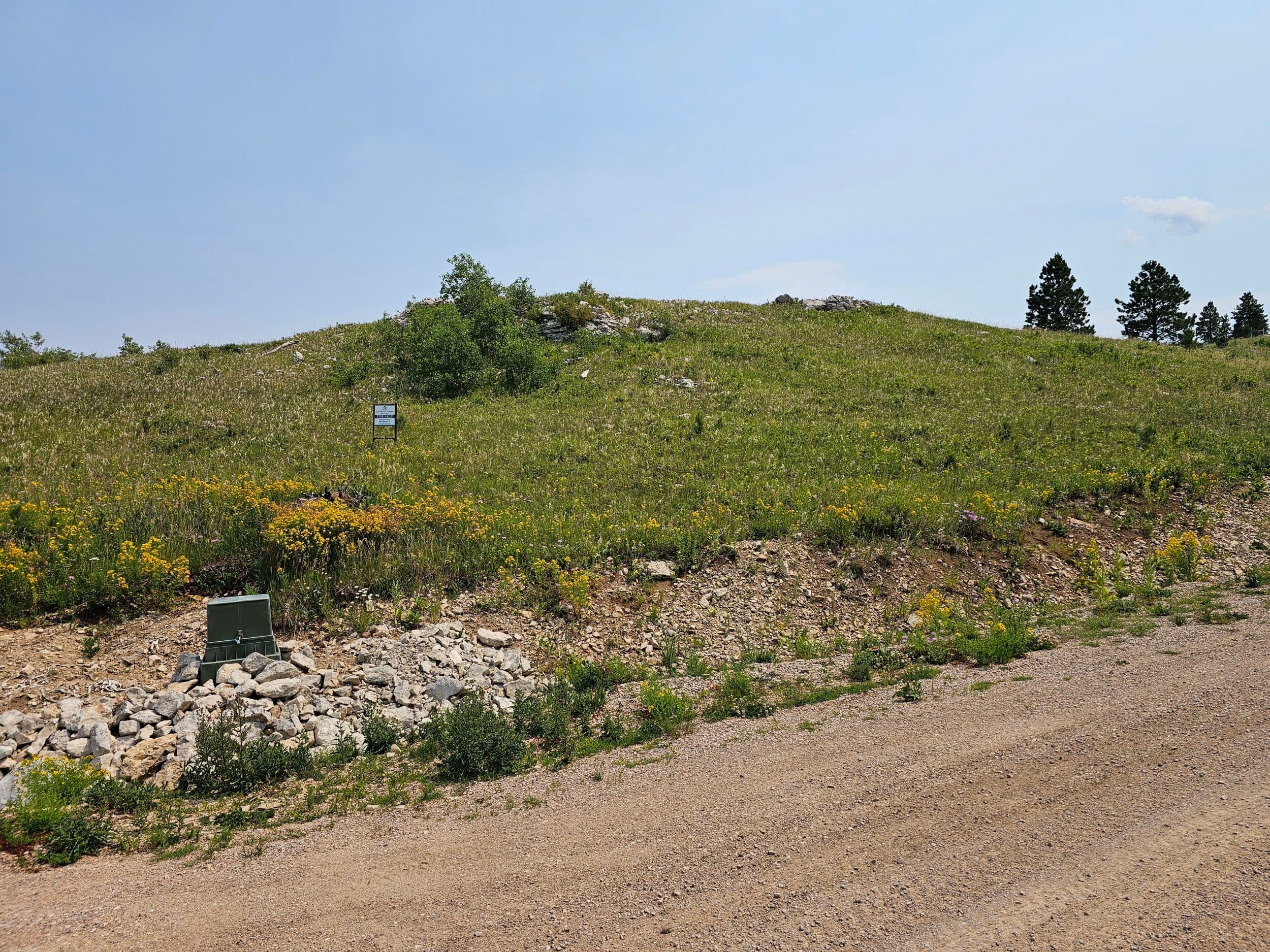
Majestic Heights Road, Lot 11
$229,000
2 Acres
Sturgis, South Dakota, 57785
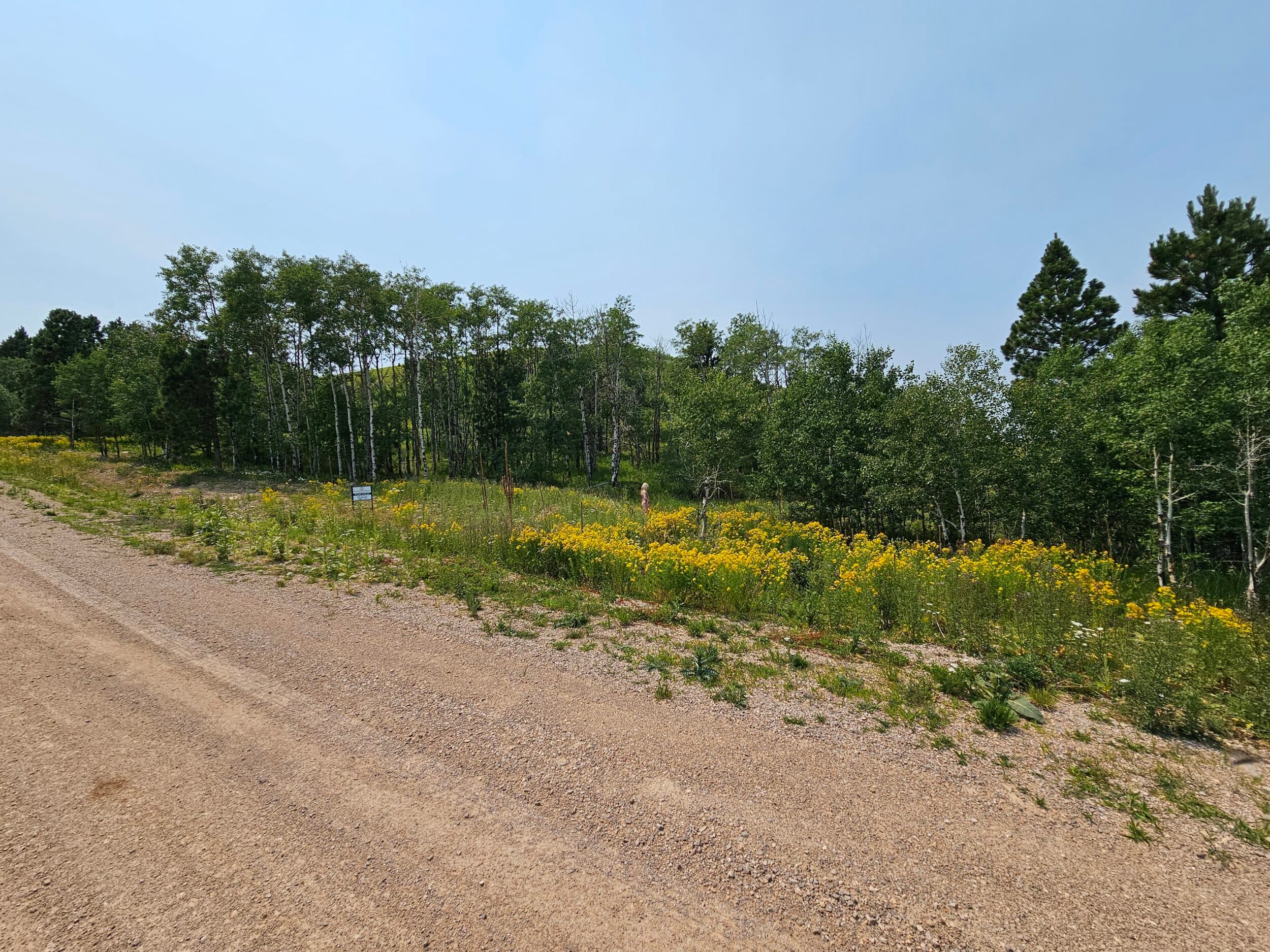
Nestled atop an iconic mountaintop in the majestic Black Hills of South Dakota, this 2 acre building site offers an unparalleled opportunity to create your dream residence or vacation getaway. Just minutes away from the vibrant downtown Deadwood, this property promises the perfect blend of seclusion and convenience, inviting you to experience the best of both worlds. This property offers the perfect canvas for your architectural masterpiece.Land Prepare to be captivated by 360-degree panoramic views that feature some of the most renowned landmarks in the area. Gaze upon the majestic Terry Peak, the spiritual Bear Butte, and the serene Orman Dam. Each view promises a unique and inspiring experience, changing with the seasons and time of day.The rear of this lot adjoins thousands of acres of BLM land, offering a serene backdrop and ensuring your view remains unspoiled. This proximity to protected land not only guarantees privacy but also provides direct access to a vast expanse of natural beauty, ideal for hiking, wildlife observation, and embracing the great outdoors. Water and electricity are to the lot line.Recreation The Black Hills, particularly the Deadwood area, offer a wide range of recreational opportunities that attract visitors year-round. The region’s diverse landscape of forests, mountains, and rivers provides a perfect setting for various outdoor activities. Here’s an overview of the recreational opportunities:Hiking and BikingTrails: The Black Hills are crisscrossed with numerous trails suitable for all levels of hikers and bikers. The George S. Mickelson Trail is particularly famous, stretching over 109 miles from Deadwood to Edgemont. It’s a converted rail trail that passes through forests, alongside creeks, and offers stunning views of the surrounding landscape.Black Elk Peak: The highest point east of the Rocky Mountains, Black Elk Peak, offers a challenging hike with rewarding panoramic views at the summit.CampingThe region has several campgrounds, ranging from primitive sites to more developed areas with amenities. Popular camping spots include Custer State Park, Spearfish Canyon, and various locations within the Black Hills National Forest.Backcountry camping is also an option for those seeking solitude and a closer connection with nature.Fishing & BoatingLakes and Reservoirs: The Black Hills are dotted with lakes and reservoirs, such as Pactola Lake, Sheridan Lake, and Deerfield Reservoir, where visitors can fish for trout, bass, and other species. These water bodies also offer opportunities for boating, kayaking, and paddle boarding.Streams and Rivers: The area’s streams and rivers, like Spearfish Creek and Rapid Creek, are popular spots for fly fishing.Wildlife and PhotographyCuster State Park: A must-visit for wildlife enthusiasts, this park is home to a large herd of bison, as well as deer, elk, pronghorn, and a variety of bird species. The park’s scenic drives, like the Wildlife Loop Road, provide ample opportunities to observe these animals in their natural habitat.The region’s diverse landscapes also make it a prime location for nature photography, with opportunities to capture everything from sweeping vistas to close-up shots of wildlife.Rock ClimbingThe Black Hills, with its granite spires and cliffs, is a popular destination for rock climbing. Sylvan Lake and Needles Highway are well-known climbing spots, offering routes for both beginners and experienced climbers.Winter SportsSnowmobiling: The Black Hills have over 350 miles of groomed snowmobile trails, winding through forests and offering beautiful winter scenery.Skiing and Snowboarding: Terry Peak Ski Area near Deadwood is a popular destination for downhill skiing and snowboarding, with runs for all skill levels.Cross-Country Skiing and Snowshoeing: These activities are popular in the winter months, with many trails converted for cross-country skiing and snowshoeing.Historical & Cultural AttractionsDeadwood: The town itself is a major attraction, offering a blend of Old West history and modern entertainment. Visitors can explore historic sites like the Adams Museum, Mount Moriah Cemetery (the final resting place of Wild Bill Hickok and Calamity Jane), and participate in reenactments of historic events.Gambling: Deadwood also offers a range of casinos and gaming establishments, making it a lively spot for those interested in nightlife.Scenic DrivesSpearfish Canyon Scenic Byway: This drive is renowned for its stunning limestone cliffs, waterfalls, and vibrant autumn colors.Needles Highway and Iron Mountain Road: These drives offer dramatic views, including the famous Needles Eye rock formation and glimpses of Mount Rushmore.Horseback RidingMany outfitters in the area offer guided horseback riding tours, allowing visitors to explore the Black Hills as the early settlers did.ATV & Off-RoadingThe Black Hills National Forest offers numerous trails and roads open to ATV and off-road vehicle use, providing an adventurous way to explore the region’s rugged terrain.CavingThe Black Hills are home to several caves, including Jewel Cave National Monument and Wind Cave National Park. These caves offer guided tours that explore their intricate formations and underground passages.These diverse recreational opportunities make the Black Hills and the Deadwood area a year-round destination for outdoor enthusiasts, history buffs, and adventure seekers alike.Region & Climate The climate of the Black Hills, including the Deadwood area, is generally classified as a continental climate, but it is also influenced by the elevation and forested environment. Here’s a breakdown of the climate characteristics:Seasons: The Black Hills experience all four seasons distinctly. Winters are cold and can be snowy, especially at higher elevations. Snowfall in Deadwood is common from late fall through early spring. Summers are warm, with temperatures typically ranging from the mid-70s to low 80s°F (24-28°C), though cooler temperatures prevail at higher elevations.Precipitation: The Black Hills receive more precipitation than the surrounding plains, due to orographic lift (where moist air is forced upward by the terrain, cooling and releasing moisture as rain or snow). Deadwood receives an average of about 28 inches (71 cm) of precipitation annually, with the majority falling as snow in the winter and rain in the spring and summer.Temperature: Due to the elevation (Deadwood sits around 4,500 feet or 1,370 meters above sea level), temperatures can be cooler compared to the surrounding plains. Winter temperatures often dip below freezing, while summer temperatures are mild to warm.Microclimates: The varied topography of the Black Hills creates numerous microclimates. Valleys and sheltered areas like Deadwood might experience milder conditions, while exposed peaks and ridges can be significantly cooler and windier.History The history of the Black Hills and the Deadwood area is rich and deeply intertwined with the cultural, economic, and social developments of the American West. Understanding this history provides valuable context for anyone considering making this unique region their home.Indigenous HeritageLakota Sioux: The Black Hills, known as Paha Sapa in Lakota, hold profound spiritual significance to the Lakota Sioux people. The area was considered sacred, with the Lakota believing it to be the center of their universe. The Black Hills were used for ceremonial purposes and were central to the cultural identity of the Lakota.The Gold Rush and SettlementGold Discovery (1874): The discovery of gold in the Black Hills by the Custer Expedition in 1874 triggered a rush of miners and settlers to the area, despite it being designated as Sioux land. This influx led to the establishment of towns like Deadwood and Lead.Deadwood’s Founding (1876): Deadwood became a boomtown almost overnight, attracting thousands of fortune seekers. The town quickly developed a reputation for lawlessness, with famous figures like Wild Bill Hickok, Calamity Jane, and Seth Bullock becoming part of its storied past. Wild Bill Hickok, famously shot while holding a hand of aces and eights, is buried in Deadwood’s Mount Moriah Cemetery, along with other notable historical figures.Economic and Cultural DevelopmentMining Industry: The initial gold rush gave way to more structured mining operations, with the Homestake Mine in Lead becoming one of the world’s largest and most productive gold mines. The mine operated for over a century, contributing significantly to the local economy and shaping the development of the surrounding communities.Frontier Culture: The early days of Deadwood were marked by a blend of rugged frontier life and rapid development. Saloons, gambling halls, and brothels were common, giving the town its wild reputation. Over time, efforts were made to bring order to the town, with the establishment of law enforcement and civic institutions.Modern TimesPreservation: As the mining boom waned, Deadwood transformed into a hub for tourism and historical preservation. In 1989, gambling was legalized in Deadwood, leading to a revitalization of the town and the preservation of many historic buildings.Tourism and Heritage: Today, Deadwood is a National Historic Landmark District, preserving its Wild West heritage while offering modern amenities and attractions. The town’s rich history is a focal point for tourism, with numerous museums, historic sites, and reenactments drawing visitors from around the world.The Black Hills TodayCommunity and Culture: The Black Hills region, including Deadwood, has a strong sense of community. Residents often embrace the area’s history and natural beauty, with a lifestyle that balances modern conveniences with a connection to the outdoors and a deep appreciation for the local heritage.Education and Healthcare: The area has access to quality education and healthcare facilities, with the nearby cities of Rapid City and Spearfish providing additional resources and amenities.Economy: While tourism remains a significant part of the local economy, the region has diversified with industries such as healthcare, education, and small businesses. The presence of the Sanford Underground Research Facility, located at the site of the former Homestake Mine, has also brought scientific research and technological innovation to the area.Sense of PlaceConnection to History: Living in the Deadwood area means being part of a community that values its rich history. Residents often participate in local events, historical societies, and cultural activities that celebrate the region’s past.Outdoor Lifestyle: The Black Hills offer abundant opportunities for outdoor recreation, which is a significant aspect of life for many residents. Whether it’s hiking, fishing, skiing, or simply enjoying the natural beauty, the connection to the land is a defining characteristic of the area.For those looking to make the Black Hills and Deadwood area their home, the region offers a unique blend of historical significance, natural beauty, and a close-knit community, making it an appealing place to live for those who appreciate both its storied past and vibrant present.Location Located just a few miles outside of Deadwood, South Dakota, this property offers a tranquil setting while being conveniently close to the historic town. This area is characterized by a mix of forested landscapes, rolling hills, and open spaces, providing a serene environment with easy access to the amenities and attractions of Deadwood.Nearest AirportsRapid City Regional Airport (RAP): Located approximately 54 miles southeast of Deadwood, this is the closest major airport. It offers regular flights to and from several major cities across the U.S. The drive from the airport to your property would take about an hour, mostly via U.S. Highway 385 and Interstate 90.Nearest Towns and AmenitiesDeadwood, South Dakota: As you are just a few miles from Deadwood, the town itself is the nearest hub for daily needs. Deadwood offers a variety of shops, restaurants, and entertainment options, including its famous casinos and historic sites. The town also has basic services like grocery stores, gas stations, and a post office.Lead, South Dakota: Just a short drive south of Deadwood (about 3 miles), Lead offers additional amenities and a small-town atmosphere. It is home to the Sanford Lab Homestake Visitor Center, which provides a glimpse into the town’s rich mining history.Spearfish, South Dakota: About 15 miles northwest of Deadwood, Spearfish is a larger town that provides more extensive services. Here you’ll find larger grocery stores, medical facilities, and educational institutions, including Black Hills State University.AmenitiesGrocery Stores: While Deadwood has smaller grocery stores and convenience shops, larger supermarkets like Walmart and Safeway are located in Spearfish.Healthcare Facilities: The nearest hospital is the Lead-Deadwood hospital, just a few miles away. For more specialized healthcare, a regional hospital is approximately 45 miles away in Rapid City.Schools: If you have school-age children, the Lead-Deadwood School District serves this area, offering elementary, middle, and high schools. For higher education, Black Hills State University in Spearfish is the closest option.Outdoor RecreationHiking and Biking: The property’s proximity to Deadwood means you’re near many hiking and biking trails, including the George S. Mickelson Trail, which offers miles of scenic paths through the Black Hills.Skiing and Snowboarding: Terry Peak Ski Area is about 7 miles from Deadwood, offering excellent winter sports opportunities.Fishing and Boating: There are several lakes and reservoirs nearby, such as Pactola Lake and Sheridan Lake, where you can fish, boat, and enjoy water sports.Points of InterestHistoric Deadwood: Living close to Deadwood means you’ll be near numerous historic sites and cultural events. Whether it’s visiting the Adams Museum, attending a reenactment, or exploring the town’s storied past, there’s always something to do.Cultural Events: Deadwood hosts a variety of events year-round, including the Deadwood Jam music festival, Days of ’76 Rodeo, and Wild West reenactments.This property just outside Deadwood offers a perfect blend of peaceful rural living with easy access to the rich cultural and historical amenities of Deadwood, as well as the larger services available in Spearfish and Rapid City. Whether you’re drawn to the outdoor recreation opportunities or the historic charm of the area, this location provides a unique and appealing place to call home.

Majestic Heights Road, Lot 15
$219,000
2.89 Acres
Sturgis, South Dakota, 57785
Nestled atop an iconic mountaintop in the majestic Black Hills of South Dakota, this 2.89 acre building site offers an unparalleled opportunity to create your dream residence or vacation getaway. Just minutes away from the vibrant downtown Deadwood, this property promises the perfect blend of seclusion and convenience, inviting you to experience the best of both worlds. This property offers the perfect canvas for your architectural masterpiece. Land Prepare to be captivated by 360-degree panoramic views that feature some of the most renowned landmarks in the area. Gaze upon the majestic Terry Peak, the spiritual Bear Butte, and the serene Orman Dam. Each view promises a unique and inspiring experience, changing with the seasons and time of day.The rear of this lot adjoins thousands of acres of BLM land, offering a serene backdrop and ensuring your view remains unspoiled. This proximity to protected land not only guarantees privacy but also provides direct access to a vast expanse of natural beauty, ideal for hiking, wildlife observation, and embracing the great outdoors. Water and electricity are to the lot line.Recreation The Black Hills, particularly the Deadwood area, offer a wide range of recreational opportunities that attract visitors year-round. The region’s diverse landscape of forests, mountains, and rivers provides a perfect setting for various outdoor activities. Here’s an overview of the recreational opportunities:Hiking and BikingTrails: The Black Hills are crisscrossed with numerous trails suitable for all levels of hikers and bikers. The George S. Mickelson Trail is particularly famous, stretching over 109 miles from Deadwood to Edgemont. It’s a converted rail trail that passes through forests, alongside creeks, and offers stunning views of the surrounding landscape.Black Elk Peak: The highest point east of the Rocky Mountains, Black Elk Peak, offers a challenging hike with rewarding panoramic views at the summit.CampingThe region has several campgrounds, ranging from primitive sites to more developed areas with amenities. Popular camping spots include Custer State Park, Spearfish Canyon, and various locations within the Black Hills National Forest.Backcountry camping is also an option for those seeking solitude and a closer connection with nature.Fishing & BoatingLakes and Reservoirs: The Black Hills are dotted with lakes and reservoirs, such as Pactola Lake, Sheridan Lake, and Deerfield Reservoir, where visitors can fish for trout, bass, and other species. These water bodies also offer opportunities for boating, kayaking, and paddle boarding.Streams and Rivers: The area’s streams and rivers, like Spearfish Creek and Rapid Creek, are popular spots for fly fishing.Wildlife and PhotographyCuster State Park: A must-visit for wildlife enthusiasts, this park is home to a large herd of bison, as well as deer, elk, pronghorn, and a variety of bird species. The park’s scenic drives, like the Wildlife Loop Road, provide ample opportunities to observe these animals in their natural habitat.The region’s diverse landscapes also make it a prime location for nature photography, with opportunities to capture everything from sweeping vistas to close-up shots of wildlife.Rock ClimbingThe Black Hills, with its granite spires and cliffs, is a popular destination for rock climbing. Sylvan Lake and Needles Highway are well-known climbing spots, offering routes for both beginners and experienced climbers.Winter SportsSnowmobiling: The Black Hills have over 350 miles of groomed snowmobile trails, winding through forests and offering beautiful winter scenery.Skiing and Snowboarding: Terry Peak Ski Area near Deadwood is a popular destination for downhill skiing and snowboarding, with runs for all skill levels.Cross-Country Skiing and Snowshoeing: These activities are popular in the winter months, with many trails converted for cross-country skiing and snowshoeing.Historical & Cultural AttractionsDeadwood: The town itself is a major attraction, offering a blend of Old West history and modern entertainment. Visitors can explore historic sites like the Adams Museum, Mount Moriah Cemetery (the final resting place of Wild Bill Hickok and Calamity Jane), and participate in reenactments of historic events.Gambling: Deadwood also offers a range of casinos and gaming establishments, making it a lively spot for those interested in nightlife.Scenic DrivesSpearfish Canyon Scenic Byway: This drive is renowned for its stunning limestone cliffs, waterfalls, and vibrant autumn colors.Needles Highway and Iron Mountain Road: These drives offer dramatic views, including the famous Needles Eye rock formation and glimpses of Mount Rushmore.Horseback RidingMany outfitters in the area offer guided horseback riding tours, allowing visitors to explore the Black Hills as the early settlers did.ATV & Off-RoadingThe Black Hills National Forest offers numerous trails and roads open to ATV and off-road vehicle use, providing an adventurous way to explore the region’s rugged terrain.CavingThe Black Hills are home to several caves, including Jewel Cave National Monument and Wind Cave National Park. These caves offer guided tours that explore their intricate formations and underground passages.These diverse recreational opportunities make the Black Hills and the Deadwood area a year-round destination for outdoor enthusiasts, history buffs, and adventure seekers alike.Region & Climate The climate of the Black Hills, including the Deadwood area, is generally classified as a continental climate, but it is also influenced by the elevation and forested environment. Here’s a breakdown of the climate characteristics:Seasons: The Black Hills experience all four seasons distinctly. Winters are cold and can be snowy, especially at higher elevations. Snowfall in Deadwood is common from late fall through early spring. Summers are warm, with temperatures typically ranging from the mid-70s to low 80s°F (24-28°C), though cooler temperatures prevail at higher elevations.Precipitation: The Black Hills receive more precipitation than the surrounding plains, due to orographic lift (where moist air is forced upward by the terrain, cooling and releasing moisture as rain or snow). Deadwood receives an average of about 28 inches (71 cm) of precipitation annually, with the majority falling as snow in the winter and rain in the spring and summer.Temperature: Due to the elevation (Deadwood sits around 4,500 feet or 1,370 meters above sea level), temperatures can be cooler compared to the surrounding plains. Winter temperatures often dip below freezing, while summer temperatures are mild to warm.Microclimates: The varied topography of the Black Hills creates numerous microclimates. Valleys and sheltered areas like Deadwood might experience milder conditions, while exposed peaks and ridges can be significantly cooler and windier.History The history of the Black Hills and the Deadwood area is rich and deeply intertwined with the cultural, economic, and social developments of the American West. Understanding this history provides valuable context for anyone considering making this unique region their home.Indigenous HeritageLakota Sioux: The Black Hills, known as Paha Sapa in Lakota, hold profound spiritual significance to the Lakota Sioux people. The area was considered sacred, with the Lakota believing it to be the center of their universe. The Black Hills were used for ceremonial purposes and were central to the cultural identity of the Lakota.The Gold Rush and SettlementGold Discovery (1874): The discovery of gold in the Black Hills by the Custer Expedition in 1874 triggered a rush of miners and settlers to the area, despite it being designated as Sioux land. This influx led to the establishment of towns like Deadwood and Lead.Deadwood’s Founding (1876): Deadwood became a boomtown almost overnight, attracting thousands of fortune seekers. The town quickly developed a reputation for lawlessness, with famous figures like Wild Bill Hickok, Calamity Jane, and Seth Bullock becoming part of its storied past. Wild Bill Hickok, famously shot while holding a hand of aces and eights, is buried in Deadwood’s Mount Moriah Cemetery, along with other notable historical figures.Economic and Cultural DevelopmentMining Industry: The initial gold rush gave way to more structured mining operations, with the Homestake Mine in Lead becoming one of the world’s largest and most productive gold mines. The mine operated for over a century, contributing significantly to the local economy and shaping the development of the surrounding communities.Frontier Culture: The early days of Deadwood were marked by a blend of rugged frontier life and rapid development. Saloons, gambling halls, and brothels were common, giving the town its wild reputation. Over time, efforts were made to bring order to the town, with the establishment of law enforcement and civic institutions.Modern TimesPreservation: As the mining boom waned, Deadwood transformed into a hub for tourism and historical preservation. In 1989, gambling was legalized in Deadwood, leading to a revitalization of the town and the preservation of many historic buildings.Tourism and Heritage: Today, Deadwood is a National Historic Landmark District, preserving its Wild West heritage while offering modern amenities and attractions. The town’s rich history is a focal point for tourism, with numerous museums, historic sites, and reenactments drawing visitors from around the world.Living in the Black Hills TodayCommunity and Culture: The Black Hills region, including Deadwood, has a strong sense of community. Residents often embrace the area’s history and natural beauty, with a lifestyle that balances modern conveniences with a connection to the outdoors and a deep appreciation for the local heritage.Education and Healthcare: The area has access to quality education and healthcare facilities, with the nearby cities of Rapid City and Spearfish providing additional resources and amenities.Economy: While tourism remains a significant part of the local economy, the region has diversified with industries such as healthcare, education, and small businesses. The presence of the Sanford Underground Research Facility, located at the site of the former Homestake Mine, has also brought scientific research and technological innovation to the area.Sense of PlaceConnection to History: Living in the Deadwood area means being part of a community that values its rich history. Residents often participate in local events, historical societies, and cultural activities that celebrate the region’s past.Outdoor Lifestyle: The Black Hills offer abundant opportunities for outdoor recreation, which is a significant aspect of life for many residents. Whether it’s hiking, fishing, skiing, or simply enjoying the natural beauty, the connection to the land is a defining characteristic of the area.For those looking to make the Black Hills and Deadwood area their home, the region offers a unique blend of historical significance, natural beauty, and a close-knit community, making it an appealing place to live for those who appreciate both its storied past and vibrant present.Location Located just a few miles outside of Deadwood, South Dakota, this property offers a tranquil setting while being conveniently close to the historic town. This area is characterized by a mix of forested landscapes, rolling hills, and open spaces, providing a serene environment with easy access to the amenities and attractions of Deadwood.Nearest AirportsRapid City Regional Airport (RAP): Located approximately 54 miles southeast of Deadwood, this is the closest major airport. It offers regular flights to and from several major cities across the U.S. The drive from the airport to your property would take about an hour, mostly via U.S. Highway 385 and Interstate 90.Nearest Towns and AmenitiesDeadwood, South Dakota: As you are just a few miles from Deadwood, the town itself is the nearest hub for daily needs. Deadwood offers a variety of shops, restaurants, and entertainment options, including its famous casinos and historic sites. The town also has basic services like grocery stores, gas stations, and a post office.Lead, South Dakota: Just a short drive south of Deadwood (about 3 miles), Lead offers additional amenities and a small-town atmosphere. It is home to the Sanford Lab Homestake Visitor Center, which provides a glimpse into the town’s rich mining history.Spearfish, South Dakota: About 15 miles northwest of Deadwood, Spearfish is a larger town that provides more extensive services. Here you’ll find larger grocery stores, medical facilities, and educational institutions, including Black Hills State University.AmenitiesGrocery Stores: While Deadwood has smaller grocery stores and convenience shops, larger supermarkets like Walmart and Safeway are located in Spearfish.Healthcare Facilities: The nearest hospital is the Lead-Deadwood hospital, just a few miles away. For more specialized healthcare, a regional hospital is approximately 45 miles away in Rapid City.Schools: If you have school-age children, the Lead-Deadwood School District serves this area, offering elementary, middle, and high schools. For higher education, Black Hills State University in Spearfish is the closest option.Outdoor RecreationHiking and Biking: The property’s proximity to Deadwood means you’re near many hiking and biking trails, including the George S. Mickelson Trail, which offers miles of scenic paths through the Black Hills.Skiing and Snowboarding: Terry Peak Ski Area is about 7 miles from Deadwood, offering excellent winter sports opportunities.Fishing and Boating: There are several lakes and reservoirs nearby, such as Pactola Lake and Sheridan Lake, where you can fish, boat, and enjoy water sports.Points of InterestHistoric Deadwood: Living close to Deadwood means you’ll be near numerous historic sites and cultural events. Whether it’s visiting the Adams Museum, attending a reenactment, or exploring the town’s storied past, there’s always something to do.Cultural Events: Deadwood hosts a variety of events year-round, including the Deadwood Jam music festival, Days of ’76 Rodeo, and Wild West reenactments.This property just outside Deadwood offers a perfect blend of peaceful rural living with easy access to the rich cultural and historical amenities of Deadwood, as well as the larger services available in Spearfish and Rapid City. Whether you’re drawn to the outdoor recreation opportunities or the historic charm of the area, this location provides a unique and appealing place to call home.

East Colorado Boulevard
$2,080,000
40 Acres
Spearfish, South Dakota, 57783
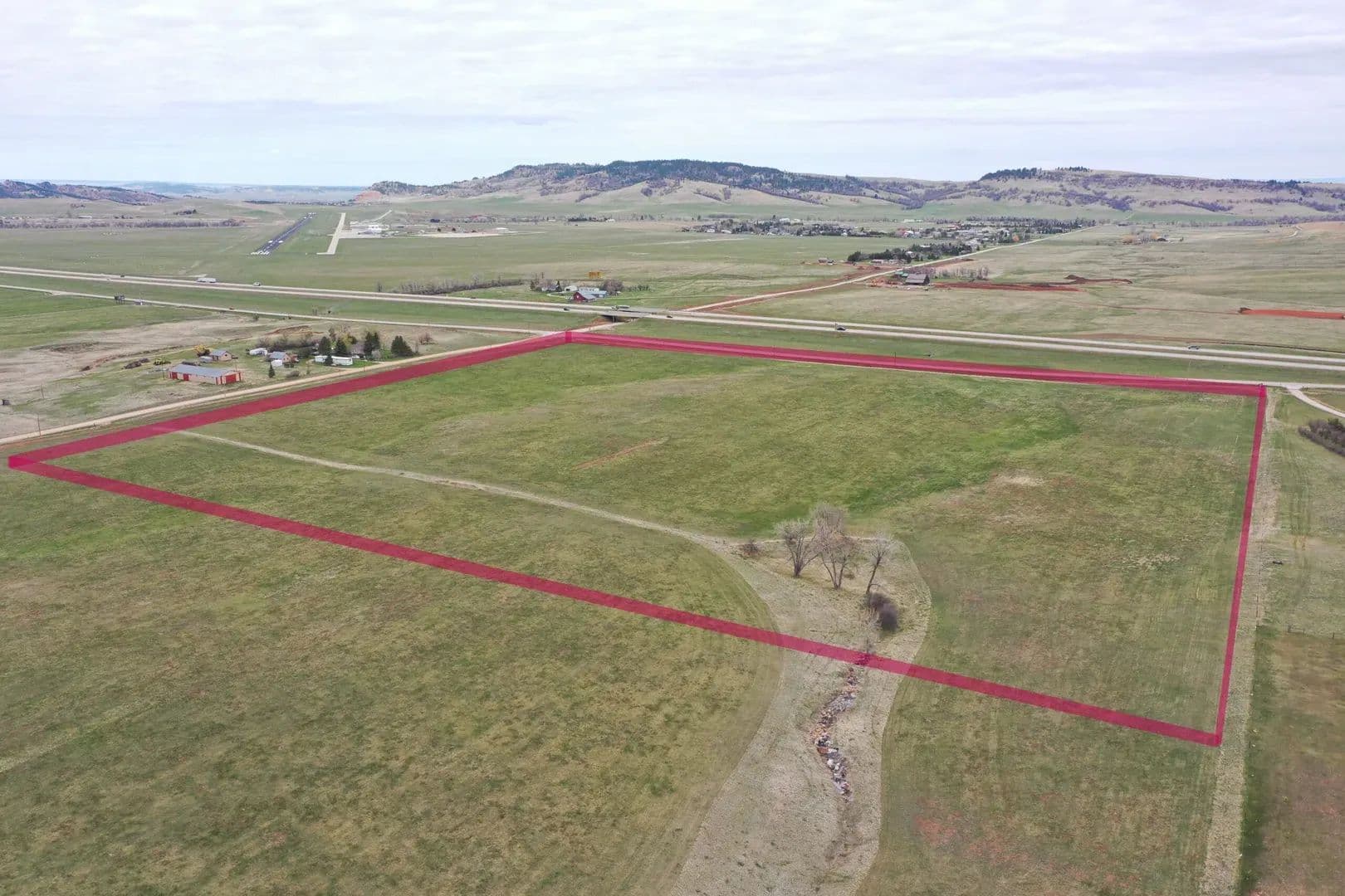
This exceptional 40± acre parcel offers an unparalleled development opportunity in the thriving city of Spearfish, South Dakota. Situated at the high-visibility intersection of East Colorado Boulevard and South Rainbow Road in Spearfish, SD, this property offers a strategic position between the City of Spearfish and the rapidly expanding Sky Ridge neighborhood and Sports Complex at Exit 17 off Interstate 90.Land The East Colorado Boulevard corridor is recognized by the City of Spearfish as a prime area for commercial and multi-use development. The city encourages a diverse mix of residential densities, commercial enterprises, and light industrial facilities within the designated City Services Boundary, which includes this property. The adjacent areas feature C-2 Highway Service Commercial and Development Review District (DRD) zoning, offering significant flexibility for various development types.Improvements Essential infrastructure is either in place or planned to support development. A 12-inch water main runs along the south side of East Colorado Boulevard, and fiber optic cable and phone lines are available in the vicinity. The City of Spearfish is actively upgrading the sewer system, with planned expansions to the Elkhorn Ridge sewer lift station. Furthermore, the City is currently undertaking the Colorado Boulevard Widening Project, which includes expanding the roadway to accommodate turn lanes, bike lanes, and improved traffic flow, directly enhancing the accessibility of this property.General Operations This prime location offers easy access to regional and national markets via I-90, making it ideal for a wide range of commercial and multi-use developments. The property benefits from significant frontage on both East Colorado Boulevard and South Rainbow Road, ensuring excellent visibility for any future development. Its location near Exit 17 provides convenient access for both local residents and the numerous visitors drawn to the area.Location Spearfish is a rapidly growing community with a strong economy. The city boasts a projected population of nearly 14,000 by 2025 and a healthy average household income. The low unemployment rate and positive job growth further underscore the area’s economic vitality. This land is strategically positioned within a dynamic growth area near the Sky Ridge neighborhood and the Sportsplex. The Sportsplex, a regional draw for sports tournaments, generates significant traffic and demand for nearby services. The adjacent Sky Ridge residential development provides a built-in customer base for commercial ventures.

Miller Creek Meadows
$3,600,000
91.55 Acres
Spearfish, South Dakota, 57783
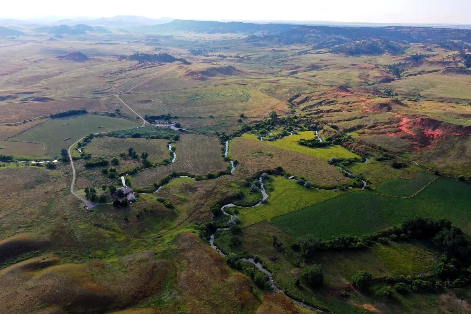
Miller Creek Meadows offers a rare blend of seclusion and proximity to Spearfish, South Dakota. 91.5± acres of rolling hay meadows, oak groves, Ponderosa pine ridges and seasonal Miller Creek provide ideal habitat for deer, turkey, and upland game. With power nearby and breathtaking building sites, this is a sportsman's dream within 15 minutes of town.Land Miller Creek Meadows is a visual masterpiece, spanning 91.55 acres of rolling meadows, timbered ridges, and rocky outcroppings typical of the northern Black Hills. The meadows are edged by mature stands of ponderosa pine and native bur oak, with an understory of aspen, chokecherry and even a few apple trees. The property’s terrain includes exposed rock ledges and outcrops composed of pale grey Paha Sapa limestone and pink‑buff Englewood limestone overlying older Spearfish Formation red siltstone and shale. These rocky ridges create natural perches for turkey and vantage points for archery hunting, while the oak–pine margins provide ideal food and cover.The seasonal Miller Creek meanders through spring-fed swales, enhancing the lush grasslands that yield hay annually, and supporting summer grazing. Gravel terraces and shallow depressions near the creek support diverse wildflowers and herbaceous plants, attracting upland birds and pollinators.Improvements The property includes a well house that delivers water to a livestock watering tank serving cattle grazing operations. Multiple natural ridges and elevated knolls offer scenic and secluded building sites—perfect for a hunting cabin or custom home tucked amidst oak groves. The site is secluded but with power accessible at the road frontage, facilitating development without disrupting the balance of meadow and timber.Recreation Miller Creek Meadows is a true haven for hunters and outdoor enthusiasts seeking both solitude and abundant wildlife. The combination of open hay meadows, seasonal creek channels, oak–pine hardwood edges, and rugged limestone outcroppings creates a rich mosaic of habitats that sustain thriving populations of white-tailed and mule deer, wild turkey, and upland game birds. The land’s diverse structure naturally funnels wildlife through the property, with well-worn game trails, bedding thickets, and shaded travel corridors visible throughout. During the spring thaw and early summer rains, Miller Creek draws wildlife from surrounding hillsides, enhancing the mix of forage, water, and cover.Its proximity to the scenic Spearfish Canyon and the vast Black Hills National Forest makes it an exceptional basecamp for both day hunts and extended outdoor pursuits. Whether you’re glassing from a ridgeline, calling turkeys along the creek bottom, or watching raptors soar overhead—including golden eagles, bald eagles, and red-tailed hawks—this property offers immersive, year-round outdoor experiences in a setting that feels truly wild yet remains close to town.Agriculture Currently utilized for annual grass hay production and seasonal cattle grazing, the property delivers both function and flexibility. Soil conditions, fed by groundwater seeps and creek flow, sustain native grasses and clover blends ideal for hay. Fencing and livestock infrastructure, along with the well and stock tank, make current grazing operations seamless. These pastures, bordered by oak and pine, are also well suited to lightly managed ranch uses such as rotational grazing, brood stock grazing, or game bird release rotation.Water/Mineral Rights & Natural Resources Spring-fed Miller Creek flows through the low-lying meadow corridor during wetter seasons, supplying riparian habitat and forage. A private well supports the well house and livestock watering system year-round. No mineral rights are known to be severed; all mineral interests owned by the seller will convey with the sale.General Operations Minimal daily oversight is required—annual hay cutting and seasonal cattle grazing are managed efficiently. Most importantly, the property’s recreational value far exceeds its modest agricultural income. It offers an established hunting retreat, wildlife habitat preserve, or future home-site investment with built-in ag operations to support low-cost carry.Region & Climate Situated in the Northern Black Hills near Spearfish, the climate provides four distinct seasons: warm, pleasant summers; colorful autumns; crisp, snowy winters; and vibrant springs. The area enjoys approximately 230 days of sunshine each year, making it ideal for year-round outdoor recreation. Precipitation averages 25–30″ annually, supporting lush forage and healthy forest growth. The region is renowned for its abundant wildlife, cold-water trout streams, and scenic uplands that draw hunters, anglers, hikers, and birdwatchers alike.History Miller Creek Meadows lies within the ecological crossroads of four vegetation zones—a botanical melting pot supporting over 1,200 plant species documented in nearby Spearfish Canyon. The property’s oak‑pine ridges and limestone outcrops are habitat features for endemic species unique to the Black Hills, such as pinyon jay, three‑toed woodpecker, and Black Hills subspecies of vole and snail. Wildlife movement between this property and public forests has long supported consistent game presence. Its moderate agricultural use preserves habitat while maintaining productivity.Location Located at 5410 Lazy Horse Ln, Spearfish, SD 57783, Miller Creek Meadows lies just 5-6 miles (approximately a 10-minute drive) southeast of downtown Spearfish. Though secluded at the end of a quiet private lane, the property offers quick access to all the amenities, dining, healthcare, and retail that Spearfish has to offer. Rapid City Regional Airport is about 60 miles away—roughly an hour’s drive—providing convenient commercial service for both regional and national travel.What truly sets this location apart is its place within the Northern Black Hills, a region known for its dramatic scenery, outdoor recreation, and exceptional quality of life. The Black Hills are a geologic island of granite peaks, pine-covered ridges, and lush valleys rising from the surrounding plains. This area is steeped in Western history, Native American heritage, and a deep-rooted appreciation for land, wildlife, and independence.Spearfish, in particular, is one of the crown jewels of the Black Hills. It’s a vibrant university town with a thriving arts and cultural scene, yet it retains its Western charm and close-knit community feel. Spearfish Canyon—just minutes from town—is a world-class destination for fly fishing, hiking, ice climbing, and sightseeing. The town is consistently ranked as one of the best places to live in the region due to its mild climate, clean air, low taxes, and access to public lands and trails. Whether you’re looking for solitude in the hills or a quick trip to the coffee shop or hardware store, this location offers the best of both worlds.

30 Alum Creek
$659,000
49.48 Acres
Aladdin, Wyoming, 82710
30 Alum Creek Road is a 49.48-acre recreational and rural residential retreat in northern Crook County, Wyoming, on the northern fringe of the Wyoming Black Hills. A 2010 home offers 1,920 square feet of finished living space plus a 1,280-square-foot unfinished walkout basement and covered deck with long hill views. The Alum Creek drainage traces the southern boundary. A permitted 15-gallon-per-minute well and fiber internet serve the property.Land The 49.48-acre parcel occupies a transitional terrain position on the northern edge of the Wyoming Black Hills, combining open pasture and native grassland with wooded draws, rocky benches, and dry drainage terrain. Elevation ranges from the Alum Creek seasonal drainage along the southern boundary to over 4,050 feet at the upper benchlands – a variation in topography that creates natural thermal cover, edge habitat, and productive wildlife movement corridors.Approximately 40 acres consist of open and partially wooded pasture ground carrying native grasses suitable for livestock grazing and haying operations. The balance is comprised of wooded draws and rocky outcroppings dominated by ponderosa pine and native brush, providing cover that holds mule deer, whitetail deer, and wild turkey on the property year-round.The land is classified as a wooded and view lot with no floodplain designation. Terrain is accessible by county road and internal tracks. The property is not subdivided and carries no HOA. Covenants of record are the Boyle Land Use Covenants established November 2007 – livestock-friendly, expressly permitting horses, cattle, corrals, barns, and residential structures, while prohibiting mobile homes and nuisance uses. These covenants are an asset to the property and should be communicated clearly to buyers as protective of value.Improvements Home – Built 2010, Frame Construction, 3,200 SF Total (1,920 SF Finished)The residence is a 1.5-story frame home with manufactured siding and a metal roof, constructed in 2010 on a poured concrete foundation. The home’s 1,920 square feet of finished living space is distributed across a main level and upper level, with an additional 1,280-square-foot full walkout basement left unfinished.The main level encompasses 1,280 square feet of finished space and includes the primary bedroom (15 x 13), an open kitchen (16 x 14) with breakfast bar, dining room (16 x 12), living room (16 x 14) with gas log fireplace, a mudroom (15 x 9), and a main floor laundry. Flooring is tile and carpet throughout, with vaulted ceilings and ceiling fans. Large view windows are positioned throughout to capture the Wyoming hills landscape.The upper level adds 640 square feet of finished space including a second bedroom (19 x 10) and a 30 x 14 loft area suitable for use as a den, bunkroom staging, additional sleeping space, or home office.The full walkout basement (1,280 SF, unfinished) presents direct exterior access and concrete foundation walls ready for buyer development into additional bedrooms, a bathroom, a wet bar, or a secondary living area. This represents significant expansion value at minimal additional cost relative to the purchase price.Heating is radiant in-floor (TruFlow manifold system, propane-fueled) on the main level, providing consistent and efficient thermal comfort through Wyoming winters. The gas log fireplace in the living room provides supplemental and ambient heat. No central air conditioning is present – not atypical for this elevation and climate. Water heater is electric. Electrical service is 200 Amps and 220 Volts.The covered deck frames elevated views across the property and surrounding hills, suitable for both everyday use and entertaining.Outbuildings / Site InfrastructureRV parking is available on the property. The property is confirmed horses-allowed under the governing covenants. The site has adequate ground for future corral, barn, or outbuilding construction consistent with the Boyle Land Use Covenants.Recreation 30 Alum Creek Road is a property designed, by terrain and setting, around recreational use. The combination of open pasture, timbered draws, rocky benches, dry drainage terrain, and elevation variation creates a self-contained hunting and wildlife habitat that holds game year-round without requiring off-property access.Mule deer, whitetail deer, and wild turkey are documented on the property. Wooded draws, rocky benches, and ponderosa pine ridgelines provide thermal and escape cover – the structure that separates a property with visible wildlife from a property that holds mature animals.The home functions equally well as a full-time residence and as a hunting camp. The open kitchen-dining-living layout, wraparound deck, gas fireplace, and large loft accommodate a full hunting party with comfort. The unfinished walkout basement offers future bunkroom development potential that is already framed by the existing foundation and walkout access.Cook Lake, a recreational lake within the Black Hills National Forest, is 22 miles from the property. The broader Black Hills National Forest provides additional riding, hiking, and recreational access within a short drive. Devils Tower National Monument is accessible from the Crook County corridor.Celerity internet service is connected and operational – a meaningful differentiator for the buyer who works remotely from camp or requires connectivity for security and communication.Agriculture The property supports limited but legitimate agricultural operations consistent with its 49.48-acre footprint. Approximately 40 acres of open pasture and native grassland are suitable for livestock grazing. The terrain and water infrastructure support a small cow-calf or horse operation without the capital burden of a full ranch.The 15-gallon-per-minute well is permitted for both domestic and stock watering under Wyoming State Engineer Permit U.W. 188393, issued with a priority date of August 18, 2008. This dual-use authorization eliminates the water supply constraint that limits many similarly sized properties from supporting livestock.The Land Use Covenants expressly permit cattle, horses, corrals, and barns – buyers seeking to establish livestock infrastructure will find no covenant barrier to building out operations. The site, well permit, and acreage support a small cow-calf or horse operation.Hay production potential exists on the open meadow ground, though current use and yield figures should be confirmed with the seller. Agricultural value on 49 acres is secondary to recreational and residential value in this corridor, but the infrastructure and water position this as a genuinely functional rural property, not merely a recreational retreat on grass acreage.Water/Mineral Rights & Natural Resources Domestic Water WellThe property is served by a drilled domestic well completed November 9, 2009. Well specifications: Permit U.W. 188393, total depth 220 feet, static water level 68 feet below surface, casing diameter 5 inches, factory screen set from 180 to 220 feet. The principal water-bearing formation is encountered between 180 and 220 feet and consists of white sand and blue shale.Pump test yield: 15 gallons per minute with 55 feet of drawdown after 1 hour of pumping. Pump is a 3/4-horsepower submersible unit set at 158 feet, powered by electricity. This yield is well above the threshold required by rural residential lenders and comfortably supports both household use and stock watering.Well use authorization under Permit U.W. 188393 includes both domestic and stock watering uses. Water priority date: August 18, 2008.Surface WaterThe Alum Creek drainage is a seasonal dry drainage that traces the southern boundary of the property. It does not carry consistent surface water. No surface water rights are conveyed with this property.Wastewater SystemThe property is served by a permitted gravity septic system with chamber trench leach field, installed in 2009. System components: 1,000-gallon Boom Concrete single-compartment tank; leach field is a two-trench chambered system. Soil type at leach field: sandy loam. Percolation rate: 15 minutes per inch (slowest of three test holes). Seasonally high groundwater at leach field site: 28+ feet below surface. System was designed for a three-bedroom residential load at 450 gallons per day.Mineral RightsAny mineral rights owned by the seller will convey to the buyer at closing. The specific extent of mineral ownership has not been independently verified. Buyers requiring a mineral title opinion should engage a Wyoming-licensed title attorney or request a mineral search through the title company.TimberPonderosa pine and native brush timber cover is present on the timbered portions of the property. No commercial timber appraisal has been conducted. General Operations The property operates as an owner-occupied rural residential and recreational holding with integrated livestock infrastructure. Day-to-day operations are straightforward and consistent with the 49.48-acre footprint.Access to the property is by county road, unpaved, maintained year-round. Private roads and tracks on the property are owner responsibility. Directions from Belle Fourche, SD: 14 miles east on Highway 34, right on Oak Creek Road, left on Pine Creek Road to Alum Road, right into property, follow signs.Utilities include propane (leased tank) for heat and cooking, electric service (220V), a private well for water, and a permitted gravity septic system with leach field (Wyoming DEQ (Department of Environmental Quality) Permit No. 09-316, Crook County Statement of Compliance issued July 2009). Celerity internet is connected. No municipal water, sewer, or natural gas service is available at this location.Fencing on the property includes metal and wood fence. Covenants governing the property are the Boyle Land Use Covenants (November 2007), which permit livestock, corrals, barns, and residential structures while prohibiting mobile homes and nuisance uses. No homeowner’s association (HOA) is in place.Wyoming’s tax structure is a consistent draw for out-of-state buyers in this market: no state income tax, low property taxes, and no inheritance tax. For buyers relocating or establishing a second home or ranch base, Wyoming’s fiscal environment is a material consideration. Real estate taxes on this property were $2,287 for tax year 2023. Real estate taxes: $2,287 (2023 tax year, Crook County, Wyoming).Region & Climate 30 Alum Creek Road occupies the northern fringe of the Wyoming Black Hills, one of the most productive recreational land corridors in the Northern Plains. The region is characterized by rugged terrain, ponderosa pine timbered ridgelines, open native grasslands, seasonal creeks, and strong wildlife density – the landscape that defines northeastern Wyoming’s premium recreational land market.The Black Hills region experiences a semi-arid continental climate with four distinct seasons. Winters are cold with significant snowfall, moderated somewhat by the elevation and terrain that defines the Hills relative to the surrounding High Plains. Springs are wet and productive. Summers are warm and dry at elevation. Fall brings cooler temperatures and the high season for hunting activity, which drives the primary buyer profile for this property type.Elevation at the property ranges from the southern drainage boundary to over 4,050 feet at the upper benchlands. The growing season is approximately 100 to 120 days. Average annual precipitation in the northern Black Hills corridor is 14 to 18 inches, with the bulk falling as spring and early summer rain and winter snowpack.History The property was platted and improved under current ownership, with the residence constructed in 2010. The 49.48-acre parcel was assembled from portions of Sections 26 and 27, Township 55N, Range 62W, in northern Crook County – the Aladdin corridor, a historically agricultural and ranching area on the northern approach to the Wyoming Black Hills.The governing land use covenants were established in November 2007, preceding the current improvements. The covenants were designed to protect property values along the Alum Creek Road corridor by prohibiting nuisance uses and mobile homes while expressly permitting the agricultural and livestock uses that define the character of the area.The domestic well was permitted in 2008 with a priority date of August 18, 2008, and drilled to completion November 9, 2009 – one year prior to home construction, establishing the water supply foundation before the residential structure was built.The Aladdin and Beulah corridor of Crook County has historically served as a transition zone between the agricultural High Plains to the north and the recreational Black Hills to the south, with land use patterns reflecting both cattle ranching heritage and, increasingly, the recreational and lifestyle demand that has reshaped the northern Wyoming land market over the past two decades.Location 30 Alum Creek Road is located in the Aladdin area of northern Crook County, Wyoming, addressed to Aladdin, WY 82710. The property is situated within the northern approach to the Wyoming Black Hills, accessible by county road off Pine Creek Road.Distances to key destinations:– Hulett, WY: 29 miles southwest– Sundance, WY (Crook County seat): 30 miles south-southwest– Belle Fourche, SD: 28 miles east– Spearfish, SD: 40 miles southeast– Cook Lake (Black Hills National Forest): 22 miles– Devils Tower National Monument: approximately 45 miles southwest– Rapid City Regional Airport (RAP): approximately 100 miles east– Gillette-Campbell County Airport (GCC): approximately 95 miles west– Black Hills National Forest boundary: within close proximity to the southThe property is within comfortable driving distance of full-service communities in both Wyoming (Sundance, Hulett) and South Dakota (Belle Fourche, Spearfish), providing access to groceries, medical services, fuel, and retail. The Aladdin community is a small rural settlement without commercial services.

T Diamond Ranch
$5,000,000
432.96 Acres
Beulah, Wyoming, 82712
T Diamond Ranch. 432.96 deeded acres on Lower Redwater Creek in the western Black Hills of Wyoming. Irrigated hay meadow, native pasture, timbered ridges, and a cold-water trout fishery. A 2001 custom entertaining residence of approximately 7,000 sq ft and a 1930s headquarters compound anchor the working cattle and hay operation. Two miles north of Beulah, 20 minutes west of Spearfish, South Dakota. Perpetual conservation partnership in place.Land T Diamond Ranch consists of 432.96 deeded acres tucked into the western folds of the Wyoming Black Hills, two miles north of the quiet ranching community of Beulah and only 20 minutes east of Spearfish, South Dakota. The ranch lies at 206 Lower Redwater Creek Road in Crook County, and Lower Redwater Creek runs cold and clear the entire length of the property.The land is a tapestry of irrigated hay meadow along the creek, native pasture rolling through gently undulating draws, riparian corridors shaded by cottonwood and oak, and ponderosa pine ridges that frame the valley. Approximately 125 acres of fertile bottom ground sit along Lower Redwater Creek, with the balance of the acreage in productive grazing ground and timbered cover.The perimeter of the property is fenced, with cross fencing that supports rotational grazing across the pasture and timbered units. The combination of creek bottom, open pasture, and timbered ridge gives the ranch both working productivity and true seclusion with everyday accessibility.Improvements The 1930s headquarters is the working heart of the ranch and a record of nearly a century of stewardship. The original 3-bedroom 1-bath farmhouse, the historic dairy barn, and the working corrals stand as they have for generations, with a shop building and attached living quarters supporting modern operations. These structures are not relics. They are part of the working ranch, maintained and ready.Across the creek and a short distance up the bench sits the 2001 custom entertaining residence, the lifestyle anchor of the property. Approximately 7,000 sq ft of total finished area unfolds across the home with a full finished walkout lower level and a finished upper level. The home is built for entertaining and family use, with expansive gathering spaces, 3 bedrooms and 7 bathrooms, and large windows that frame the surrounding ranchland and the creek bottom below.Additional improvements include two registered wells, one of which is a flowing artesian well, a permanent stock water pipeline easement appurtenant to the ranch, perimeter fencing with cross fencing, and fiber optic broadband along the County Road 142 frontage that supports full remote work capability at the residence. Together, the historic compound and the modern residence give a new owner the working infrastructure of a ranch and the comfort of a home built for hosting.All existing improvements are fully grandfathered under the conservation partnership and may be maintained, repaired, and reconstructed in kind.Recreation For the avid outdoorsman, T Diamond Ranch is a private sanctuary. Lower Redwater Creek runs cold and clear the length of the property, holding wild brown and rainbow trout in its undercut banks and shaded riffles. Quiet pools beneath the cottonwoods give way to gravel runs that test the angler with the kind of fly fishing most people travel hundreds of miles to find. Here, it is a hundred yards from the porch.The hay bottoms and timbered draws hold abundant wildlife year-round. Whitetail deer, mule deer, Merriam’s turkey, and elk move freely between the Black Hills National Forest and the creek corridor, drawn by the water, the cover, and the food the ranch quietly produces. Upland birds work the field edges and waterfowl frequent the creek through the season. The ranch falls in Wyoming Game and Fish hunt areas applicable to Crook County and offers excellent opportunity for bow, rifle, and shotgun across multiple species.Beyond the boundary, the western Black Hills open into a vast playground of public land, with horseback riding, hiking, mountain biking, and backcountry skiing all within a short drive. The conservation partnership permits and protects noncommercial recreation on the ranch, including hunting, fishing, horseback riding, and backcountry exploration. Whether you are stalking the timber with a bow or simply glassing the hills from a porch chair with morning coffee, this land rewards patience and presence.Agriculture T Diamond Ranch has supported a working cattle and hay operation for nearly a century, and the infrastructure is in place to continue that tradition seamlessly. Approximately 125 acres of riparian and irrigated hay bottom along Lower Redwater Creek produce one to two cuttings of grass and grass legume hay each season under the Miller Ditch surface water right.The remaining acreage rolls through productive pasture and timbered grazing, fully fenced on the perimeter and cross fenced for rotational management. Estimated carrying capacity ranges from 30 to 45 cow calf pairs on a year-round basis under good management, factoring the higher producing irrigated bottom ground and the more conservative wooded ridges.Working corrals at the historic headquarters accommodate cattle handling, sorting, loading, and horse care. The ranch is suited for a continued cattle and hay operation, a horse operation, or a lifestyle ranch that runs a smaller herd and holds the hay for winter feed. The land is zoned for agriculture, supporting a favorable property tax structure under Wyoming’s agricultural valuation framework.Water/Mineral Rights & Natural Resources Water is the central asset of T Diamond Ranch. Lower Redwater Creek flows the length of the property and provides live water for stock and fishing. The Miller Ditch delivers surface irrigation to the hay meadow.Two registered wells serve the headquarters. The Matthews A well, drilled to 700 feet, is permitted at 25 gallons per minute for domestic and stock use, with a static water level of 20 feet. The Matthews #1 well is a flowing artesian well drilled to 1,745 feet for domestic supply. A permanent stock water pipeline easement, recorded in Crook County records, runs from a wellhead across the adjoining property under a 20-foot-wide underground easement appurtenant to T Diamond Ranch and delivers year-round stock water to the southern grazing units.Any mineral rights currently owned by the Seller will convey with the sale, subject to the conservation partnership’s restrictions on surface impacting extraction.Natural resources across the ranch include the riparian corridor of cottonwood and oak along Lower Redwater Creek and the ponderosa pine ridges that frame the valley, together with the wildlife habitat and cold-water fishery those resources sustain. The conservation partnership permits water development for ranching purposes and protects the ecological richness of the Lower Redwater Creek corridor in perpetuity.General Operations The ranch operates as a working cattle and hay unit with the infrastructure in place for a seamless transition. The perimeter is fenced and the interior is cross fenced for rotational grazing. Working corrals at the historic headquarters handle sorting, cattle work, and horse care, and the shop building with attached living quarters supports day to day operations. The permanent stock water pipeline easement carries year-round stock water to the southern grazing units, and the Miller Ditch delivers irrigation water to the hay meadow.T Diamond Ranch was placed under a perpetual conservation partnership with The Nature Conservancy in 1998. The partnership permits and protects the very activities that make this ranch what it is: cattle and livestock grazing, hay production, water development for ranching purposes, fencing and structure maintenance, and noncommercial recreation. All existing improvements are fully grandfathered and may be maintained, repaired, and reconstructed in kind. The ranch will not be subdivided, and the vistas across the creek and into the timbered ridges will not be carved up by neighboring development. The conservation framework also supports a favorable agricultural property tax structure.The Seller is making known to all potential purchasers that there may be variations between the deeded property lines and the location of the existing fence boundary lines on the subject property. The Seller makes no warranties with regard to the location of fence lines in relationship to the deeded property lines, nor does the Seller make any warranties or representations with regard to specific acreage within the fenced property lines. The Seller is selling the property in an as is condition, which includes the location of the fences as they exist. Boundaries shown on accompanying maps are approximate based on the legal description and may not indicate a survey. Maps are not to scale and are for visual aid only. Their accuracy is not guaranteed.Region & Climate T Diamond Ranch enjoys a classic four-season High Plains climate, marked by warm, sunny summers ideal for hay production, crisp autumns perfect for hunting and harvest, snowy winters softened by abundant sunshine and low humidity, and vibrant springs that recharge the creek and ditch. Average annual precipitation runs 20 to 25 inches and the area enjoys approximately 200 days of sunshine each year. Growing season is approximately 120 days, supporting hay and pasture production along with seasonal vegetable gardens at the headquarters.The ranch sits at the western edge of the Black Hills, a region long recognized as one of the most diverse landscapes in the American West. Timbered ridges give way to open prairie within a few miles of the ranch, and the surrounding country carries the character that has drawn people to this corner of Wyoming for generations. Spearfish Canyon, the Black Hills National Forest, Devils Tower National Monument, and the historic mining town of Deadwood are all regional draws within an easy drive, and the vast public land of the western Black Hills begins just beyond the ranch boundary.History T Diamond Ranch is part of the historic Matthews family ranching legacy that extends across the western Black Hills region, from Gillette and Sundance to Spearfish. The Matthews family were long time ranchers in Texas and played a role in the early development of the Austin colony. In 1881, they migrated north to Wyoming, establishing a large ranch south of present-day Gillette. By the early 1900s, the family expanded into Spearfish, South Dakota, where they developed the Matthews Block and the Matthews Opera House, an architectural and cultural landmark that continues to serve the community today as a vibrant arts center. The Matthews family ranching legacy continues in the region through both T7 Ranch and T Diamond, carrying forward a deep-rooted connection to the land, community, and history of the Black Hills region.The ranch headquarters dates to the 1930s, with the original farmhouse, historic dairy barn, and corrals all standing as a working record of nearly a century of family stewardship of the land. The 2001 custom residence was added by the family for entertaining and multigenerational use, and the conservation partnership placed in 1998 ensures the working character and ecological integrity of the ranch will continue under future ownership. The new owner steps into a story already nearly a century in the making.T Diamond Ranch is the kind of property that does not come to market often. A productive working ranch with year-round live water on Lower Redwater Creek, a well-appointed entertaining residence built for hosting and family use, a historic 1930s headquarters compound that anchors nearly a century of stewardship, and the rare guarantee that the working character and ecological richness of the land will remain for generations. For the rancher seeking working productivity, the sportsman seeking private water and abundant game, or the legacy buyer seeking a permanent stake in one of the most quietly beautiful corners of the American West, T Diamond Ranch is more than an acquisition. It is an invitation to step into a story that began nearly a century ago and continues, well stewarded, for the generations to come.Location T Diamond Ranch is located at 206 Lower Redwater Creek Road, Beulah, Crook County, Wyoming 82712, two miles north of Beulah. Access is from Lower Redwater Creek County Road No. 142, which fronts and crosses the ranch. Beulah sits on Interstate 90 at the Wyoming and South Dakota state line, placing the ranch minutes from the interstate while the headquarters itself lies on a quiet stretch of county road with strong privacy, no through traffic, and excellent rural character. Fiber optic broadband runs along the County Road 142 frontage, supporting full remote work capability at the residence.Spearfish, South Dakota is approximately 17 miles east, a drive of about 20 minutes by way of Interstate 90. Spearfish offers full services including dining, retail, hospital and medical care, and the Black Hills State University campus. Sundance, the Crook County seat, is approximately 21 miles southwest and provides county offices, fuel, and basic services. Rapid City, South Dakota, the regional hub for medical specialists, retail, and commerce, is approximately 63 miles east, roughly an hour by car.Rapid City Regional Airport is the nearest commercial service airport, approximately 76 miles east of the ranch and a drive of about an hour and fifteen minutes. The airport carries year-round nonstop service to Denver, Minneapolis, and Dallas Fort Worth, with additional seasonal nonstop routes including Chicago, Phoenix, Charlotte, Atlanta, Las Vegas, and Orlando. For private and corporate aircraft, Black Hills Airport, also known as Clyde Ice Field, sits three miles east of Spearfish and roughly 20 miles from the ranch. It offers a paved asphalt runway of 6,401 feet by 75 feet, a fixed base operator with jet fuel and hangar space, and is the largest general aviation airport west of the Missouri River in South Dakota by based aircraft. Gillette Campbell County Airport lies approximately 86 miles west.The ranch is well positioned among the landmarks of the region. Devils Tower National Monument is approximately 31 miles west as the crow flies, a drive of about 49 miles and 50 minutes by way of United States Highway 14. Spearfish Canyon, the Black Hills National Forest, and the historic mining town of Deadwood all lie within an easy drive to the east and southeast, and Sturgis is a straightforward run-down Interstate 90.

Borglum Ranchette
$175,000
4.42 Acres
Keystone, South Dakota, 57702
Set along Borglum Road just 13 minutes from Keystone, South Dakota, this 4.42-acre building lot rests in the heart of the central Black Hills. A platted lot of record in Rushmore Ranch Estates, it offers district-maintained roads and available utilities among established custom homes. Open grassland gives way to mature Ponderosa pine, while dramatic topographic relief frames sweeping views toward Mount Rushmore and the surrounding hills. Land The lot is triangularly configured, with the southern apex at Borglum Road and the parcel widening progressively to the north. Total area is 4.42 acres. Elevation ranges from 3,922.0 feet at the southern end near the road to 4,069.5 feet at the upper northern extent, a total relief of 147.6 feet. Average slope is 19.6 percent, ranging from a minimum of 6.9 percent on the more gradual upper benches to a maximum of 33.3 percent on the steeper pitches. The most practical building area is concentrated near the Borglum Road frontage and on the more gradual benches in the upper southern portion of the lot, where a two-track trail has been established.Land cover as of 2024 is approximately 47.6 percent evergreen forest (Ponderosa pine), 47.6 percent grassland and pasture, and 4.8 percent developed or low-intensity disturbed area. The soil unit across the entire parcel is the Sawdust-Hopdraw-Rockerville complex on 10 to 40 percent slopes (NCCPI 4.9 out of 100), typical of shallow, rocky Black Hills forest soils. No FEMA flood hazard is mapped within the parcel boundaries.Improvements An existing two-track trail leads to the bottom of the property from Borglum Road. A small shed and playhouse on stilts are located toward the lower end of the parcel.Recreation Borglum Ranchette sits at the hub of Black Hills recreation, placing a buyer within minutes of some of the most iconic outdoor destinations in the country. Mount Rushmore National Memorial is just up the road, and the surrounding Black Hills National Forest opens onto a vast trail system for hiking, horseback riding, and all-terrain vehicle exploration. Black Elk Peak, at 7,244 feet the highest summit east of the Rocky Mountains, is reachable from that same forest network and rewards the climb with panoramic views across the granite spires of the Needles.Custer State Park lies roughly 20 miles to the south, a 71,000-acre wildlife park home to one of the largest free-roaming bison herds in the country, along with elk, pronghorn, bighorn sheep, and the park’s famous begging burros. Within easy day-trip distance a buyer will also find the Crazy Horse Memorial, Jewel Cave National Monument, and Wind Cave National Park, one of the longest and most complex cave systems on earth.Keystone itself delivers a full slate of family recreation. The historic 1880 Train runs vintage steam excursions between Keystone and Hill City, and Rush Mountain Adventure Park pairs the underground wonder of Rushmore Cave with a mountain coaster and aerial course. Rushmore Tramway Adventures adds ziplines, an alpine slide, and chairlift rides to a summit overlook. Anglers and boaters have their pick of nearby waters, with Sheridan Lake and Pactola Reservoir minutes away for trout, bass, and open water, while the 109-mile George S. Mickelson Trail offers premier rails-to-trails biking through the heart of the Hills. Winter brings snowmobiling and cross-country skiing across an extensive groomed trail network.Closer to home, the lot itself provides on-property habitat for whitetail deer, wild turkey, and other Black Hills wildlife, letting owners enjoy the region’s natural character from their own ground. For the buyer seeking both a personal homesite and immediate access to the full range of Black Hills outdoor experience, this location is difficult to surpass.Agriculture Agricultural value is minimal, as expected for a platted residential lot on shallow, rocky Black Hills forest soils. The NCCPI composite of 4.9 out of 100 reflects essentially no crop production capacity. Recorded subdivision covenants permit up to two horses and limited livestock on the property.Water/Mineral Rights & Natural Resources A shared community well is available to lot owners within Rushmore Ranch Estates. Terms of the shared-well agreement, associated water rights, and maintenance obligations should be confirmed through the title and closing process. Private on-site septic will be required; given the steep and rocky soils, an engineered system may be necessary and soil perc testing is recommended prior to offer. No surface water or drainage features are documented within the parcel. Any mineral ownership owned by the seller will convey at the time of sale.General Operations Road maintenance for Borglum Road and the internal subdivision network is funded through the Rushmore Ranch No. 1 Road District, a dedicated taxing district providing year-round road maintenance without reliance on a homeowner’s association. Recorded covenants govern land use within Rushmore Ranch Estates; a copy is available from the listing agent. Covenant provisions should be reviewed prior to purchase to confirm restrictions on building setbacks, land use, short-term rental, and livestock. No HOA dues are reported for this subdivision.Region & Climate Keystone is the gateway community to Mount Rushmore National Memorial and sits in the heart of the central Black Hills, one of the most recognized geographic destinations in the American Great Plains. The Black Hills rise dramatically from the surrounding prairie and support a distinct ecosystem of Ponderosa pine forest, granite peaks, and prairie grassland parks. The climate at this elevation is notably milder than the surrounding plains in summer and more snowfall-productive in winter, with annual precipitation averaging 18 to 22 inches. Summers are warm and dry, making the area a premier destination from May through October. South Dakota imposes no state personal income tax, a significant draw for retirees and second-home buyers relocating from higher-tax states. The Black Hills real estate market, particularly in the Keystone and Custer County corridor, has seen sustained appreciation driven by remote-work migration and continued tourism-economy growth.History The Black Hills carry a history as layered as their geology. The Lakota Sioux, who called the hills Paha Sapa, regarded the region as sacred ground and a center of cultural and spiritual life. The U.S. Army’s 1874 Custer Expedition confirmed rumors of gold in the hills and ignited one of the most consequential gold rushes in American history. Keystone was founded as a mining community in the 1880s and prospered through the early 20th century. The town’s enduring place in American culture was secured beginning in 1927, when sculptor Gutzon Borglum began carving the faces of four presidents into the granite of Mount Rushmore, a project completed in 1941. Borglum Road, on which this property fronts, carries the sculptor’s name as a lasting acknowledgment of the transformation he brought to this corner of the Black Hills. The corridor from Keystone to Mount Rushmore has evolved from a mining camp road into one of the most traveled scenic byways in the American West.Location Approximately 13 minutes to Keystone and 30 minutes to Rapid City. Mount Rushmore National Memorial is a short drive via Borglum Road and South Dakota Highway 244. Custer State Park is approximately 20 miles south via US 16A. Rapid City Regional Airport is approximately 30 miles northwest, providing commercial air service with connections to major hubs. The property is accessed via Borglum Road with direct frontage along the southwestern boundary. Rushmore Ranch Road off South Dakota Highway 40 provides the primary route from the state highway network. Full commercial services, hospital-grade medical, and major retail are available in Rapid City.