Search Brokers - Richard Kusel

Richard Kusel
Hayden Outdoors
Windsor, Colorado
Richard Kusel is a land and rural real estate professional with Hayden Outdoors based in Windsor, Colorado, listed on Land Broker MLS, the broker-owned co-op for farms, ranches and land for sale. Use the contact form on this page to get in touch about buying or selling rural property.
Contact
Fill in the Form below to send a message to this broker
By submitting, you agree to our privacy policy and terms.
Land for Sale from Richard Kusel

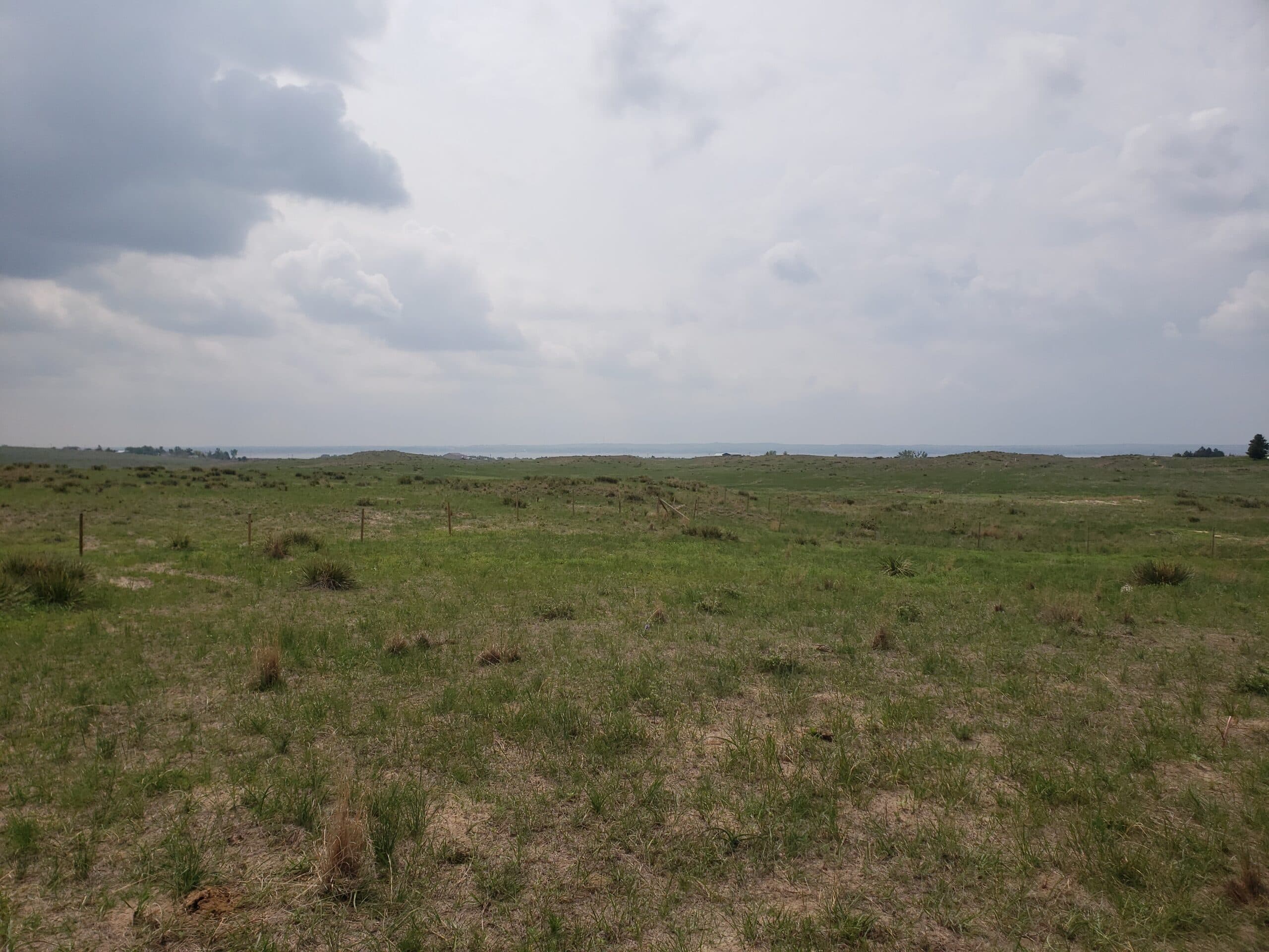
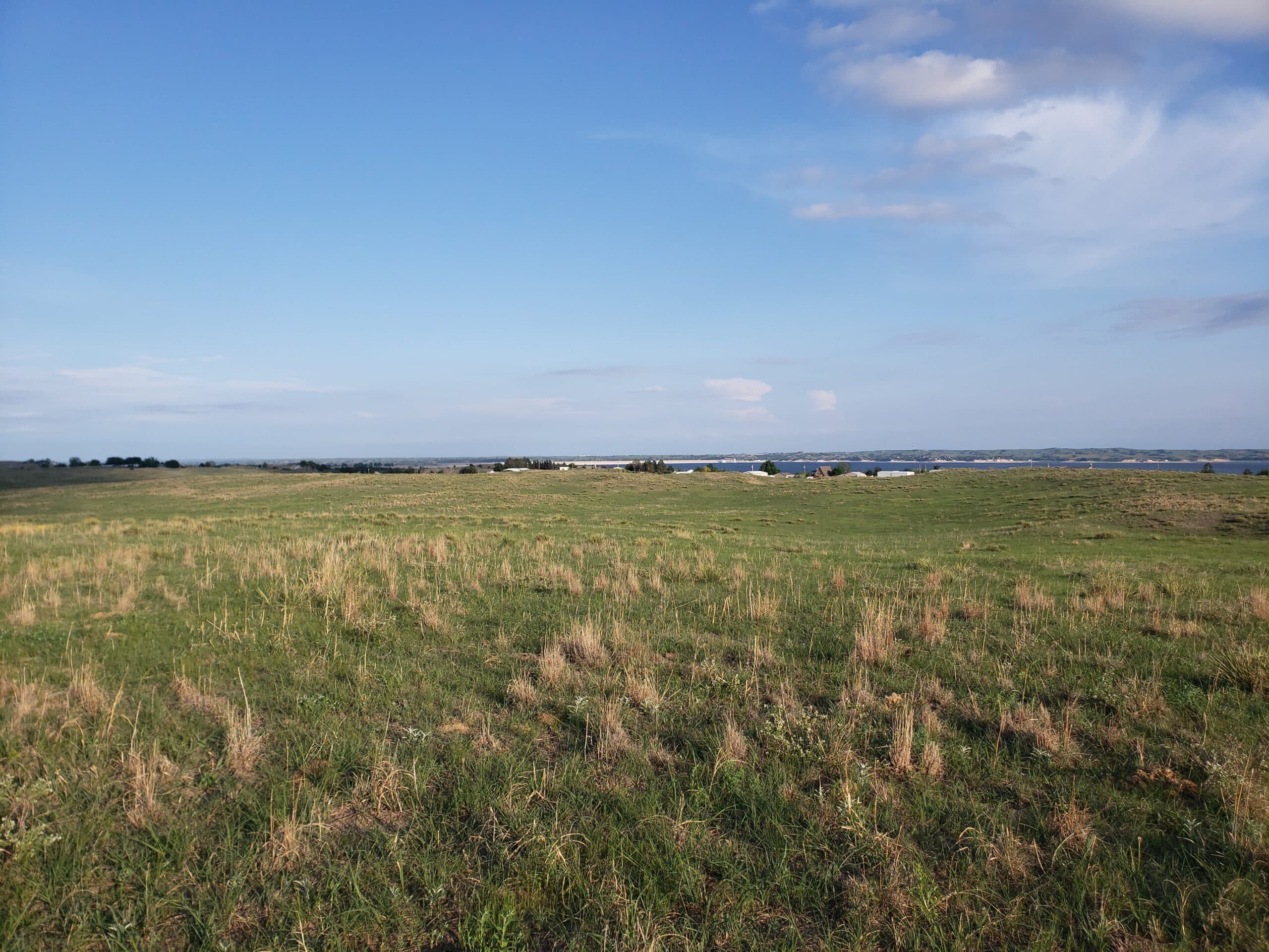
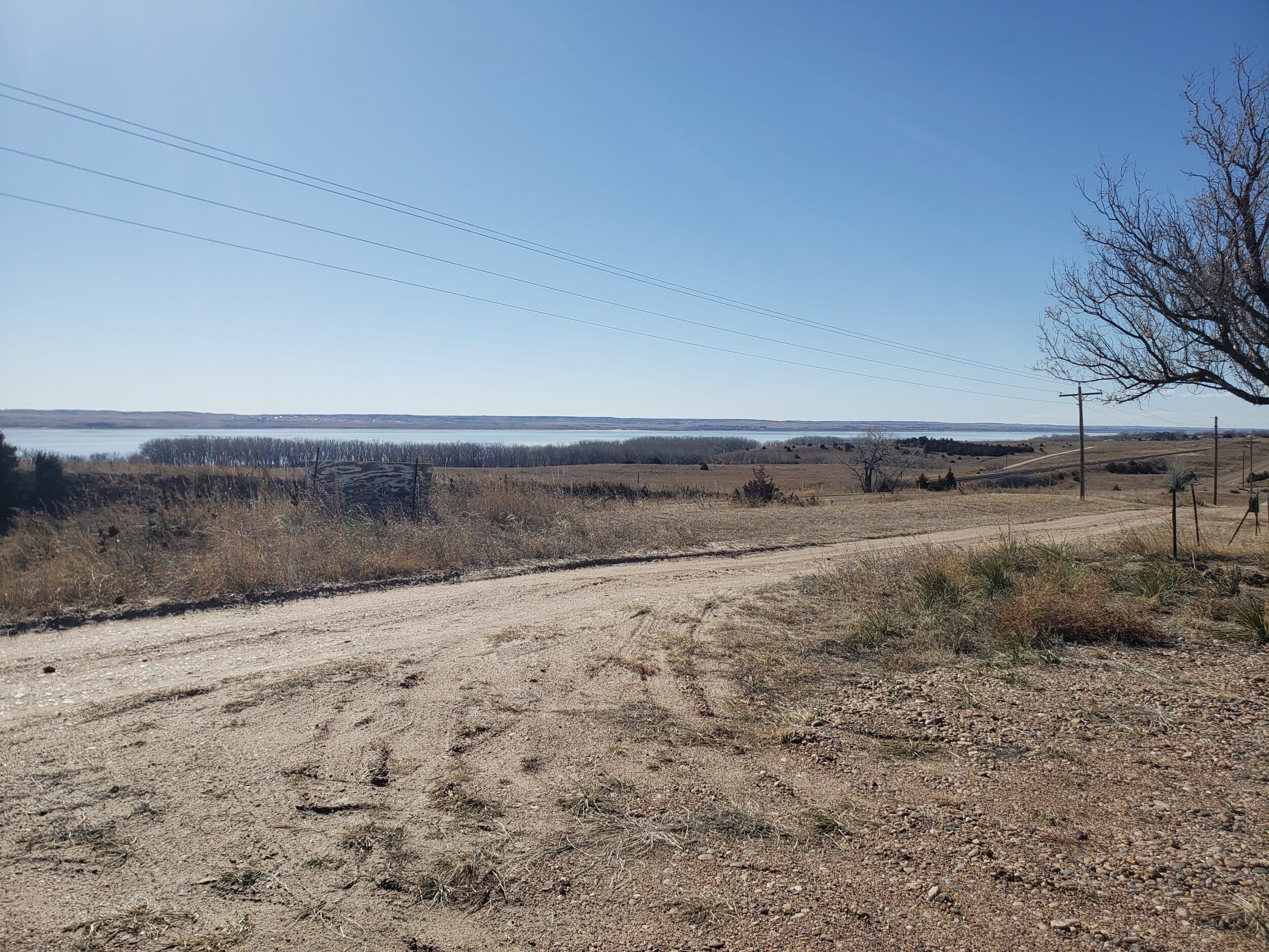
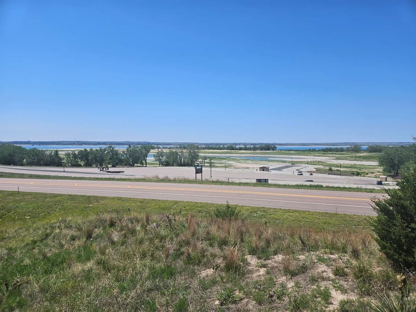
Haythorn’s Lake McConaughy Vistas
$6,000,000
632 Acres
Lemoyne, Nebraska, 69146
Haythorn's Lake McConaughy Vistas will be 10 plus acre lots determined by survey. The entire project is planned to be completed in 3 or 4 phases depending on the amount of interest in the lots. Haythorn's Lake McConaughy Vistas would also be a tremendous opportunity for a developer to take the reins of.The majority of the proposed lots will have lake views and great access to Lake McConaughy.Contact Rick Kusel or Clay Owens for information.Land There is approximately 632 total acres to be sold in 10.01+ acre lots. Buyers will be able to purchase larger tracts if desired. Lots will be surveyed as needed.Improvements This is undeveloped land.Recreation Lake McConaughy, the recreational jewel of western Nebraska, is the largest lake in the state with over 100 miles of shoreline, 35,700 surface acres of water, 24 miles long, 4 miles wide, and is famous for its white sand beaches. Each year, thousands of boaters, campers and outdoor enthusiasts make the Lake McConaughy area their destination for fun! In addition to Lake McConaughy which is fed by the North Platte River, you have Lake Ogallala at 320 surface acres “the little lake” nestled below Kingsley Dam (the 2nd largest earthen dam in the world). These two bodies of water provide endless opportunities for anglers of any skill level, young and old. The vast variety of fish you can catch between these two lakes include; Walleye, White Bass, Stripers, Wipers, Catfish, Northern Pike, Smallmouth Bass, Yellow Perch, Rainbow & Brown Trout. Lake McConaughy can accommodate virtually every type of watercraft you can imagine. Lake McConaughy and the North Platte River Valley also provide tremendous opportunities for hunters. This area is famous for duck and goose hunting. In addition to waterfowl hunting there is small game, varmints, White Tailed Deer, Mule Deer, and Pronghorn in the area.Agriculture This property is currently native grass pasture.Water/Mineral Rights & Natural Resources All appurtenant water rights associated with this property/lots will transfer to the Buyer at Closing.General Operations N/ARegion & Climate Weather HighlightsSummer High: the July high is around 90 degreesWinter Low: the January low is 15Rain: averages 20 inches of rain a yearSnow: averages 30 inches of snow a yearHistory “Geography is often destiny. It has always been so with Ogallala, a town that came into existence at the junction of the major routes of the transcontinental migrations and of the cattle trails north from Texas.”The Haythorn family homesteaded in the Lemoyne, NE area in 1884, some of the first to settle in the beautiful sandhills near the North Platte River.From 1870 to 1885, Ogallala was the “gateway of the Northern Plains”. Hard-bitten Wyoming and Montana cattlemen met in Ogallala’s hotel and saloons with Texas cattle kings and bargained over cattle prices. Gold flowed freely across the table, liquor across the bar, and occasionally blood across the floor as a bullet brought some unlucky cowhand to his death on the floorboards of Tuck’s Saloon.The first non-native visitors to this area were the trappers from St. Louis.Next came the pioneers who followed the Oregon Trail. To protect them, the government established forts at intervals along the trail. Then came the Union Pacific Railroad. It is assumed that Ogallala had its beginning about 1867. Settlers started to follow the railroad west, and the cattlemen started driving their cattle to Ogallala to be shipped east or to be sold to Montana and Wyoming ranchers.Ogallala’s early history was unspectacular, promising to be nothing but a section house and water tank for the railroad. Then, in the spring of 1868, three men appeared to set the destiny of Ogallala. These men were the Lonergan brothers and Louis Aufdengarten. The Lonergan brothers came to do construction work for the Union Pacific Railroad. They found the plains to their liking, and subsequently became interested in Ogallala.By 1876, Ogallala had changed little from its infant days in 1868. The stores were all south of the railroad tracks, and fronted what was called Railroad Street and the trail leading south to the Platte River. Along this trail extended the rest of the town. The town consisted of saloons with such names as The Cowboy’s Rest and the Crystal Palace. The last building on the street was the Ogallala House – dining room widely patronized because of its excellent fare. It was run by S.S. Gast.By 1880, Ogallala consisted of one courthouse, one school, one hotel, two dwelling houses, and twenty-five permanent residents. The tempo of living in early Ogallala changed with the seasons. During the months of winter and early spring life was drab and dreary. Shortly after the first of June the town began to hum with activity as the first Texas trail herds started to arrive. During the three summer months business boomed – ten to twelve herds, each of two hundred or more trail hands taxed the facilities of Ogallala. Sleeping rooms and meals were hard to find when the trail hands were in town. Activities in Ogallala continued at a fever pitch until the end of August, by then the Texans were heading back to Texas; by November Ogallala had settled back in quiet and peaceful repose.Ogallala’s population of floaters, gamblers, trades-people and dance hall hostesses drifted to Omaha or Cheyenne to spend the winter. One hotel, one supply house and a single saloon remained open for the winter. The community sank into a state of inanimation until next spring.In 1882-1884, the settlers and farmers reached Ogallala. These men were encouraged by the Union Pacific Railroad because the railroad started selling their land at quite low prices.A serious epidemic of Texas fever swept over Nebraska during the summer of 1884. The disease first appeared near Ogallala in July apparently being brought in by Texas cattle. The disease spread quickly and it caused very heavy losses to the cattlemen. The ranchers had started to put expensive blooded bulls in their herds. These ranchers demanded that Texas cattle be excluded from Nebraska. This ban of Texas cattle was a damaging blow to the Texas trail herd business. This was the end of the trail period of Ogallala, as the wild, often violent town became a peaceful farmer’s settlement.Location Haythorn’s Lake McConaughy Vistas are on average 15 minutes from Ogallala and Interstate I-80, 3 .5 hours northeast of Denver, CO and 4.5 hours west of Omaha, NEThis property is only minutes away from the lake’s famous white sands beaches, a very popular boat ramp, convenience stores, many restaurants and bars.
Lake View at Arthur Bay Lot 1
$79,500
4.5 Acres
Lemoyne, Nebraska, 69146
Lake View at Arthur Bay Lot 1 is a 4.5 +/- acre lot located directly north of Arthur Bay on the north side of beautiful Lake McConaughy. The property has some great views of the lake and multiple potential building sites. The property is accessed by a partially paved County Road and less than a half mile north of Hwy 92 This property is in a terrific location for the simple fact that is close to everything you will ever want to do at Lake Mac!Land 4.5 +/- acres of undeveloped land.Improvements This property is partially fenced and is ready for you to build your dream lake home.There is electrical service running to the property.There is the possibility of entering into a shared water well agreement with the adjoining property.Recreation Lake McConaughy, the recreational jewel of western Nebraska, is the largest lake in the state with over 100 miles of shoreline, 35,700 surface acres of water, 24 miles long, 4 miles wide, and is famous for its white sand beaches. Each year, thousands of boaters, campers and outdoor enthusiasts make the Lake McConaughy area their destination for fun! In addition to Lake McConaughy which is fed by the North Platte River, you have Lake Ogallala at 320 surface acres “the little lake” nestled below Kingsley Dam (the 2nd largest earthen dam in the world). These two bodies of water provide endless opportunities for anglers of any skill level, young and old. The vast variety of fish you can catch between these two lakes include; Walleye, White Bass, Stripers, Wipers, Catfish, Northern Pike, Smallmouth Bass, Yellow Perch, Rainbow & Brown Trout. Lake McConaughy can accommodate virtually every type of watercraft you can imagine. Lake McConaughy and the North Platte River Valley also provide tremendous opportunities for hunters. This area is famous for duck and goose hunting. In addition to waterfowl hunting there is small game, varmints, White Tailed Deer, Mule Deer, and Pronghorn in the area.Agriculture The property is currently in native grass.Water/Mineral Rights & Natural Resources All appurtenant Water Rights associated with the property will transfer to the Buyer at Closing.There currently is no well or septic on the property.General Operations N/ARegion & Climate Weather HighlightsSummer High: the July high is around 90 degreesWinter Low: the January low is 15Rain: averages 20 inches of rain a yearSnow: averages 30 inches of snow a yearHistory “Geography is often destiny. It has always been so with Ogallala, a town that came into existence at the junction of the major routes of the transcontinental migrations and of the cattle trails north from Texas.”From 1870 to 1885, Ogallala was the “gateway of the Northern Plains”. Hard-bitten Wyoming and Montana cattlemen met in Ogallala’s hotel and saloons with Texas cattle kings and bargained over cattle prices. Gold flowed freely across the table, liquor across the bar, and occasionally blood across the floor as a bullet brought some unlucky cowhand to his death on the floorboards of Tuck’s Saloon.The first non-native visitors to this area were the trappers from St. Louis.Next came the pioneers who followed the Oregon Trail. To protect them, the government established forts at intervals along the trail. Then came the Union Pacific Railroad. It is assumed that Ogallala had its beginning about 1867. Settlers started to follow the railroad west, and the cattlemen started driving their cattle to Ogallala to be shipped east or to be sold to Montana and Wyoming ranchers.Ogallala’s early history was unspectacular, promising to be nothing but a section house and water tank for the railroad. Then, in the spring of 1868, three men appeared to set the destiny of Ogallala. These men were the Lonergan brothers and Louis Aufdengarten. The Lonergan brothers came to do construction work for the Union Pacific Railroad. They found the plains to their liking, and subsequently became interested in Ogallala.By 1876, Ogallala had changed little from its infant days in 1868. The stores were all south of the railroad tracks, and fronted what was called Railroad Street and the trail leading south to the Platte River. Along this trail extended the rest of the town. The town consisted of saloons with such names as The Cowboy’s Rest and the Crystal Palace. The last building on the street was the Ogallala House – dining room widely patronized because of its excellent fare. It was run by S.S. Gast.By 1880, Ogallala consisted of one courthouse, one school, one hotel, two dwelling houses, and twenty-five permanent residents. The tempo of living in early Ogallala changed with the seasons. During the months of winter and early spring life was drab and dreary. Shortly after the first of June the town began to hum with activity as the first Texas trail herds started to arrive. During the three summer months business boomed – ten to twelve herds, each of two hundred or more trail hands taxed the facilities of Ogallala. Sleeping rooms and meals were hard to find when the trail hands were in town. Activities in Ogallala continued at a fever pitch until the end of August, by then the Texans were heading back to Texas; by November Ogallala had settled back in quiet and peaceful repose.Ogallala’s population of floaters, gamblers, trades-people and dance hall hostesses drifted to Omaha or Cheyenne to spend the winter. One hotel, one supply house and a single saloon remained open for the winter. The community sank into a state of inanimation until next spring.In 1882-1884, the settlers and farmers reached Ogallala. These men were encouraged by the Union Pacific Railroad because the railroad started selling their land at quite low prices.A serious epidemic of Texas fever swept over Nebraska during the summer of 1884. The disease first appeared near Ogallala in July apparently being brought in by Texas cattle. The disease spread quickly and it caused very heavy losses to the cattlemen. The ranchers had started to put expensive blooded bulls in their herds. These ranchers demanded that Texas cattle be excluded from Nebraska. This ban of Texas cattle was a damaging blow to the Texas trail herd business. This was the end of the trail period of Ogallala, as the wild, often violent town became a peaceful farmer’s settlement.Location Lake View at Arthur Bay Lot 1 is 15 minutes from Ogallala and Interstate I-80, 3 .5 hours northeast of Denver, CO and 4.5 hours west of Omaha, NEThis property is only minutes away from the lake’s famous white sands beaches, a very popular boat ramp, convenience stores, many restaurants and bars.
Haythorn’s Lake McConaughy Vistas Lots
$95,000
10.01 Acres
Lemoyne, Nebraska, 69146
Haythorn's Lake McConaughy Vistas Lots are some of the best buildable locations at Lake McConaughy!These lots are in the perfect location to get to the best spots at the lake.The majority of the proposed lots will have lake views and great access to Lake McConaughy.Just begin to imagine your beautiful new lake home and spending days on the water.Contact Rick Kusel for information.Land 10.01 + acre lots available. Buyers will be able to purchase larger tracts if desired. Lots will be surveyed as needed.Lot prices are based on surveyed acres @ $9,500 per acre.Improvements None, this is undeveloped land.Recreation Lake McConaughy, the recreational jewel of western Nebraska, is the largest lake in the state with over 100 miles of shoreline, 35,700 surface acres of water, 24 miles long, 4 miles wide, and is famous for its white sand beaches. Each year, thousands of boaters, campers and outdoor enthusiasts make the Lake McConaughy area their destination for fun! In addition to Lake McConaughy which is fed by the North Platte River, you have Lake Ogallala at 320 surface acres “the little lake” nestled below Kingsley Dam (the 2nd largest earthen dam in the world). These two bodies of water provide endless opportunities for anglers of any skill level, young and old. The vast variety of fish you can catch between these two lakes include; Walleye, White Bass, Stripers, Wipers, Catfish, Northern Pike, Smallmouth Bass, Yellow Perch, Rainbow & Brown Trout. Lake McConaughy can accommodate virtually every type of watercraft you can imagine. Lake McConaughy and the North Platte River Valley also provide tremendous opportunities for hunters. This area is famous for duck and goose hunting. In addition to waterfowl hunting there is small game, varmints, White Tailed Deer, Mule Deer, and Pronghorn in the area.Agriculture Currently native grass pasture with lake views.Water/Mineral Rights & Natural Resources All appurtenant water rights associated with this property/lots will transfer to the Buyer at Closing.General Operations N/ARegion & Climate Keith County, Nebraska gets 20 inches of rain, on average, per year. The US average is 38 inches of rain per year.Keith County averages 27 inches of snow per year. The US average is 28 inches of snow per year.On average, there are 224 sunny days per year in Keith County. The US average is 205 sunny days.Keith County gets some kind of precipitation, on average, 68 days per year. Precipitation is rain, snow, sleet, or hail that falls to the ground. In order for precipitation to be counted you have to get at least .01 inches on the ground to measure.Weather HighlightsSummer High: the July high is around 90 degreesWinter Low: the January low is 15Rain: averages 20 inches of rain a yearSnow: averages 30 inches of snow a yearHistory “Geography is often destiny. It has always been so with Ogallala, a town that came into existence at the junction of the major routes of the transcontinental migrations and of the cattle trails north from Texas.”The Haythorn family homesteaded in the Lemoyne, NE area in 1884, some of the first to settle in the beautiful sandhills near the North Platte River.From 1870 to 1885, Ogallala was the “gateway of the Northern Plains”. Hard-bitten Wyoming and Montana cattlemen met in Ogallala’s hotel and saloons with Texas cattle kings and bargained over cattle prices. Gold flowed freely across the table, liquor across the bar, and occasionally blood across the floor as a bullet brought some unlucky cowhand to his death on the floorboards of Tuck’s Saloon.The first non-native visitors to this area were the trappers from St. Louis.Next came the pioneers who followed the Oregon Trail. To protect them, the government established forts at intervals along the trail. Then came the Union Pacific Railroad. It is assumed that Ogallala had its beginning about 1867. Settlers started to follow the railroad west, and the cattlemen started driving their cattle to Ogallala to be shipped east or to be sold to Montana and Wyoming ranchers.Ogallala’s early history was unspectacular, promising to be nothing but a section house and water tank for the railroad. Then, in the spring of 1868, three men appeared to set the destiny of Ogallala. These men were the Lonergan brothers and Louis Aufdengarten. The Lonergan brothers came to do construction work for the Union Pacific Railroad. They found the plains to their liking, and subsequently became interested in Ogallala.By 1876, Ogallala had changed little from its infant days in 1868. The stores were all south of the railroad tracks, and fronted what was called Railroad Street and the trail leading south to the Platte River. Along this trail extended the rest of the town. The town consisted of saloons with such names as The Cowboy’s Rest and the Crystal Palace. The last building on the street was the Ogallala House – dining room widely patronized because of its excellent fare. It was run by S.S. Gast.By 1880, Ogallala consisted of one courthouse, one school, one hotel, two dwelling houses, and twenty-five permanent residents. The tempo of living in early Ogallala changed with the seasons. During the months of winter and early spring life was drab and dreary. Shortly after the first of June the town began to hum with activity as the first Texas trail herds started to arrive. During the three summer months business boomed – ten to twelve herds, each of two hundred or more trail hands taxed the facilities of Ogallala. Sleeping rooms and meals were hard to find when the trail hands were in town. Activities in Ogallala continued at a fever pitch until the end of August, by then the Texans were heading back to Texas; by November Ogallala had settled back in quiet and peaceful repose.Ogallala’s population of floaters, gamblers, trades-people and dance hall hostesses drifted to Omaha or Cheyenne to spend the winter. One hotel, one supply house and a single saloon remained open for the winter. The community sank into a state of inanimation until next spring.In 1882-1884, the settlers and farmers reached Ogallala. These men were encouraged by the Union Pacific Railroad because the railroad started selling their land at quite low prices.A serious epidemic of Texas fever swept over Nebraska during the summer of 1884. The disease first appeared near Ogallala in July apparently being brought in by Texas cattle. The disease spread quickly and it caused very heavy losses to the cattlemen. The ranchers had started to put expensive blooded bulls in their herds. These ranchers demanded that Texas cattle be excluded from Nebraska. This ban of Texas cattle was a damaging blow to the Texas trail herd business. This was the end of the trail period of Ogallala, as the wild, often violent town became a peaceful farmer’s settlement.Location Haythorn’s Lake McConaughy Vistas Lots are on average 15 minutes from Ogallala and Interstate I-80, 3 .5 hours northeast of Denver, CO and 4.5 hours west of Omaha, NEThis property is only minutes away from the lake’s famous white sands beaches, a very popular boat ramp, convenience stores, many restaurants and bars.
Hilltop Lot at Lake Mac
$79,000
0.43 Acres
Lemoyne, Nebraska, 69146
Location! Location! Hilltop Lot at Lake Mac is exactly what it says, located only a few miles west of the Kingsley Dam and off of Hwy 92, perched on one of the high spots on the north side of beautiful Lake McConaughy.This property boasts easy access to the lake with some breathtaking views.There is electrical service to the property as well as a water well with a submersible pump already on site.Get ready to build your dream home at Lake Mac!Land Hilltop Lot at Lake Mac is 0.43 acres of undeveloped land ready to build on.Improvements Hilltop Lot at Lake Mac is an unimproved lot ready to build on with electrical service and a water well with a submersible pump already in place.The water is sand filtered, very clear and tastes good.Recreation Lake McConaughy, the recreational jewel of western Nebraska, is the largest lake in the state with over 100 miles of shoreline, 35,700 surface acres of water, 24 miles long, 4 miles wide, and is famous for its white sand beaches. Each year, thousands of boaters, campers and outdoor enthusiasts make the Lake McConaughy area their destination for fun! In addition to Lake McConaughy which is fed by the North Platte River, you have Lake Ogallala at 320 surface acres “the little lake” nestled below Kingsley Dam (the 2nd largest earthen dam in the world). These two bodies of water provide endless opportunities for anglers of any skill level, young and old. The vast variety of fish you can catch between these two lakes include; Walleye, White Bass, Stripers, Wipers, Catfish, Northern Pike, Smallmouth Bass, Yellow Perch, Rainbow & Brown Trout. Lake McConaughy can accommodate virtually every type of watercraft you can imagine. Lake McConaughy and the North Platte River Valley also provide tremendous opportunities for hunters. This area is famous for duck and goose hunting. In addition to waterfowl hunting there is small game, varmints, White Tailed Deer, Mule Deer, and Pronghorn in the area.Water/Mineral Rights & Natural Resources The Buyer will receive all appurtenant water rights associated with this property at Closing.Region & Climate Weather HighlightsSummer High: the July high is around 90 degreesWinter Low: the January low is 15Rain: averages 20 inches of rain a yearSnow: averages 30 inches of snow a yearHistory “Geography is often destiny. It has always been so with Ogallala, a town that came into existence at the junction of the major routes of the transcontinental migrations and of the cattle trails north from Texas.”From 1870 to 1885, Ogallala was the “gateway of the Northern Plains”. Hard-bitten Wyoming and Montana cattlemen met in Ogallala’s hotel and saloons with Texas cattle kings and bargained over cattle prices. Gold flowed freely across the table, liquor across the bar, and occasionally blood across the floor as a bullet brought some unlucky cowhand to his death on the floorboards of Tuck’s Saloon.The first non-native visitors to this area were the trappers from St. Louis.Next came the pioneers who followed the Oregon Trail. To protect them, the government established forts at intervals along the trail. Then came the Union Pacific Railroad. It is assumed that Ogallala had its beginning about 1867. Settlers started to follow the railroad west, and the cattlemen started driving their cattle to Ogallala to be shipped east or to be sold to Montana and Wyoming ranchers.Ogallala’s early history was unspectacular, promising to be nothing but a section house and water tank for the railroad. Then, in the spring of 1868, three men appeared to set the destiny of Ogallala. These men were the Lonergan brothers and Louis Aufdengarten. The Lonergan brothers came to do construction work for the Union Pacific Railroad. They found the plains to their liking, and subsequently became interested in Ogallala.By 1876, Ogallala had changed little from its infant days in 1868. The stores were all south of the railroad tracks, and fronted what was called Railroad Street and the trail leading south to the Platte River. Along this trail extended the rest of the town. The town consisted of saloons with such names as The Cowboy’s Rest and the Crystal Palace. The last building on the street was the Ogallala House – dining room widely patronized because of its excellent fare. It was run by S.S. Gast.By 1880, Ogallala consisted of one courthouse, one school, one hotel, two dwelling houses, and twenty-five permanent residents. The tempo of living in early Ogallala changed with the seasons. During the months of winter and early spring life was drab and dreary. Shortly after the first of June the town began to hum with activity as the first Texas trail herds started to arrive. During the three summer months business boomed – ten to twelve herds, each of two hundred or more trail hands taxed the facilities of Ogallala. Sleeping rooms and meals were hard to find when the trail hands were in town. Activities in Ogallala continued at a fever pitch until the end of August, by then the Texans were heading back to Texas; by November Ogallala had settled back in quiet and peaceful repose.Ogallala’s population of floaters, gamblers, trades-people and dance hall hostesses drifted to Omaha or Cheyenne to spend the winter. One hotel, one supply house and a single saloon remained open for the winter. The community sank into a state of inanimation until next spring.In 1882-1884, the settlers and farmers reached Ogallala. These men were encouraged by the Union Pacific Railroad because the railroad started selling their land at quite low prices.A serious epidemic of Texas fever swept over Nebraska during the summer of 1884. The disease first appeared near Ogallala in July apparently being brought in by Texas cattle. The disease spread quickly and it caused very heavy losses to the cattlemen. The ranchers had started to put expensive blooded bulls in their herds. These ranchers demanded that Texas cattle be excluded from Nebraska. This ban of Texas cattle was a damaging blow to the Texas trail herd business. This was the end of the trail period of Ogallala, as the wild, often violent town became a peaceful farmer’s settlement.Location Hilltop Lot at Lake Mac is less than 30 minutes from Ogallala and Interstate 80, 3 .5 hours northeast of Denver, CO and 4.5 hours west of Omaha, NEThis property is only minutes away from the lake’s famous white sands beaches, popular boat ramps, restaurants, and bars.

Mestas Lot at Lake McConaughy
$120,000
12.74 Acres
Lemoyne, Nebraska, 69146
Mestas Lot at Lake McConaughy is a 12.74 +/- acre lot centrally located just north of Arthur Bay and Martin Bay on the north side of beautiful Lake McConaughy, with access via a private road.The property has some great views of the lake and multiple potential building sites. This property is in a terrific location for the simple fact that is close to everything!Land Mestas Lot at Lake McConaughy is 12.74 +/- acres (surveyed) of native grass with views of Lake Mcconaughy.There is a chance that the buyer of this property will have the opportunity to purchase the adjacent 12.67 +/- acre lot located directly south if they desire to have more land.Improvements There is private road access and electrical service to the property.Buyer is required to enter into a shared road agreement on this property and will receive a copy of the covenants.Recreation Lake McConaughy, the recreational jewel of western Nebraska, is the largest lake in the state with over 100 miles of shoreline, 35,700 surface acres of water, 24 miles long, 4 miles wide, and is famous for its white sand beaches. Each year, thousands of boaters, campers and outdoor enthusiasts make the Lake McConaughy area their destination for fun! In addition to Lake McConaughy which is fed by the North Platte River, you have Lake Ogallala at 320 surface acres “the little lake” nestled below Kingsley Dam (the 2nd largest earthen dam in the world). These two bodies of water provide endless opportunities for anglers of any skill level, young and old. The vast variety of fish you can catch between these two lakes include; Walleye, White Bass, Stripers, Wipers, Catfish, Northern Pike, Smallmouth Bass, Yellow Perch, Rainbow & Brown Trout. Lake McConaughy can accommodate virtually every type of watercraft you can imagine. Lake McConaughy and the North Platte River Valley also provide tremendous opportunities for hunters. This area is famous for duck and goose hunting. In addition to waterfowl hunting there is small game, varmints, White Tailed Deer, Mule Deer, and Pronghorn in the area.Agriculture Mestas Lot at Lake McConaughy is currently native grass.Water/Mineral Rights & Natural Resources All appurtenant Water Rights associated with this property will transfer to the Buyer at Closing.Any Mineral Rights currently owned by the Seller on this property will transfer to the Buyer at Closing.General Operations N/ARegion & Climate Weather HighlightsSummer High: the July high is around 90 degreesWinter Low: the January low is 15Rain: averages 20 inches of rain a yearSnow: averages 30 inches of snow a yearHistory “Geography is often destiny. It has always been so with Ogallala, a town that came into existence at the junction of the major routes of the transcontinental migrations and of the cattle trails north from Texas.”The Haythorn family homesteaded in the Lemoyne, NE area in 1884, some of the first to settle in the beautiful sandhills near the North Platte River.From 1870 to 1885, Ogallala was the “gateway of the Northern Plains”. Hard-bitten Wyoming and Montana cattlemen met in Ogallala’s hotel and saloons with Texas cattle kings and bargained over cattle prices. Gold flowed freely across the table, liquor across the bar, and occasionally blood across the floor as a bullet brought some unlucky cowhand to his death on the floorboards of Tuck’s Saloon.The first non-native visitors to this area were the trappers from St. Louis.Next came the pioneers who followed the Oregon Trail. To protect them, the government established forts at intervals along the trail. Then came the Union Pacific Railroad. It is assumed that Ogallala had its beginning about 1867. Settlers started to follow the railroad west, and the cattlemen started driving their cattle to Ogallala to be shipped east or to be sold to Montana and Wyoming ranchers.Ogallala’s early history was unspectacular, promising to be nothing but a section house and water tank for the railroad. Then, in the spring of 1868, three men appeared to set the destiny of Ogallala. These men were the Lonergan brothers and Louis Aufdengarten. The Lonergan brothers came to do construction work for the Union Pacific Railroad. They found the plains to their liking, and subsequently became interested in Ogallala.By 1876, Ogallala had changed little from its infant days in 1868. The stores were all south of the railroad tracks, and fronted what was called Railroad Street and the trail leading south to the Platte River. Along this trail extended the rest of the town. The town consisted of saloons with such names as The Cowboy’s Rest and the Crystal Palace. The last building on the street was the Ogallala House – dining room widely patronized because of its excellent fare. It was run by S.S. Gast.By 1880, Ogallala consisted of one courthouse, one school, one hotel, two dwelling houses, and twenty-five permanent residents. The tempo of living in early Ogallala changed with the seasons. During the months of winter and early spring life was drab and dreary. Shortly after the first of June the town began to hum with activity as the first Texas trail herds started to arrive. During the three summer months business boomed – ten to twelve herds, each of two hundred or more trail hands taxed the facilities of Ogallala. Sleeping rooms and meals were hard to find when the trail hands were in town. Activities in Ogallala continued at a fever pitch until the end of August, by then the Texans were heading back to Texas; by November Ogallala had settled back in quiet and peaceful repose.Ogallala’s population of floaters, gamblers, trades-people and dance hall hostesses drifted to Omaha or Cheyenne to spend the winter. One hotel, one supply house and a single saloon remained open for the winter. The community sank into a state of inanimation until next spring.In 1882-1884, the settlers and farmers reached Ogallala. These men were encouraged by the Union Pacific Railroad because the railroad started selling their land at quite low prices.A serious epidemic of Texas fever swept over Nebraska during the summer of 1884. The disease first appeared near Ogallala in July apparently being brought in by Texas cattle. The disease spread quickly and it caused very heavy losses to the cattlemen. The ranchers had started to put expensive blooded bulls in their herds. These ranchers demanded that Texas cattle be excluded from Nebraska. This ban of Texas cattle was a damaging blow to the Texas trail herd business. This was the end of the trail period of Ogallala, as the wild, often violent town became a peaceful farmer’s settlement.Location Mestas Lot at Lake McConaughy is 15 minutes from Ogallala and Interstate I-80, 3 .5 hours northeast of Denver, CO and 4.5 hours west of Omaha, NEThis property is only minutes away from the lake’s famous white sands beaches, a very popular boat ramp, convenience stores, many restaurants and bars.

Bryan Bridge Loop Getaway
$1,100,000
8.9 Acres
Valentine, Nebraska, 69201
Bryan Bridge Loop Hideaway is an amazing 8.9 +/- acre equine property with direct access to the Niobrara River located just east of Valentine, Nebraska in beautiful Cherry County.This property boasts a magnificent custom-built 4 bedroom, 2 full bath & 2 half bath home with attached 2 car garage, a 6-stall horse barn, a 60' X 120' indoor riding arena and a utility shed.A property like this doesn't come around very often! Land 8.9 acres more or less residential/equestrian property with grass and trees.The property has direct access to the Niobrara River.The natural beauty of this property surrounds you at every turn.Improvements Bryan Bridge Loop Hideaway is a magnificent property boasting a beautiful open floor plan custom built home with a gourmet eat-in kitchen, 4 bedroom, 2 full bath and 2 half baths, office/den, sewing/craft room, dining area with built-in China hutch, large living room with terrific views of the Niobrara River, a large lower level family room, a mud room with laundry and an attached 2 car garage.The home was built in 2003 and the kitchen was remodeled in 2014. The eat-in kitchen with a large island has hickory cabinets all with soft close doors and drawers, granite countertops, stainless steel appliances, and a pantry cabinet with pull-outs.The large, main level primary suite has a large shower, double sink vanity, whirlpool bathtub and a large walk-in closet as well as direct access to the wrap around deck.The main entry with a large skylight provides easy access to one of the half baths, the kitchen, the main living room, a large coat closet, the mud/laundry room and the 2 car attached garage.The large living room and dining area are showcased with a working fireplace and large windows that provide excellent views of the Niobrara River and the natural surroundings.The fully finished walkout basement has 3 bedrooms, 1 full bath, 1 half bath, a large family room with a working fireplace and wet bar, a craft/sewing room, a cedar lined closet and the mechanical room.The flooring in the home consists of hardwood, ceramic and wood laminate. The HVAC system is an all-electric geothermal forced air furnace and AC that can be controlled from inside the house and also by an app on any of your smart devices while you’re away. There is endless storage throughout the home. This home has wrap around decks and patios that let you enjoy the natural surroundings. There is also a security system on the property.The large 60’X120′ indoor riding arena is set on a stem wall foundation with deep sand floor, is fully insulated, has excellent lighting, 2 walk in doors and 2 overhead doors and a lean-to area for parking your horse trailer.The heated horse barn is older and in great condition, there are 6 stalls, a feed room, a tack room and 2 smaller outside runs.The utility shed provides great storage and is located near the fenced-in garden area and also has a section that was originally used as a chicken coup. Recreation Bryan Bridge Loop Hideaway is literally surrounded by recreational opportunities.It’s a place unlike any other. This region is an outdoor enthusiast’s dream. From rolling sandhills to the winding Niobrara River, there’s always adventure around the bend.The area has so much to offer. Hiking, horseback riding, nationally acclaimed canoeing, tubing, kayaking, hunting, fishing, camping—there’s never a dull moment. And it’s all wrapped up in the scenic beauty Cherry County is famous for.The property is located less than 30 minutes form Merritt Reservoir, World Class golfing at The Prairie Club, Smith Falls State Park, Ft. Niobrara National Wildlife Refuge, Valentine National Wildlife Refuge and the Samuel R. Mckelvie National Forest, as well as countless other attractions. General Operations Bryan Bridge Loop Hideaway is best suited as an equestrian property.Region & Climate Weather HighlightsSummer High: the July high is around 89 degreesWinter Low: the January low is 11Rain: averages 21 inches of rain a yearSnow: averages 38 inches of snow a yearValentine, NE has a semi-arid climate with hot summers and cold winters. Summers are usually dry and sunny with temperatures reaching well into the 80s and 90s, while winters have cooler temperatures and occasional snowfall. In the spring and fall months, there is often moderate rain or snowfall accompanied by mild temperatures. Overall, Valentine enjoys relatively mild weather throughout the year making it a great place to visit or live.Valentine, Nebraska gets 21 inches of rain, on average, per year. The US average is 38 inches of rain per year.Valentine averages 38 inches of snow per year. The US average is 28 inches of snow per year.On average, there are 224 sunny days per year in Valentine. The US average is 205 sunny days.Valentine gets some kind of precipitation, on average, 83 days per year. Precipitation is rain, snow, sleet, or hail that falls to the ground. In order for precipitation to be counted you have to get at least .01 inches on the ground to measure. History Valentine was founded in 1882. The Valentine post office was established on December 4, 1882. The Sioux City and Pacific Railroad was extended to that point and train service began on April 1, 1883. It was named for Edward K. Valentine, a Nebraska representative.As late as 1967, Valentine was split between two time zones. According to a news report, “The mountain and central time zones meet at the center of Main Street, so an hour separates the two curb lines.” According to the report, when clocks were required to be set back one hour for daylight saving time, Valentine’s post office (which was in the central zone) split the difference and turned back its clock by half an hour.Valentine participates in an annual re-mailing program where thousands of pieces of mail flow into the local United States Post Office so that they can be re-mailed with a special Valentine’s Day postmark and verse.In 2007, National Geographic Adventure magazine included Valentine in its list of the best 100 adventure towns and cities.Location Bryan Bridge Loop Hideaway is located approximately 2.5 miles southeast of Valentine just off of US Hwy 20 and US Hwy 83Valentine is located at the crossroads of US Hwy 20 and US Hwy 83. 5 hours from Omaha, 4 hours from Sioux City, IA, 4 hours from Sioux Falls, SD, 3 hours from Rapid City, SD, 2 hours from North Platte and 6 hours from Denver, COValentine offers endless choices for shopping, restaurants and nightlife.Valentine is also home to Miller Field, Valentine’s general aviation airport. It is supported by a 4,703.7 foot long by 75 foot wide primary runway (Runway 14/32) and a 3,700 foot long by 60 foot wide crosswind runway (Runway 3/21). It is home to six municipality owned box type hangars, three private hangars and three six space T-Hangars. The terminal building is complete with restrooms, a lounge, WIFI, and television. Sandhills Aero is the airport’s fixed base operator.
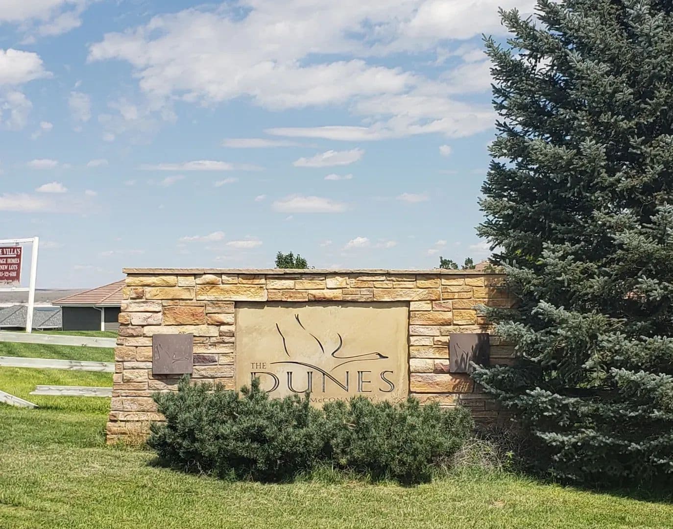
The Dunes Subdivision
$10,000,000
740 Acres
Brule, Nebraska, 69127
The Dunes Subdivision is a wonderful 740 +/- acre gated subdivision on beautiful Lake McConaughy.The Seller will consider selling the property in it's entirety or will sell individual lots starting at $65,000 for a 2 +/- acre lot.With everything going on in Ogallala and Keith County, this is a tremendous opportunity for a seasoned developer.The Dunes is on the south side of Lake McConaughy with 1 1/4 miles of lake frontage! Land 740 +/- acres of land partially subdivided.The Dunes Subdivision consists of beautiful rolling sandhills on the south side of Lake McConaughy that has been partially developed. There are currently 4 separate areas that have been platted into 75 individual lots ranging in size from approximately 2 +/- acres to 5 +/- acres. The Dunes lots, the Country Estates lots, the Lighthouse Ranchettes lots and The Sands lots. Of the 740 +/- total acres, approximately 2/3 of the remaining land is a clean slate to be developed as seen fit with the potential for additional recreational opportunities.The Dunes lots which are the waterfront lots of this subdivision on Lake McConaughy will remind you a lot of the Outer Banks of N. Carolina with their beautiful sand dunes rolling off into the white sand beaches. The Lighthouse Ranchettes and Country Estates are slightly more to the interior of the subdivision and The Sands lots have been designed as more entry level lots and also opportunity for multi-family builds.Plat maps showing the available lots and the individual lot prices are available upon request from the listing Broker.Improvements Main roads, electrical service, fiber optic lines and some water wells are in place.Recreation Lake McConaughy, the recreational jewel of western Nebraska, is the largest lake in the state with over 100 miles of shoreline, 35,700 surface acres of water, 24 miles long, 4 miles wide, and is famous for its white sand beaches. Each year, thousands of boaters, campers and outdoor enthusiasts make the Lake McConaughy area their destination for fun! In addition to Lake McConaughy which is fed by the North Platte River, you have Lake Ogallala at 320 surface acres “the little lake” nestled below Kingsley Dam (the 2nd largest earthen dam in the world). These two bodies of water provide endless opportunities for anglers of any skill level, young and old. The vast variety of fish you can catch between these two lakes include; Walleye, White Bass, Stripers, Wipers, Catfish, Northern Pike, Smallmouth Bass, Yellow Perch, Rainbow & Brown Trout. Lake McConaughy can accommodate virtually every type of watercraft you can imagine. Lake McConaughy and the North Platte River Valley also provide tremendous opportunities for hunters. This area is famous for duck and goose hunting. In addition to waterfowl hunting there is small game, varmints, White Tailed Deer, Mule Deer, and Pronghorn in the area.Agriculture N/AWater/Mineral Rights & Natural Resources All appurtenant water rights associated with this property will transfer to the Buyer(s) at Closing.General Operations The Dunes Subdivision is a planned development with tremendous opportunity.Region & Climate Keith County, Nebraska gets 20 inches of rain, on average, per year. The US average is 38 inches of rain per year.Keith County averages 27 inches of snow per year. The US average is 28 inches of snow per year.On average, there are 224 sunny days per year in Keith County. The US average is 205 sunny days.Keith County gets some kind of precipitation, on average, 68 days per year. Precipitation is rain, snow, sleet, or hail that falls to the ground. In order for precipitation to be counted you have to get at least .01 inches on the ground to measure.Weather HighlightsSummer High: the July high is around 89 degreesWinter Low: the January low is 14Rain: averages 20 inches of rain a yearSnow: averages 27 inches of snow a year History “Geography is often destiny. It has always been so with Ogallala, a town that came into existence at the junction of the major routes of the transcontinental migrations and of the cattle trails north from Texas.”From 1870 to 1885, Ogallala was the “gateway of the Northern Plains”. Hard-bitten Wyoming and Montana cattlemen met in Ogallala’s hotel and saloons with Texas cattle kings and bargained over cattle prices. Gold flowed freely across the table, liquor across the bar, and occasionally blood across the floor as a bullet brought some unlucky cowhand to his death on the floorboards of Tuck’s Saloon.The first non-native visitors to this area were the trappers from St. Louis.Next came the pioneers who followed the Oregon Trail. To protect them, the government established forts at intervals along the trail. Then came the Union Pacific Railroad. It is assumed that Ogallala had its beginning about 1867. Settlers started to follow the railroad west, and the cattlemen started driving their cattle to Ogallala to be shipped east or to be sold to Montana and Wyoming ranchers.Ogallala’s early history was unspectacular, promising to be nothing but a section house and water tank for the railroad. Then, in the spring of 1868, three men appeared to set the destiny of Ogallala. These men were the Lonergan brothers and Louis Aufdengarten. The Lonergan brothers came to do construction work for the Union Pacific Railroad. They found the plains to their liking, and subsequently became interested in Ogallala.By 1876, Ogallala had changed little from its infant days in 1868. The stores were all south of the railroad tracks, and fronted what was called Railroad Street and the trail leading south to the Platte River. Along this trail extended the rest of the town. The town consisted of saloons with such names as The Cowboy’s Rest and the Crystal Palace. The last building on the street was the Ogallala House – dining room widely patronized because of its excellent fare. It was run by S.S. Gast.By 1880, Ogallala consisted of one courthouse, one school, one hotel, two dwelling houses, and twenty-five permanent residents. The tempo of living in early Ogallala changed with the seasons. During the months of winter and early spring life was drab and dreary. Shortly after the first of June the town began to hum with activity as the first Texas trail herds started to arrive. During the three summer months business boomed – ten to twelve herds, each of two hundred or more trail hands taxed the facilities of Ogallala. Sleeping rooms and meals were hard to find when the trail hands were in town. Activities in Ogallala continued at a fever pitch until the end of August, by then the Texans were heading back to Texas; by November Ogallala had settled back in quiet and peaceful repose.Ogallala’s population of floaters, gamblers, trades-people and dance hall hostesses drifted to Omaha or Cheyenne to spend the winter. One hotel, one supply house and a single saloon remained open for the winter. The community sank into a state of inanimation until next spring.In 1882-1884, the settlers and farmers reached Ogallala. These men were encouraged by the Union Pacific Railroad because the railroad started selling their land at quite low prices.A serious epidemic of Texas fever swept over Nebraska during the summer of 1884. The disease first appeared near Ogallala in July apparently being brought in by Texas cattle. The disease spread quickly and it caused very heavy losses to the cattlemen. The ranchers had started to put expensive blooded bulls in their herds. These ranchers demanded that Texas cattle be excluded from Nebraska. This ban of Texas cattle was a damaging blow to the Texas trail herd business. This was the end of the trail period of Ogallala, as the wild, often violent town became a peaceful farmer’s settlement.Location The Dunes Subdivision is approximately 15 minutes from Ogallala and Interstate I-80, 3 .5 hours northeast of Denver, CO, 4.5 hours west of Omaha, NE and 2 hours east of Cheyenne, WYThis property is minutes away from the lake’s famous white sands beaches, popular boat ramps, convenience stores, many restaurants and bars.

The Dunes Lots
$65,000
2 Acres
Brule, Nebraska, 69127
The Dunes Lots are located in a gated subdivision on beautiful Lake McConaughy. Individual lots starting at $65,000 for a 2 +/- acre lot and ranging upwards to $325,000 for a 5 +/- acre lot.With all the excitement going on in Ogallala and Keith County, this is a tremendous opportunity to build your dream lake home. There is 1 1/4 miles of lake frontage so get one of these highly coveted lots while they are still available! Land The Dunes Lots consist of beautiful rolling sandhills on the south side of Lake McConaughy that has been partially developed. There are currently 4 separate areas that have been platted into 75 individual lots ranging in size from approximately 2 +/- acres to 5 +/- acres. The Dunes lots, the Country Estates lots, the Lighthouse Ranchettes lots and The Sands lots.The Dunes lots which are the lakefront lots of this subdivision on Lake McConaughy. will remind you a lot of the Outer Banks of N. Carolina with their beautiful sand dunes rolling off into the white sand beaches. The Lighthouse Ranchettes and Country Estates are slightly more to the interior of the subdivision and The Sands lots have been designed as more entry level lots and also opportunity for multi-family builds.Plat maps showing the available lots and the individual lot prices are available upon request from the listing Broker.Seller financing may be available to well qualified Buyers.Improvements Main roads, electrical service and fiber optic lines are in place. Recreation Lake McConaughy, the recreational jewel of western Nebraska, is the largest lake in the state with over 100 miles of shoreline, 35,700 surface acres of water, 24 miles long, 4 miles wide, and is famous for its white sand beaches. Each year, thousands of boaters, campers and outdoor enthusiasts make the Lake McConaughy area their destination for fun! In addition to Lake McConaughy which is fed by the North Platte River, you have Lake Ogallala at 320 surface acres “the little lake” nestled below Kingsley Dam (the 2nd largest earthen dam in the world). These two bodies of water provide endless opportunities for anglers of any skill level, young and old. The vast variety of fish you can catch between these two lakes include; Walleye, White Bass, Stripers, Wipers, Catfish, Northern Pike, Smallmouth Bass, Yellow Perch, Rainbow & Brown Trout. Lake McConaughy can accommodate virtually every type of watercraft you can imagine. Lake McConaughy and the North Platte River Valley also provide tremendous opportunities for hunters. This area is famous for duck and goose hunting. In addition to waterfowl hunting there is small game, varmints, White Tailed Deer, Mule Deer, and Pronghorn in the area.Agriculture N/AWater/Mineral Rights & Natural Resources All appurtenant water rights associated with each individual lot will transfer to the Buye at Closing.General Operations The Dunes Lots are located in is a planned development with tremendous opportunity.Region & Climate Keith County, Nebraska gets 20 inches of rain, on average, per year. The US average is 38 inches of rain per year.Keith County averages 27 inches of snow per year. The US average is 28 inches of snow per year.On average, there are 224 sunny days per year in Keith County. The US average is 205 sunny days.Keith County gets some kind of precipitation, on average, 68 days per year. Precipitation is rain, snow, sleet, or hail that falls to the ground. In order for precipitation to be counted you have to get at least .01 inches on the ground to measure.Weather HighlightsSummer High: the July high is around 89 degreesWinter Low: the January low is 14Rain: averages 20 inches of rain a yearSnow: averages 27 inches of snow a year History “Geography is often destiny. It has always been so with Ogallala, a town that came into existence at the junction of the major routes of the transcontinental migrations and of the cattle trails north from Texas.”From 1870 to 1885, Ogallala was the “gateway of the Northern Plains”. Hard-bitten Wyoming and Montana cattlemen met in Ogallala’s hotel and saloons with Texas cattle kings and bargained over cattle prices. Gold flowed freely across the table, liquor across the bar, and occasionally blood across the floor as a bullet brought some unlucky cowhand to his death on the floorboards of Tuck’s Saloon.The first non-native visitors to this area were the trappers from St. Louis.Next came the pioneers who followed the Oregon Trail. To protect them, the government established forts at intervals along the trail. Then came the Union Pacific Railroad. It is assumed that Ogallala had its beginning about 1867. Settlers started to follow the railroad west, and the cattlemen started driving their cattle to Ogallala to be shipped east or to be sold to Montana and Wyoming ranchers.Ogallala’s early history was unspectacular, promising to be nothing but a section house and water tank for the railroad. Then, in the spring of 1868, three men appeared to set the destiny of Ogallala. These men were the Lonergan brothers and Louis Aufdengarten. The Lonergan brothers came to do construction work for the Union Pacific Railroad. They found the plains to their liking, and subsequently became interested in Ogallala.By 1876, Ogallala had changed little from its infant days in 1868. The stores were all south of the railroad tracks, and fronted what was called Railroad Street and the trail leading south to the Platte River. Along this trail extended the rest of the town. The town consisted of saloons with such names as The Cowboy’s Rest and the Crystal Palace. The last building on the street was the Ogallala House – dining room widely patronized because of its excellent fare. It was run by S.S. Gast.By 1880, Ogallala consisted of one courthouse, one school, one hotel, two dwelling houses, and twenty-five permanent residents. The tempo of living in early Ogallala changed with the seasons. During the months of winter and early spring life was drab and dreary. Shortly after the first of June the town began to hum with activity as the first Texas trail herds started to arrive. During the three summer months business boomed – ten to twelve herds, each of two hundred or more trail hands taxed the facilities of Ogallala. Sleeping rooms and meals were hard to find when the trail hands were in town. Activities in Ogallala continued at a fever pitch until the end of August, by then the Texans were heading back to Texas; by November Ogallala had settled back in quiet and peaceful repose.Ogallala’s population of floaters, gamblers, trades-people and dance hall hostesses drifted to Omaha or Cheyenne to spend the winter. One hotel, one supply house and a single saloon remained open for the winter. The community sank into a state of inanimation until next spring.In 1882-1884, the settlers and farmers reached Ogallala. These men were encouraged by the Union Pacific Railroad because the railroad started selling their land at quite low prices.A serious epidemic of Texas fever swept over Nebraska during the summer of 1884. The disease first appeared near Ogallala in July apparently being brought in by Texas cattle. The disease spread quickly and it caused very heavy losses to the cattlemen. The ranchers had started to put expensive blooded bulls in their herds. These ranchers demanded that Texas cattle be excluded from Nebraska. This ban of Texas cattle was a damaging blow to the Texas trail herd business. This was the end of the trail period of Ogallala, as the wild, often violent town became a peaceful farmer’s settlement.Location The Dunes Lots are approximately 15 minutes from Ogallala and Interstate I-80, 3 .5 hours northeast of Denver, CO, 4.5 hours west of Omaha, NE and 2 hours east of Cheyenne, WYThese lots are only minutes away from the lake’s famous white sands beaches, popular boat ramps, convenience stores, many restaurants and bars.

Tower Bluff Ranch
$3,800,000
2,920 Acres
Mitchell, Nebraska, 69357
Tower Bluff Ranch is an amazing hunting and cattle ranch.This ranch boasts terrific hunting and is yet close to Mitchell and Scottsbluff.The property is accessed by a well-maintained county road but is at the end of the road and surrounded by other ranches and farmland making it feel very remote. An exceptional property like this is very hard to come by. Land Tower Bluff Ranch consists of 2920 +/- acres of very diverse land. Rolling meadows, chalk bluffs and deep canyons filled with trees.There are several wells with submersible pumps and a pipeline system and watering locations as well as several natural springs and an artesian well.Improvements There is a recently remodeled 4 bedroom, with 2 full bath home and 2 half baths, Central Heat and AC, a fireplace and wood burning stove, laundry room with built-in ironing board and a partially finished basement on the property. The home also boasts an amazing amount of storage areas.A large carport and 2 smaller utility sheds near the main house.A smaller set of corrals in average condition for gathering livestock.There is a second improvement site with several outbuildings and an older house.Recreation Tower Bluff Ranch is at the end of the road and nestled in the bluffs just south of the North Platte River, providing exceptional hunting and endless recreational opportunities!This ranch has very diverse topography and provides excellent habitat for a wide variety of wildlife.Tower Bluff Ranch is home to elk, mule deer, White-tailed deer, Big Horn sheep, pronghorn, turkey, Sharptail grouse and an array of varmints and small game.In addition, the property is only a short distance south of the North Platte River valley which boasts excellent waterfowl hunting.Tower Bluff Ranch will allow you to enjoy all the recreational activities associated with the rural lifestyle, from riding UTV’s, ATV’s and horses, stargazing, or just relaxing and enjoying nature.Agriculture Tower Bluff Ranch is a great cow/calf ranch that is owner rated at 150 pairs with some additional winter feed being required.Tower Bluff Ranch is located close to additional feed sources and thriving livestock markets.Water/Mineral Rights & Natural Resources All appurtenant water rights associated with this property will transfer to the Buyer at Closing.All mineral rights associated with this property and currently owned by the Seller will transfer to the Buyer at Closing.There are several natural springs on the property.General Operations Tower Bluff Ranch has been traditionally operated as a cow/calf ranch with excellent hunting opportunities.Region & Climate Weather HighlightsSummer High: the July high is around 89 degreesWinter Low: the January low is 14Rain: averages 14 inches of rain a yearSnow: averages 39 inches of snow a yearMitchell, NE enjoys a temperate climate with four distinct seasons. Summers are hot and humid, with temperatures regularly reaching the high 80s and low 90s. Winters are cold but dry, with temperatures typically falling into the teens and twenties. Spring brings mild weather and abundant rainfall, while autumn offers beautiful views of the changing leaves. Rainfall is spread fairly evenly throughout the year resulting in an average precipitation of 24 inches annually. This moderate climate provides perfect conditions for outdoor activities year-round!Mitchell, Nebraska gets 14 inches of rain, on average, per year. The US average is 38 inches of rain per year.Mitchell averages 39 inches of snow per year. The US average is 28 inches of snow per year.On average, there are 223 sunny days per year in Mitchell. The US average is 205 sunny days.Mitchell gets some kind of precipitation, on average, 73 days per year. Precipitation is rain, snow, sleet, or hail that falls to the ground. In order for precipitation to be counted you have to get at least .01 inches on the ground to measure. History History around this area dates back to the days of the Oregon Trail.Mitchell was established in 1900, when the Chicago, Burlington and Quincy Railroad was extended westward to that point. It was named after the historic Fort Mitchell nearby, which had been named after General Robert B. Mitchell, a brigadier general in the Union Army during the American Civil War. Mitchell was incorporated as a city in 1902.Scottsbluff is the largest city in the Nebraska Panhandle, and the 13th-most-populous city in Nebraska.Scottsbluff was founded in 1899 across the North Platte River from its namesake, a bluff that is now protected by the National Park Service as Scotts Bluff National Monument. The monument was named after Hiram Scott, a fur trader with the Rocky Mountain Fur Company who was found dead in the vicinity on the return trip from a fur expedition. The smaller town of Gering had been founded south of the river in 1887. The two cities have since grown together to form the 7th-largest urban area (the Scottsbluff Micropolitan Statistical Area) in Nebraska.Scottsbluff was founded by the Lincoln Land Company, a subsidiary of the Burlington Railroad. By 1900, the Burlington Railroad laid tracks into the town and placed a discarded boxcar next to the tracks as a temporary depot. Scottsbluff was the first town in the region to be located along a railroad line, resulting in some older businesses relocating from Gering to Scottsbluff. Location Tower Bluff Ranch is located in western Nebraska, 10 minutes south of Mitchell and approximately 20 minutes west of Scottsbluff/Gering.Scottsbluff is home to the Western Nebraska Regional Airport.This property is located approximately 3 hours northeast of Denver, CO. 1.5 hours northeast of Cheyenne, WY. 3 hours south of Rapid City, S.D. and 7 hours west of Omaha, NE.

Oasis on the Plains Ranch
$3,500,000
1,640 Acres
Flagler, Colorado, 80815
Oasis on the Plains Ranch is exactly what is says, an oasis in the Eastern Plains of Colorado.The Republican River runs through the heart of the property and there are several ponds, water holes and natural springs throughout the property.The ranch is terrific for hunting White Tailed deer, mule deer, pronghorn, turkey, waterfowl and a wide variety of small game.The ponds have bass, bluegill, sunfish, crappie, bullheads and catfish. Land Oasis on the Plains Ranch consists of 1640 +/- acres of level to rolling land with the Republican River (seasonal) running through the heart of the ranch.The ranch surrounds the Flagler Reservoir State Wildlife Area on 3 sides.There are several ponds and water holes fed by runoff water and the natural springs located throughout the property.This property also boasts a large apple orchard and there are several Wild Plum bushes around the ponds, both attract significant wildlife. Improvements The ranch headquarters is located at the end of a well-maintained county road providing great seclusion yet close to town.The main home is a 2100 sq ft 3 bedroom, 1.5 bath, with large mud room, large eat in kitchen and living room and is a manufactured home, there is also an older unoccupied 3 bedroom, 2 bath home with a basement that could easily be remodeled.There is a 34’X100′ cattle/horse barn with a shop area located off the corrals and working facilities.The homes have well water, septic systems, electrical service, fiber optic and propane.The main house has a new roof and gutters, a new AC unit and duct work all in 2025.Recreation Oasis on the Plains Ranch is probably one of the most diverse hunting/recreational ranches on the Eastern Plains of Colorado and it surrounds the Flagler Reservoir State Wildlife Area on 3 sides for additional recreational opportunities.This ranch consists of open rolling plains with deep canyons and rock outcroppings, the tree filled Republican River Valley, multiple natural springs, large ponds and watering holes scattered throughout the property.Whether you are wanting to hunt mule deer, white tailed deer, pronghorn, waterfowl, varmints or small game, you will find them all in abundance on the Oasis on the Plains Ranch.In addition to the tremendous hunting opportunities, the ponds and water holes on the ranch hold a variety of fish, including bass, bluegill, sunfish, crappie, bullheads and catfish.Are you a bird watcher? The wide variety of birds that frequent the property will amaze you; the Seller has estimated that they have seen in excess of 30 species of birds on the ranch.Oasis on the Plains Ranch checks all the boxes when it comes to recreation, come check it out and you won’t be disappointed.Agriculture Oasis on the Plains Ranch is a great cow/calf ranch owner rated at 125 pairs with 76 acres of crop production ground.The east side of the ranch is enrolled in the USDA/FSA Grassland CRP program.Depending on available water, some of the production land is set up to be flood irrigated. Water/Mineral Rights & Natural Resources All appurtenant water rights associated with this property will transfer to the Buyer at Closing.This property boasts extensive and rare deeded water rights. This information will be provided to serious and well qualified Buyers.All mineral rights currently owned by the Seller on this property will transfer to the Buyer at Closing.General Operations The Oasis on the Plains Ranch has traditionally been operated as a cow/calf and horse ranch with excellent hunting and fishing.Region & Climate Flagler, CO has a semi-arid climate with hot summers and cold winters. The average summer temperature is around 80 degrees Fahrenheit while the average winter temperature is around 20 degrees Fahrenheit. Precipitation is fairly low in Flagler, with an average of only about 13 inches of rainfall per year. Snowfall amounts can vary widely from one year to the next, but the average amount is usually around 33 inches annually. Winters are typically mild, with temperatures rarely dipping below 0 degrees Fahrenheit. Despite the low precipitation averages and dry climate, Flagler does have some beautiful natural features, including rolling hills and plenty of greenery in springtime and autumn months.Flagler, Colorado gets 17 inches of rain, on average, per year. The US average is 38 inches of rain per year.Flagler averages 30 inches of snow per year. The US average is 28 inches of snow per year.On average, there are 257 sunny days per year in Flagler. The US average is 205 sunny days.Flagler gets some kind of precipitation, on average, 57 days per year. Precipitation is rain, snow, sleet, or hail that falls to the ground. In order for precipitation to be counted you have to get at least .01 inches on the ground to measure.Weather HighlightsSummer High: the July high is around 89 degreesWinter Low: the January low is 14Rain: averages 17 inches of rain a yearSnow: averages 30 inches of snow a year History The Eastern Plains of Colorado have long been the hunting grounds for Native Americans and early settlers, once tens of thousands of bison roamed these grass covered rolling hills and lush stream bottoms. The area was also grazing territory for the historic cattle drives from Texas to Montana. Most recently this area has mainly been utilized for ranching or dryland farming.The town of Flagler was established in 1888 as a small settlement near the then-new Rock Island Railroad. The area has had several names, and prior to the settlement of the town, the location had been home to a combined general store and post office, owned by W.H. Lavington, and named Bowser in memory of the owner’s favorite dog who had died. When the town was founded, the town was named Malowe after Rock Island Railroad attorney M. A. Lowe. The town was later renamed after Henry Flagler, railroad builder and oil man, at the request of his daughter who liked the area.The town was officially incorporated in 1916. Location Oasis on the Plains Ranch is located approximately 5 minutes from Flagler, CO and Interstate I-701 hour and 45 minutes east of Denver and DIA and 40 minutes west of Burlington, CO
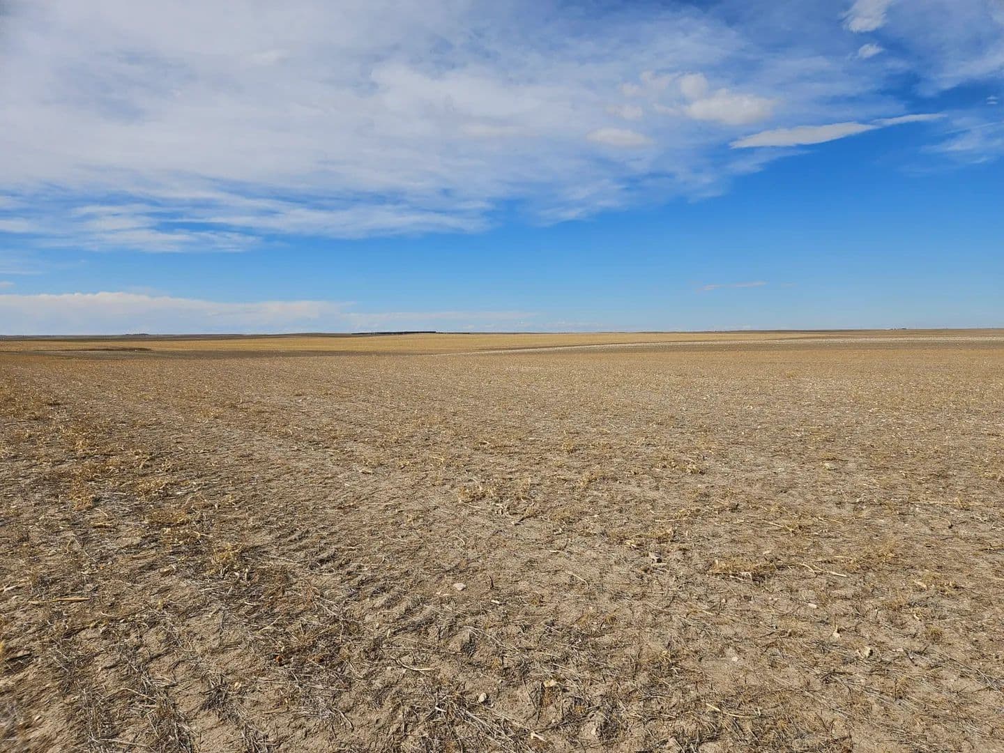
G4U4 Kimball County Farm
$91,000
79 Acres
Kimball, Nebraska, 69145
G4U4 Kimball County Farm is an excellent opportunity to expand your current farm or add to your investment portfolio.The farm has a good tenant in place with 1 year remaining on the current crop share lease.This farm is located in an area that doesn't trade hands very often so take advantage of this opportunity as it may not come around again! Land G4U4 Kimball County Farm is 79 acres more or less of level dryland crop ground with good soils.It should also be noted that the Corps of Engineers recently acquired an easement for a future underground communications line that will go diagonally South to North across the site.Soils Map below in Documents.Improvements NoneRecreation G4U4 Kimball County Farm will allow you to enjoy all the recreational activities associated with the rural lifestyle, from riding UTV’s, ATV’s and horses to just enjoying nature.The property is only a short distance south of Kimball and boasts excellent Mule deer, pronghorn and upland bird hunting.Agriculture G4U4 Kimball County Farm is 79 +/- acres of dryland crop ground.The farm is currently leased through the 2026 growing season with a 1/3 (owner) 2/3 (tenant) crop share lease.The owners 1/3 share of the growing 2026 crop will transfer to the Buyer.Water/Mineral Rights & Natural Resources All appurtenant water rights associated with this property will transfer to the Buyer at Closing.All (if any) mineral rights currently owned by the Seller on this property will transfer to the Buyer at Closing.General Operations This property is currently operated as a dryland farm with a 1/3 (owner) 2/3 (tenant) crop share lease through 2026Region & Climate Weather HighlightsSummer High: the July high is around 86 degreesWinter Low: the January low is 14Rain: averages 17 inches of rain a yearSnow: averages 38 inches of snow a yearKimball, Nebraska has a semi-arid climate characterized by hot summers and cold winters. Average daily highs in the summer can reach into the mid-80s, while winter temperatures can dip below zero when snow is present. Precipitation occurs throughout the year but is heaviest during the spring months, averaging over three inches per month between April and June. However, even during those months, much of the precipitation falls in the form of hail or snow rather than rain due to Kimball’s high elevation and location at the edge of a desert region. Despite these conditions, Kimball often experiences mild weather due to its continental climate which moderates extreme temperatures that are common in other areas of Nebraska.Kimball, Nebraska gets 17 inches of rain, on average, per year. The US average is 38 inches of rain per year.Kimball averages 38 inches of snow per year. The US average is 28 inches of snow per year.On average, there are 226 sunny days per year in Kimball. The US average is 205 sunny days.Kimball gets some kind of precipitation, on average, 79 days per year. Precipitation is rain, snow, sleet, or hail that falls to the ground. In order for precipitation to be counted you have to get at least .01 inches on the ground to measure. History Kimball is the county seat of Kimball County, Nebraska. The population was 2,290 at the 2020 census.Kimball was originally called Antelopeville, and under the latter name was established circa 1870 when the Union Pacific Railroad was extended to that point. It initially consisted of a telegraph and coal station with a siding and section house. It was renamed in 1885 in honor of Thomas Lord Kimball, a railroad official. Kimball was incorporated in 1888.Kimball is located in the southwestern Panhandle. According to the United States Census Bureau, the city has a total area of 2.07 square miles of land.Kimball declares itself as “The High Point of Nebraska!”, as the highest point in the state is approximately 33 miles from the city. Panorama Point, 5,424 feet above sea level, is located at N 41 degrees 00.461 minutes, W 104 degrees 01.883 minutes. It is marked by a small monument. However, Kimball itself is not the Nebraska town with the highest elevation: that status belongs to Harrison, at 4,876 feet.Kimball is mainly a farm and ranch community with some oil and gas production in the area. Location G4U4 Kimball County Farm is located 1/4 mile west of Hwy 71 on Road 14S approximately 8.5 miles south of Interstate I-80 at the Kimball Exit.The property is 2 hours northeast of Denver, CO, 1 hour east of Cheyenne, WY and 6.25 hours west of Omaha, NE.Kimball is also home to the Kimball Municipal Airport.Kimball Municipal Airport is a public use airport with self-serve CC fuel, 100LL, and straight Jet A fuel is available. Other amenities include: free tie down area, flight center with meeting area/lounge/tv, and two courtesy cars are available for local use. A private part-time aviation company provides storage, repair, flight instruction, and rentals.
51 McGinley at Lake Mac
$75,000
1.31 Acres
Keystone, Nebraska, 69144
51 McGinley at Lake Mac is a 1.31 +/- acre parcel of land zoned commercial directly east of Martin Bay This property is currently being utilized as a storage area and has tremendous potential.There is electrical service to the property.The views of Lake McConaughy are wonderful. Land 1.31 +/- acres of property zoned CommercialImprovements Electrical service to the property.Recreation Lake McConaughy, the recreational jewel of western Nebraska, is the largest lake in the state with over 100 miles of shoreline, 35,700 surface acres of water, 24 miles long, 4 miles wide, and is famous for its white sand beaches. Each year, thousands of boaters, campers and outdoor enthusiasts make the Lake McConaughy area their destination for fun! In addition to Lake McConaughy which is fed by the North Platte River, you have Lake Ogallala at 320 surface acres “the little lake” nestled below Kingsley Dam (the 2nd largest earthen dam in the world). These two bodies of water provide endless opportunities for anglers of any skill level, young and old. The vast variety of fish you can catch between these two lakes include; Walleye, White Bass, Stripers, Wipers, Catfish, Northern Pike, Smallmouth Bass, Yellow Perch, Rainbow & Brown Trout. Lake McConaughy can accommodate virtually every type of watercraft you can imagine. Lake McConaughy and the North Platte River Valley also provide tremendous opportunities for hunters. This area is famous for duck and goose hunting. In addition to waterfowl hunting there is small game, varmints, White Tailed Deer, Mule Deer, and Pronghorn in the area.Agriculture N/AWater/Mineral Rights & Natural Resources All appurtenant water rights associated with this property will transfer to the Buyer at Closing.General Operations The property is currently being used for storage.Region & Climate Keith County, Nebraska gets 20 inches of rain, on average, per year. The US average is 38 inches of rain per year.Keith County averages 27 inches of snow per year. The US average is 28 inches of snow per year.On average, there are 224 sunny days per year in Keith County. The US average is 205 sunny days.Keith County gets some kind of precipitation, on average, 68 days per year. Precipitation is rain, snow, sleet, or hail that falls to the ground. In order for precipitation to be counted you have to get at least .01 inches on the ground to measure.Weather HighlightsSummer High: the July high is around 89 degreesWinter Low: the January low is 14Rain: averages 20 inches of rain a yearSnow: averages 27 inches of snow a yearHistory “Geography is often destiny. It has always been so with Ogallala, a town that came into existence at the junction of the major routes of the transcontinental migrations and of the cattle trails north from Texas.”From 1870 to 1885, Ogallala was the “gateway of the Northern Plains”. Hard-bitten Wyoming and Montana cattlemen met in Ogallala’s hotel and saloons with Texas cattle kings and bargained over cattle prices. Gold flowed freely across the table, liquor across the bar, and occasionally blood across the floor as a bullet brought some unlucky cowhand to his death on the floorboards of Tuck’s Saloon.The first non-native visitors to this area were the trappers from St. Louis.Next came the pioneers who followed the Oregon Trail. To protect them, the government established forts at intervals along the trail. Then came the Union Pacific Railroad. It is assumed that Ogallala had its beginning about 1867. Settlers started to follow the railroad west, and the cattlemen started driving their cattle to Ogallala to be shipped east or to be sold to Montana and Wyoming ranchers.Ogallala’s early history was unspectacular, promising to be nothing but a section house and water tank for the railroad. Then, in the spring of 1868, three men appeared to set the destiny of Ogallala. These men were the Lonergan brothers and Louis Aufdengarten. The Lonergan brothers came to do construction work for the Union Pacific Railroad. They found the plains to their liking, and subsequently became interested in Ogallala.By 1876, Ogallala had changed little from its infant days in 1868. The stores were all south of the railroad tracks, and fronted what was called Railroad Street and the trail leading south to the Platte River. Along this trail extended the rest of the town. The town consisted of saloons with such names as The Cowboy’s Rest and the Crystal Palace. The last building on the street was the Ogallala House – dining room widely patronized because of its excellent fare. It was run by S.S. Gast.By 1880, Ogallala consisted of one courthouse, one school, one hotel, two dwelling houses, and twenty-five permanent residents. The tempo of living in early Ogallala changed with the seasons. During the months of winter and early spring life was drab and dreary. Shortly after the first of June the town began to hum with activity as the first Texas trail herds started to arrive. During the three summer months business boomed – ten to twelve herds, each of two hundred or more trail hands taxed the facilities of Ogallala. Sleeping rooms and meals were hard to find when the trail hands were in town. Activities in Ogallala continued at a fever pitch until the end of August, by then the Texans were heading back to Texas; by November Ogallala had settled back in quiet and peaceful repose.Ogallala’s population of floaters, gamblers, trades-people and dance hall hostesses drifted to Omaha or Cheyenne to spend the winter. One hotel, one supply house and a single saloon remained open for the winter. The community sank into a state of inanimation until next spring.In 1882-1884, the settlers and farmers reached Ogallala. These men were encouraged by the Union Pacific Railroad because the railroad started selling their land at quite low prices.A serious epidemic of Texas fever swept over Nebraska during the summer of 1884. The disease first appeared near Ogallala in July apparently being brought in by Texas cattle. The disease spread quickly and it caused very heavy losses to the cattlemen. The ranchers had started to put expensive blooded bulls in their herds. These ranchers demanded that Texas cattle be excluded from Nebraska. This ban of Texas cattle was a damaging blow to the Texas trail herd business. This was the end of the trail period of Ogallala, as the wild, often violent town became a peaceful farmer’s settlement.Location 51 McGinley at Lake Mac is approximately 15 minutes from Ogallala and Interstate I-80, 3 .5 hours northeast of Denver, CO, 4.5 hours west of Omaha, NE and 2 hours east of Cheyenne, WYThis property is minutes away from the lake’s famous white sands beaches, popular boat ramps, convenience stores, many restaurants and bars.