Search Brokers - Philip Weatherford
Philip Weatherford
AFM Real Estate
Philip Weatherford is a land and rural real estate professional with AFM Real Estate, listed on Land Broker MLS, the broker-owned co-op for farms, ranches and land for sale. Use the contact form on this page to get in touch about buying or selling rural property.
Contact
Fill in the Form below to send a message to this broker
By submitting, you agree to our privacy policy and terms.
Land for Sale from Philip Weatherford
Premier Listing
Millcreek
$1,762,287
332 Acres
Pacolet, South Carolina, 29372
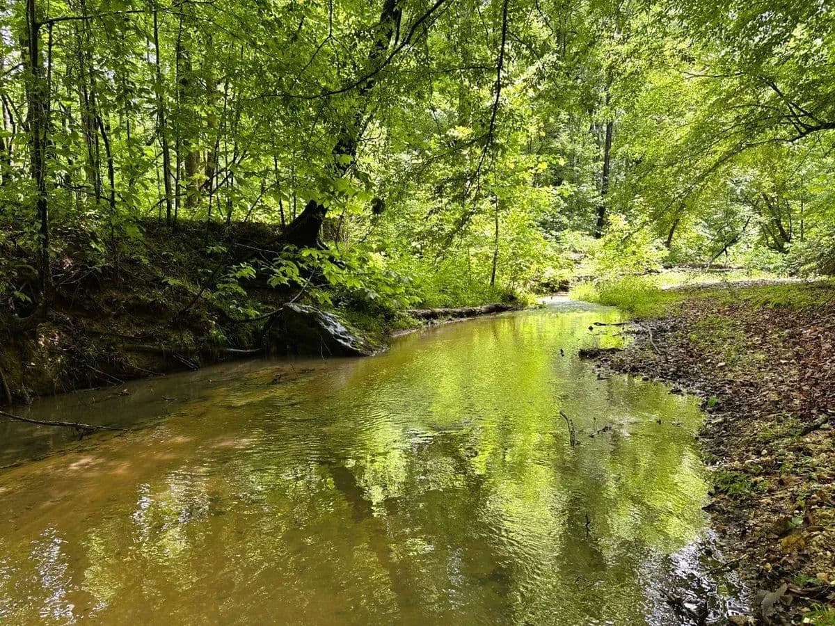
Millcreek Tract is a big outdoor playground in the hills of northwest Union County. It lies on Jerusalem Road in a quiet area just east of the small town of Pacolet and less than two miles from the Spartanburg County line. Rolling hills are forested with two ages of planted pines, each covering more than 100 acres. Mill Creek is big, year-round stream with a sand and gravel base that flows through the land near its southern boundary for more than 4,000 feet. Mature hardwoods line the creek banks and fill the bottomland. A large powerline right-of-way crosses the northern part of the property. Quail are heard calling among the youngest pines. Wild turkeys are common and whitetail deer are abundant. More than 115 acres of loblolly pines were planted in 2021. These young trees look good and are growing fast. An estimated 113 acres of pines are now about 22 years old. They have been thinned and are well-spaced. More than 15 acres are in a large powerline right-of-way providing readymade shooting lanes and opportunities to improve wildlife plots. The land extends beyond Mill Creek to take in mature hardwood forest on both sides. Yellow poplar, paw paw, and sweetgum are common along with oak and beech on surrounding slopes. Almost 80 acres of the property are covered with mature hardwoods. Access across the land is good with more than a mile and a half of woods roads and trails. Soils are mostly sandy clay loam or sandy loam and productive for timber and wildlife openings. Some areas could be converted to other uses such dove fields, pastures, or orchards with about 70 acres mapped as useful farmland (USDA farmland classification). The highest point on the property sits at about 630 feet elevation. The tract has more than 4,000 feet of paved road frontage and three gates enter the land from Jerusalem Road, a rural 2-lane highway. Gentle topography offering potential home sites can be found in places along Jerusalem Road. Fiberoptic lines and powerlines that serve nearby homes run near the road frontage. Soil mapping for septic drain field potential looks favorable for some areas near Jerusalem Road. There are no public waterlines in the area. A home would require well and septic. The immediate neighborhood is mostly wooded tracts and pastures. Houses are scattered in the area with no planned subdivisions or commercial sites nearby. This property is timberland with no improvements and no address. The northwest corner of the land sits across Jerusalem Road from its intersection with Cricket Lane (GPS=Cricket Ln, Pacolet, SC 29372). Union County tax parcel number is 005-00-00-014 000.**There is an active hunt lease on this property. Please do not visit without first contacting the agent.Spartanburg is just over 20-minutes away and has everything from Aldi to Zaxby’s. There are local favorites like Beacon Drive-in, Carolina Barbecue and Wade’s southern comfort food, and big chains like Publix, Lowes, and Tractor Supply. Medical services are anchored by Spartanburg Medical Center, a regional research and teaching hospital. The tract is about 4 miles from Pacolet, 15 miles from Spartanburg, 16 miles from Union, and 47 miles from Greenville. All distances are approximate road miles to the center of town.

Premier Listing
Clear Branch
$1,227,380
221.39 Acres
Blacksburg, South Carolina, 29702
Clear Branch Tract is a beautiful, forested property located in the quiet rolling hills of northern Cherokee County. It lies north of I-85 near the North Carolina line, just above the town of Blacksburg.Kings Mountain can be seen to the east, looking from high points near the middle of the tract. Broad ridges are covered with young, planted pines. Mature pines mixed with hardwoods stand in patches and on slopes between the ridges. Two small branches flow through the land. The immediate neighborhood is mostly wooded tracts and hay fields with scattered houses.Turner Road is a small, paved road which serves as the western boundary of the land. Part of the road frontage is maintained by state DOT and part by the county. A plat from 1983 describes the tract as 221.39 acres and indicates more than 800 feet of road frontage.Two woods roads enter the tract from Turner Road. Multiple building sites can be found on gentle terrain near the road frontage or further into the tract. Soil map for septic drain field potential looks favorable in these areas. A powerline serves a home directly across Turner Road. The closest homes to the north have pubic water and the local water company has indicated this property could be served by that water line. No public sewer service is available. Two nearby homes are within view of the property along Turner Road.The land is all forested except for woods roads and a few small openings formerly used as log loading decks. Soils are mostly sandy loam or clay loam and are productive for timber, wildlife openings, and fields where slopes allow. More than 100 acres are covered in loblolly pine now 3 or 4 years old. These trees are healthy and growing fast.Mature pines, about 38 years old, dominate the southern part of the land covering about 45 acres. Slopes become steeper in places as you move further into the tract. Mature pines mixed with hardwoods stand on about 55 acres of steeper slopes and low areas around the creek branches. These areas are dominated by loblolly pine, yellow poplar, and American beech. White oaks and red oaks are also common.The town of Gaffney is a 10 to 15-minute drive away and offers restaurants, doctors, churches, and stores including Tractor Supply, Lowes, and Ingles Grocery. From local favorites like Daddy Joes Beach House BBQ and Zackary’s Coffee to national chains like Chick-fil-a and Starbucks, Gaffney offers a lot of variety for its size. The Outlet Marketplace is on I-85 just north of town with shops like Micheal Kors and Kate Spade. The tract is about 9 miles from Gaffney, 29 miles from Spartanburg, 57 miles from Greenville, 11 miles from Shelby, NC and 48 miles from Charlotte. All distances are approximate road miles to center of town.**There is an active hunt lease on this property. Please do not visit without first contacting the agent.The property is timberland with no improvements and does not have an address. A nearby home has a mailbox at the address 355 Turner Rd, Blacksburg, SC 29702. A gate for the tract is across the road to the east from this mailbox. County tax map # 151-00-00-026.000.
Premier Listing
Littlejohn
$1,269,000
241 Acres
Jonesville, South Carolina, 29353
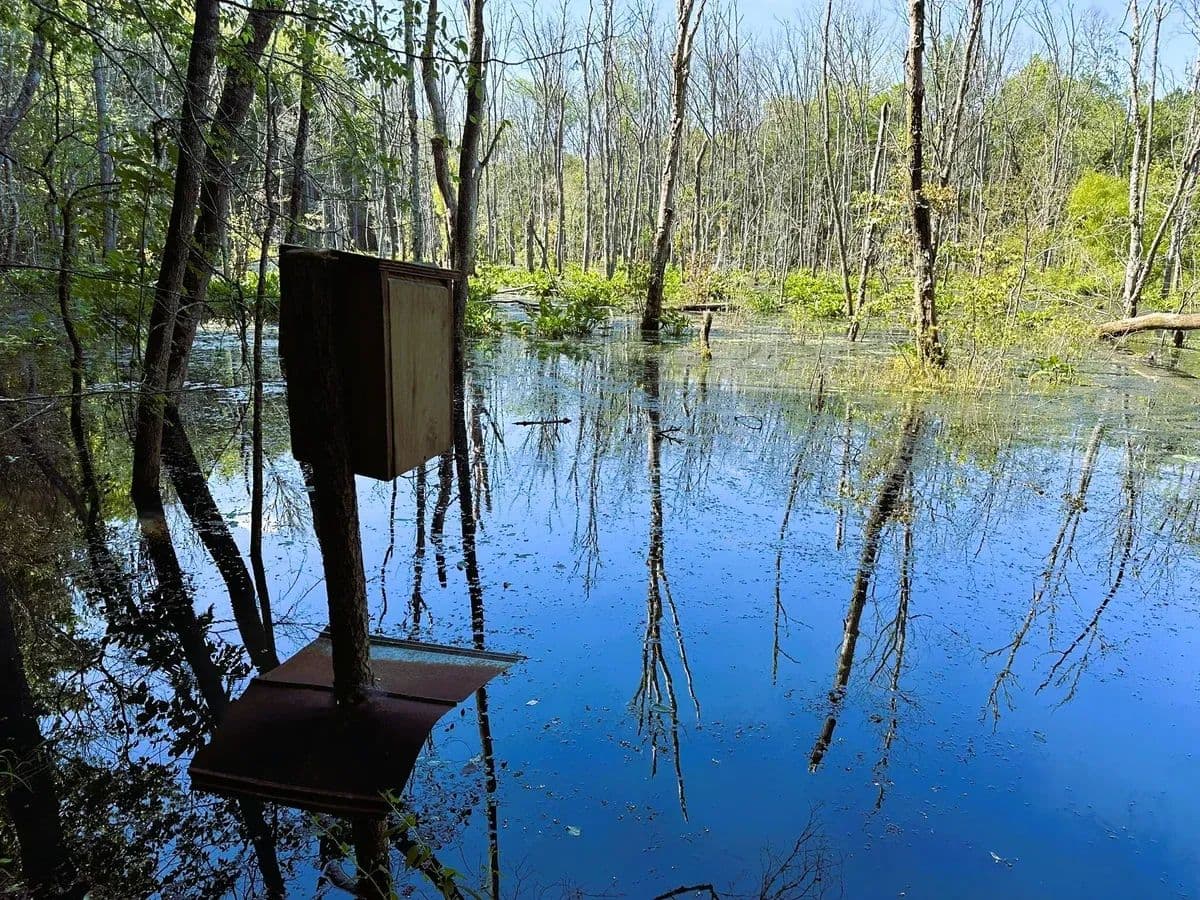
Littlejohn Tract is an outstanding rural property with great diversity for wildlife habitat and standing timber value, close to the conveniences of a big town. It lies on Littlejohn Road in a quiet area just east of the small town of Pacolet, about three miles from the Spartanburg County line. Mill Creek is a large stream with bottomlands of mature hardwoods and a big beaver swamp. Uplands are rolling hills covered by forests of tall, well-spaced, open pines. Steeper slopes overlook the creek bottom and nearby drainageways, shaded by big, mixed upland hardwoods. A large powerline right-of-way crosses the tract. Wild turkeys are common and whitetail deer are abundant. About 140 acres are forested with loblolly pine planted in 2002. Another 22 acres near the south boundary were planted in 1997. All pine areas have been fertilized, thinned, and fertilized again. The 140 acres also had a hardwood control treatment after thinning leading to an open understory that is easy to see through and move through. Close to the south bank of Mill Creek, the land is strongly rolling to steep. Red oak, white oak and American beech are common. On the north side of Mill Creek, upland slope transitions gently down into the wide bottomland. Yellow poplar, and sweetgum are dominant in the creek bottom along with maple and ash. Around 63 acres are covered by mature hardwood. About 5 acres are flooded between the main creek channel and steep slopes south of the creek. This area is a mix of dead timber, open water and wetland plants. Geese and ducks frequent this natural pond. Just over 20 acres of the tract are identified in the National Wetlands Inventory. Access across the land is good with well over a mile of woods roads. No internal roads cross Mill Creek, but access comes from public roads on both sides. About six acres are maintained by Duke Power as a powerline right-of-way that is about 100 feet wide and a half mile long within the property. Some small openings of around a quarter acre are scattered along the roads. These are mostly sites used as logging decks. A small part of the bottomland has been kept open as a wildlife area. Soils are mostly sandy clay loam and are productive for timber and wildlife openings. Over much of the property, soils would be productive for larger openings and pastures if desired. Topography is gently rolling in many areas, but steeper along the transition between uplands and the creek bottom. A few large gullies are scattered across the tract. The property has access from 3 public roads. The main gate is on Littlejohn Road with about 1,100 feet of road frontage. A powerline along the road is maintained by Broad River Electric. A natural gas line ends near the neighbor’s house across the road and fiber internet lines have been installed. There are no public waterlines nearby. A home would require well and septic. Soil maps indicate that septic perc potential is good for the most accessible parts of the property. Another gate sits beside Tinsley Road with about 400 feet of frontage and a small electric distribution line. The third gate is near Jerusalem Road. This access crosses a neighbor’s land for about 100 feet between the property line and the public road. The immediate neighborhood is mostly wooded tracts mixed with pastures. Houses are widely scattered in the area with no planned subdivisions or commercial sites nearby. A couple of residences are within sight of the property along Littlejohn Road. Two plats are recorded with the county which total 241 acres. The portion south of Mill Creek was surveyed in 1960 as 136.4 acres. The northern part is 105 acres surveyed in 1959. The property is timberland with no improvements and does not have an address. The main gate is on Littlejohn Road (GPS = “Littlejohn Rd, Jonesville, SC 29353”) about a quarter mile north of its junction with Robinson Farm Road. County tax map number is 009-00-00-003 000.**There is an active hunt lease on this property. Please do not visit without first contacting the agent.Spartanburg is about 25-minutes away and has everything from Aldi to Zaxby’s. There are local favorites like Beacon Drive-in, Carolina Barbecue and Wade’s southern comfort food, and big chains like Publix, Lowes, and Tractor Supply. Medical services are anchored by Spartanburg Medical Center, a regional research and teaching hospital. The tract is about 6 miles from Pacolet, 14 miles from Union, 17 miles from Spartanburg, and 48 miles from Greenville. All distances are approximate road miles to the center of town.

Premier Listing
Browns Branch
$294,080
64 Acres
Pacolet, South Carolina, 29340
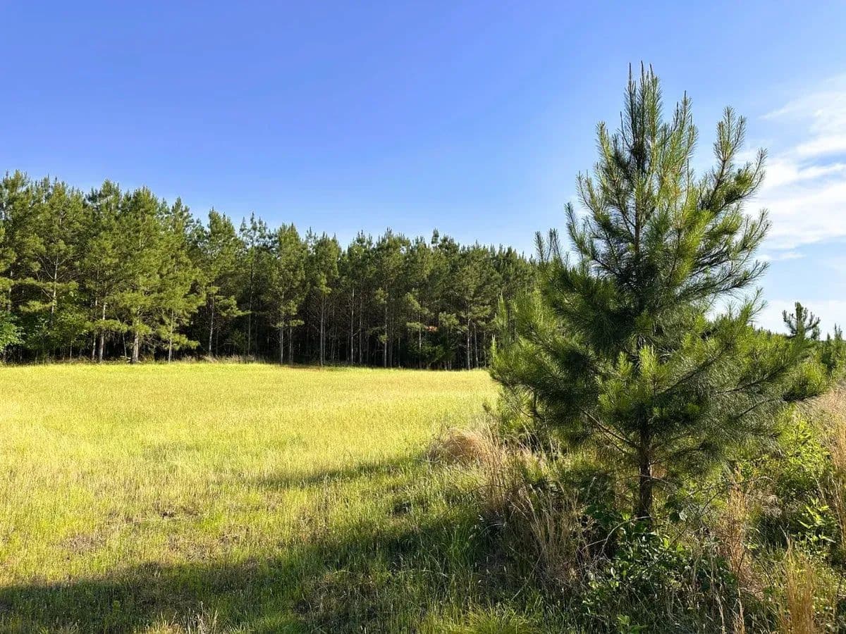
Browns Branch Tract is characterized by rolling hills and vigorous young pine trees. The land lies south of Goucher Green Bethel Road in the White Plains area of western Cherokee County, about a mile from the Spartanburg County line.About 44 acres are forested with loblolly pine planted in 2021 and now in their fifth growing season. These young trees are healthy and growing fast. The upper end of Browns Branch is a small stream that crosses the back side of the land. Some steep slopes overlook the little stream. Older pines, interspersed with a few hardwoods, stand in patches that collectively cover approximately 12 acres. A steel tower power line crosses the property about two-thirds of the way back from the paved road, occupying a right-of-way that spans about 5 acres.Soils are mostly sandy loam and are productive for timber and wildlife openings. Where slopes allow, soils would be productive for larger fields and pastures if desired. Topography is rolling over most of the land. Some of the most level parts of the tract are in the area cleared for powerline right-of-way. The neighborhood is rural, with houses scattered along the road and wooded tracts between.The property has an entrance along Goucher Green Bethel Road with about 50 feet of frontage. A power line, a fiber-optic line, and a public water line run along the paved road. Soil maps indicate that septic perc potential is good in places, including the area with the best topography nearest the paved road. A driveway of about 1,000 to 1,200 feet would be required to reach a building site within the tract. Most of this distance is already an established woods road and much of it is graveled.The amenities of Spartanburg are about 20 to 30 minutes away. The tract is about 5 miles from Pacolet, 11 miles from Gaffney, 15 miles from Spartanburg, and 48 miles from Greenville. All distances are approximate road miles to the center of town.**There is an active hunt lease on this property. Please do not visit without first contacting the agent. The property is timberland with no improvements and does not have an address. It is on Goucher Green Bethel Road between mailbox #874 and Millen Farm Road. For GPS directions, use “Millen Farm Rd, Gaffney, SC 29340”. Once at the intersection of Millen Farm and Goucher Green Bethel Roads, continue about 300 feet east on Goucher Green Bethel and look for a for-sale sign at the gated woods road. County tax map # is 053-00-00-029.000.

Premier Listing
Jordan Tract
$1,336,000
289 Acres
Greenwood, South Carolina, 29848
The Jordan Tract is an exceptional timber and recreation property located in a very rural area of southern Greenwood County. It lies about halfway between Greenwood and Edgefield on Jordan Road in the Callison community. Broad rolling uplands are covered with mature pine forests. Cuffytown Creek is a large stream flowing along the southern border. Mixed hardwoods are found in low areas near the creek and in other scattered patches. The neighborhood is made up of wooded tracts and pastures. Houses are widely scattered in the area. US Forest Service land adjoins. The land is all forested except for woods roads and a few small openings. A little over 250 acres are covered with planted loblolly pine. About 211 acres were established in 1989 and ±43 acres in 1999. These trees were thinned in the fall of 2025. About 25 acres of mixed, mature hardwoods stand on creek bottoms and in small, scattered patches. White oaks and red oaks are common. Willow oaks and swamp chestnut oaks are found along with dwarf palmetto glades in a flat bottomland on the south side. Cuffeytown Creek is a broad stream shaded by sycamore and maple and makes the tract’s southern boundary for about 800 feet. Woods ducks frequent pools along the creek created by downed logs. Jordan Road is a narrow county maintained paved road. The property has great access with about 2,000 feet of frontage on each side of Jordan Road. Bell Road, a county gravel road, cuts through the western part of the land for about 1,800 feet. Woods roads enter the land in two places off Jordan Road and are open and drivable for about a mile total through the tract. A small powerline runs near Jordan Road and could serve a home on the property. Cable / fiber line also runs along the road. Areas of gentle slopes lie along the road frontage on both sides and should be attractive as cabin or home sites. There are no public waterlines in the area. A home would require well and septic. Soils are mostly silt loam or sandy loam and are productive for timber or other uses. Topography is gently rolling and good for continued timber management or conversion to other uses such as fields, orchards, barns or homesites. USDA farmland classification indicates that soils could be productive for pastures and some crops with over two-thirds of the property classed as useful farmland. Soil maps indicate that septic perc potential is good for most of the property and soils would serve well for house construction.A little pond is tucked into the woods west of Jordan Road. It is now a third to half acre but was at least twice this size. It appears that years ago beavers blocked the spillway and a small section washed out of the dam. This needs to be repaired to restore the pond. A small, unmaintained cemetery (old DeVore Mill Cemetery) lies near the southeast corner. National Forest land joins on the west side of Jordan Road with almost one mile of common boundary. The neighbor along the eastern boundary line has a deeded easement crossing the property on established roads. In the past, this has been used infrequently for logging traffic. A plat from 1950 describes the property as 289 acres.Greenwood is less than a 30-minute drive away and has everything from Aldi to Zaxby’s. There are local favorites like Lowcountry Grill (southern cooking) and Olive Branch Mediterranean & Italian, and lots of big names like Publix, Lowes, and even one of the newest locations of Whataburger. The tract is about 17 miles from Greenwood, 24 miles from Edgefield, 45 miles from Augusta, GA, and 70 miles from Greenville. All distances are approximate road miles to the center of town. **There is an active hunt lease on this property. Please do not visit without first contacting the agent.The property is timberland with no improvements and does not have an address. It is near the end of Jordan Road (GPS = “600 Jordan Rd, Troy, SC 29848”). County tax map # 6768-294-579.

Premier Listing
Love Springs
$936,225
100.69 Acres
Gaffney, South Carolina, 29330
One-Hundred acres of development potential in the desirable community of Love Springs which sits within commutable distances of Spartanburg and Gaffney.This premium site is made up of gentle topography across broad uplands. A perennial stream flows southward through the tract. The land has excellent access, with more than 2,600 feet of paved frontage on Love Springs Road and more than 2,000 on Thornbird Road. A public water line runs along Love Springs Road.This property offers a high percentage of useful land. Floodplains associated with the streams are narrow, and only the streambeds are designated on national wetlands inventory maps. No FEMA floodplains are designated on the property. A plat prepared in 1980 describes the tract as 100.69 acres. One graveled driveway enters the eastern portion of the tract. There are no structures or other improvements on the land. The property is all wooded with a mix of mature hardwood and planted pine.The surrounding neighborhood contains well-kept homes and new construction. There are planned subdivisions within a mile to the east and west. This tract is about 1.5 miles by road from exit 87 on I-85. This exit has been redesigned, improved, and completed as part of the multiyear widening project on the interstate between Spartanburg and the North Carolina state line. Commercial projects within three miles of Exit 87 include a new Dollar Tree, DHL distribution warehouses, and the Gaffney Outlet Marketplace.Soils are mostly clay loam or sandy clay loam and are generally suited to the placement of roads, driveways, and houses. USDA soil maps show about 75% of the tract as having no limitation for the construction of dwellings without basements and more than 80% of the tract as likely to support septic tank drain fields. These maps are general in nature and should not be regarded as a guarantee for these uses, the owner has not had the soils studied by a scientist. Soil maps and descriptions are included in the documents section.The property contains a small landfill (+/- 200-foot by 100-foot L-shaped trench) that predates the seller’s ownership. This was a permitted landfill operated for +/- 6 weeks in 1976, when SCDHEC suspended the permit due to concerns. Remediation was conducted in the early 1990’s, and monitoring continued until 2021. In a certificate of completion letter dated April 2021, the SC Department of Health and Environmental Control acknowledged that required work had been completed and no further environmental assessment is required. The entire area is now wooded with little apparent signs of past disturbance. A portion of the area (approximately 145’ x 85’) is to remain undisturbed to protect a subsurface liner that was installed during remediation. Out of an abundance of caution, the seller will have the area not to be disturbed marked on the ground and has drafted covenants to be included in the deed of conveyance stating the grantee shall not permit any activity that would disturb this area. The SCDHEC certificate of completion letter and a draft of language for the covenants are included in the documents section. Further information is available on request.**There is an active hunt lease on this property. Please do not visit without first contacting the agent.The property is about 7 miles from Gaffney, 13 miles from Spartanburg, 44 miles from Greenville, and 60 miles from Charlotte, NC. All distances are approximate road miles to the center of town. The county tax map number is 029-00-00-026.000.
Premier Listing
Worth Mountain
$1,250,975
206 Acres
Hickory Grove, South Carolina, 29717
Worth Mountain Tract is an exceptional timber and recreation property located in the quiet hills of western York County. It lies a few miles southwest of the small town of Hickory Grove on Scenic View Road. Broad upland ridges are covered with young and mature pine forests. Beaverdam Creek is a perennial stream flowing through the land for more than 2,000 feet. Boulders and rock outcrops are found along the creek and small tributaries. Patches of hardwood stand along the creek and on hillsides. The immediate neighborhood is mostly wooded tracts and pastures. Houses are widely scattered in the area. The land is all forested except for woods roads and a few small openings and trails. Soils are mostly sandy clay loam or clay loam and productive for timber and wildlife openings. About 125 acres are covered in loblolly pine now 3 or 4 years old. These trees are healthy and growing fast. About 46 acres of pines are 30 to 40 years old. More than 40 acres of these pine stands are classed as useful farmland (USDA soil class prime farmland). These areas could be productive for larger openings and pastures if desired. Some of the bottomland areas along Beaverdam Creek could also be used for small fields, orchards or gardens, but occasional flooding occurs on these soils. Scenic View Road is a rural 2-lane highway. About 30 acres lie west of Scenic View Road with good access and a potential building site on a prominent hill. Around 175 acres lie on the east side of the road. Topography along the road is gentle and easily accessible in most places. Multiple building sites can be found on gentle terrain near the road frontage. Soil map for septic drain field potential looks favorable in these areas. Powerline and fiber optic cable are present along the road. There are no public waterlines in the area. A home would require well and septic. Worth Mountain Wildlife Management Area is a 1,643-acre area of public land owned by York County and leased and managed by South Carolina Department of Natural Resources. The WMA shares common boundaries with the property and lands are open year-round daylight hours. The WMA has long frontage on Broad River and provides river access via Dalton’s Landing. This small parking area and river ramp lie at the end of Dalton’s Landing Road just over a mile from the tract’s south boundary. Public dove fields are located along Dalton’s Landing Road. Closer to the property, the WMA’s 4-acre Horseshoe fishing pond comes within about 100 feet of the tract’s southwest corner. Adjacent landowners can walk to the pond though the woods or use the gravel access road which leaves Scenic View Road about 600 feet from the south property line. State fishing license is required for use of the pond. Special WMA rules may apply to hunting activities in addition to general licenses and game zone rules. The WMA also offers hiking trails including a walk to the top of its namesake Worth Mountain. The highest point on the property is a rocky knoll near the southwest corner which sits at just over 600 feet elevation. A small, old family cemetery is found in an area of mature pines near the center of the tract on a hill just west of Beaverdam Creek. A plat from 1980 describes the tract as 211.0 acres.The town of York is about a 20-minute drive away and offers restaurants, doctors, churches, and stores. There are local favorites like Garden Café, York Coffee Roastery, Black’s Peaches and Bush-n-Vine farm store, and chains including Tractor Supply, Lowes, and Food Lion Grocery. The tract is about 4 miles from Hickory Grove, 16 miles from York, 31 miles from Rock Hill, and 54 miles from Charlotte. All distances are approximate road miles to the center of town. **There is an active hunt lease on this property. Please do not visit without first contacting the agent.The property is vacant timberland and does not have an address. A neighbor’s home sits on about an acre along Scenic View Road that is surrounded by the property. This house is at 1741 Scenic View Rd, Hickory Grove, SC 29717. Gates enter the property to the north, south and across the paved road. See attached location map. County tax map number is 017-00-00-004.
Premier Listing
Beaverdam Branch
$1,581,862
366 Acres
Bradley, South Carolina, 29819
The Beaverdam Branch property is a big productive timberland tract in southern Greenwood County with great soils and gentle topography. The land lies along Hwy 221 in a quiet area near Bradley and about 10 miles by road from the Greenwood post office. Beaverdam Branch is a large stream with wide bottomlands full of mixed hardwoods and a series of beaver swamps. Uplands are gentle hills covered by young forests of well-managed pines. Hard Labor Creek makes part of the southern boundary and is shaded by big hardwoods. A large powerline right-of-way crosses the tract. Wild turkeys can be found along the creeks and whitetail deer are abundant across this property. About 169 acres of planted loblolly pines are now 13 years old. These trees are open and easy to move through. More than 130 acres of pines were planted in 2022. They are looking good and are growing fast. About five acres are maintained as a powerline right-of-way that is about 80 feet wide and more than a half mile long within the property. Access across the land is good with more than 2 miles of woods roads and trails. Beaverdam Branch runs through the property for about 3,000 feet. True to its name, the creek is dammed in multiple places making wetlands and pockets of open water. Almost 40 acres are in this low bottomland area. Just over 30 acres are identified in the National Wetlands Inventory. Hackberry, sweetgum, and maple are common along with a mix of flooded dead timber and wetland plants. Hard Labor Creek is a large stream shaded by mature oaks and other hardwoods. It runs along the tract’s southern boundary for 800 to 900 feet. The tract has more than 2,000 feet of paved road frontage. Gentle topography offering potential home sites can be found in places along the highway and a powerline that serves nearby homes runs along the road frontage. There are no public waterlines in the area. A home would require well and septic. Soil maps indicate that septic perc potential is good for much of the property.Soils are mostly sandy loam and are productive for timber or other uses. Topography is gently rolling and good for continued timber management or conversion to other uses such as fields, orchards, barns or homesites. USDA farmland classification indicates that soils could be productive for pastures and some crops with over half of the property classed as useful farmland. The immediate neighborhood is mostly wooded tracts. Houses are widely scattered in the area with no planned subdivisions or commercial sites for many miles. A plat from 1966 describes the property as 367 acres. The property is timberland with no improvements and does not have an address. The land lies on the east side of Hwy 221 across from its junction with Gold Mine Road (GPS = “Gold Mine Rd, Bradley, SC 29819”). County tax map number is 6831-213-505.**There is an active hunt lease on this property. Please do not visit without first contacting the agent.Greenwood is about a 15-minute drive away and has everything from Aldi to Zaxby’s. There are local favorites like Lowcountry Grill (southern cooking) and Olive Branch Mediterranean & Italian, and lots of big names like Publix, Lowes, and even one of the newest locations of Whataburger. The tract is about 10 miles from Greenwood, 51 miles from Augusta, GA, and 65 miles from Greenville. All distances are approximate road miles to the center of town.

Premier Listing
Hickory Hills
$2,194,260
421 Acres
Hickory Grove, South Carolina, 29717
Hickory Hills Tract is a big family playground or investment property in the quiet, rolling hills of western York County. It lies on the west side of Hwy 97 about a mile north of the small town of Hickory Grove and right at an hour’s drive from downtown Charlotte. Broad ridges covered with young pine invite views of distant hills. A small, rocky branch flows along the southern boundary. Almost half the land is covered by mature pine forest with trees that have been well-managed and thinned twice. Wild turkeys are common and whitetail deer are abundant. The land is all forested except for woods roads and a few small openings. About 175 acres are covered in loblolly pine now 2 or 3 years old. These trees are healthy and growing fast. Just over 200 acres are in loblolly pine now 33 to 35 years old. More than three miles of woods roads and additional ATV trails give good access to the property. Soils are mostly silty clay loam and productive for timber and wildlife openings. Topography is gentle in many areas and may lend itself to other uses such as pastures. The highest point on the property sits at just over 700 feet elevation. The immediate neighborhood is mostly wooded tracts and pastures. Houses are scattered along Hwy 97. The property has about 100 feet of frontage on Hwy 97 and access via deeded easements to the highway at two other points. Hwy 97 is a rural 2-lane highway and the main road between Hickory Grove and Smyrna. Topography near the highway allows for potential building sites. Soil mapping for septic drain field potential looks favorable for some of these areas. Powerlines and fiber optic cable run along the highway. Underground power and fiber run through the tract along an easement that gives access to a neighbor’s house, passing through one of the best building sites on the land. There are no public waterlines in the area. A home would require well and septic. An old, abandoned railway forms the eastern boundary of the property for about 2,300 feet. The property line is the center of the railroad bed which runs parallel to Hwy 97. The tract is near the highway for this distance but only touches the highway for a distance of about 100 feet. The property is shown on three plats. A plat from 1979 describes 295 acres, a plat from 1988 describes 130 acres, and a plat from 2013 describes the, more or less, 100 feet of highway frontage. York County tax parcel numbers are 0680000001 and 0660000001.The town of York is about a 20-minute drive away and offers restaurants, doctors, churches, and stores. There are local favorites like Garden Café, York Coffee Roastery, Black’s Peaches and Bush-n-Vine farm store, and chains including Tractor Supply, Lowes, and Food Lion Grocery. The tract is about 1 mile from Hickory Grove, 13 miles from York, 29 miles from Rock Hill, and 49 miles from Charlotte. All distances are approximate road miles to the center of town.

Premier Listing
Stevens Branch
$339,858
86.04 Acres
Edgefield, South Carolina, 29824
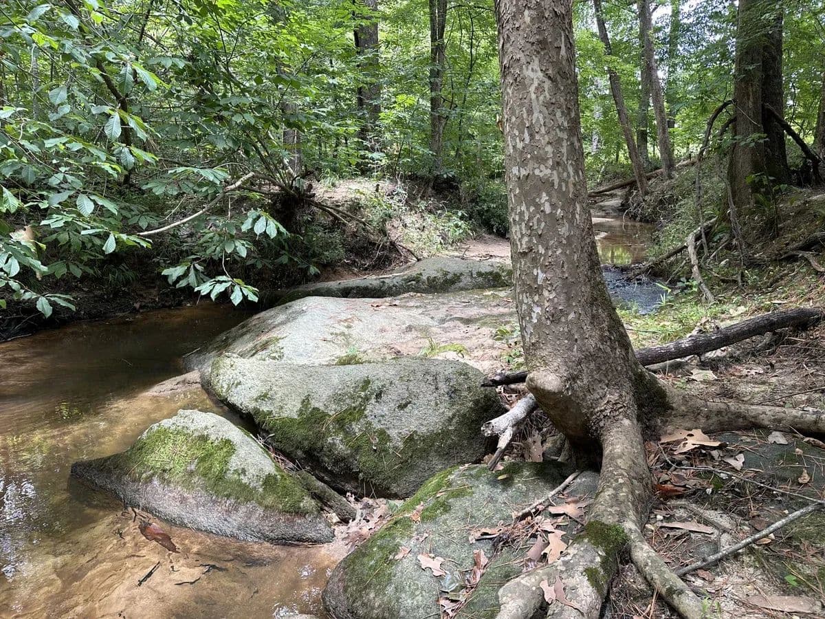
Stevens Branch Tract is a great recreation and timberland property located in a quiet area of northern Edgefield County. The land lies south of Hwy 378 about eight miles north of Edgefield. About 80 acres are forested with loblolly pine planted in 2021 and now in their fifth growing season. These young trees are healthy and growing fast. The land is all wooded except for roads and trails. Topography in the planted pine area is gently rolling to nearly level. A small, rocky branch runs along the eastern property line and joins Turkey Creek as it makes the southern boundary. Turkey Creek is a large steam with a gravely base and rock outcrops scattered along the creek bed. Some steeper slopes overlook the streams where hardwoods mixed with pine cover 4 to 5 acres. Soils are mostly silt loam or fine sandy loam and are productive for timber and other uses. Over much of the property, soils would be productive for larger fields and pastures if desired. Topography is gently rolling over most of the land. Well over 50 percent of the property is classed as useful farmland (USDA soil class for prime farmland). Thus, the land could lend itself to a variety of uses. Soil maps indicate that septic perc potential is good over most of the tract. The property has no road frontage and is accessed by a deeded easement. This deeded roadway begins where state maintenance and the pavement stops at the end of Gordontown Road. The dirt road continues straight from the end of Gordontown Road and runs about 600 feet to the north boundary of the property. It is in good condition and easily drivable. There are internal roads and trails giving access across most of the property. The property is surrounded by large, wooded tracts. Houses are widely scattered in the area. A few homes sit along Gordontown Road. A powerline serves homes near the road. It is assumed this line could be extended to serve this tract if desired. There are no public waterlines nearby. Soil maps indicate that septic perc potential is good over most of the tract. A plat from 2003 describes the tract as 86.04 acres.The town of Edgefield is about a 15-minute drive away and offers restaurants, hardware stores and groceries. Edgefield has that stereotype southern charm centered around the old courthouse square with local favorites like TLC Confections, Park Row Market and Christine’s Farm to Fork. There are also some favorites off the square like the Ole Edgefield Butcher Shop. And headquarters for the National Wild Turkey Federation sits just south of town. The tract is about 11 miles from Edgefield, 15 miles from Saluda, 25 miles from Greenwood, and 39 miles from Augusta, GA. All distances are approximate road miles to the center of town. The property is timberland with no improvements and does not have an address. It is at the end of Gordontown Road (GPS = “Gordon Town Rd, Edgefield, SC 29824”). County tax map # 088-00-00-024-000.

Premier Listing
Smith Ford
$2,592,000
554 Acres
Hickory Grove, South Carolina, 29717
Smith Ford Tract is a big outdoor playground rolling across the hills and hollows of western York County. It lies on Smith Ford Road a couple of miles west of the small town of Hickory Grove. Broad ridges covered with young pine give views of the surrounding hills. Guyonmoore Creek is big, year-round stream with a rock and gravel base that flows through the land and along its boundary for more than 8,000 feet. Patches of hardwood stand along the creek and on hillsides. Almost half the land is covered by mature forest with pines around 40 years old and hardwoods that are older. Wood ducks can be seen dabbling in the pools along Guyonmoore Creek. Quail are heard calling among the youngest pines. Wild turkeys are common and whitetail deer are abundant. The land is all forested except for woods roads and a few small openings and trails. About 131 acres are covered in loblolly pine now 3 or 4 years old. These trees are healthy and growing fast. About 130 acres are in loblolly pine now 10 to 11 years old and about 128 acres of pines were planted in 1986. Another ±150 acres or more is forested with a mix of mature pine and hardwood standing on steeper slopes and near streams. Almost three miles of woods roads and additional ATV trails give good access to the property. Soils are mostly sandy clay loam or sandy loam and productive for timber and wildlife openings. The highest point on the property sits at about 600 feet elevation. The immediate neighborhood is mostly wooded tracts and pastures. Houses are widely scattered in the area. The property has about 5,000 feet of frontage on Smith Ford Road, a rural 2-lane highway. About 70 acres lie north of Smith Ford Road with good access and a potential building site on a prominent hill. Topography along the road is gentle and easily accessible in some other places providing a few more potential building sites. Soil mapping for septic drain field potential looks favorable for these areas. Powerlines and fiber optic cable run near the road. There are no public waterlines in the area. A home would require well and septic. Worth Mountain Wildlife Management Area is a 1,643-acre area of public land owned managed by South Carolina Department of Natural Resources. The WMA lies to the south sharing over a mile of common boundary with the property. Its lands are open year-round daylight hours. The WMA has long frontage on Broad River and provides river access via Dalton’s Landing, to the south off Scenic View Road. Special WMA rules may apply to hunting activities in addition to general licenses and game zone rules. The property is shown on two plats. A plat from 1957 describes 100 acres and a plat from 1978 describes 457 acres including 3 acres of highway right-of-way. York County tax parcel numbers are 0110000002 and 0130000001. The town of York is about a 20-minute drive away and offers restaurants, doctors, churches, and stores. There are local favorites like Garden Café, York Coffee Roastery, Black’s Peaches and Bush-n-Vine farm store, and chains including Tractor Supply, Lowes, and Food Lion Grocery. The tract is about 2 miles from Hickory Grove, 14 miles from York, 29 miles from Rock Hill, and 52 miles from Charlotte. All distances are approximate road miles to the center of town.

Premier Listing
White Plains
$906,605
193.14 Acres
Cowpens, South Carolina, 29340
White Plains Tract is a big, forested property located in the gentle rolling hills of western Cherokee County. It lies south of the town of Cowpens, about a mile from the Spartanburg County line. Broad ridges are covered with planted pines. The land has good access from Soap Stone Road. North Goucher Creek bisects the tract running from north to south. Mature Hardwoods shade areas near the creeks. Three pipeline rights-of-way cross the land running west to east. About 82 acres of planted pines were established in 1994. These mature trees make up the forest west of the main creek. They have been thinned twice, leaving trees that are tall and well-spaced. About 62 acres of younger pine, eight to nine years old, lie between the creek and Soap Stone Road. Two petroleum pipelines and a natural gas pipeline cross portions of the land running roughly parallel from west to east. These open right-of-way areas total close to 15 acres. Mature hardwoods stand on slopes and low areas around North Goucher Creek and smaller branches that feed into it. Yellow poplar and sweetgum dominate about 25 acres. Red maple and oaks are also common. Soap Stone Road is a paved state road which serves as the eastern boundary of the land with more than 2,000 feet of frontage. Multiple building sites can be found on gentle terrain near the road frontage or further into the tract. Soil maps indicate that septic perc potential is good for more than half the property, including the most accessible parts. A powerline, an internet line, and a public water line all run along Soap stone Road. The immediate neighborhood is mostly wooded tracts and hay fields with scattered houses. Soils are mostly sandy loam and are productive for timber, wildlife openings, and pastures where slopes allow. More than one-third of the property (about 75 acres) is classed as useful farmland (USDA soil classes for prime farmland or farmland of importance). Thus, the land could lend itself to a variety of uses. The land has been surveyed in two tracts. A plat from 1978 describes 92.35 acres east of North Goucher Creek. A plat from 1976 indicates 103.2 acres west of the creek. The town of Gaffney is a 10 to 15-minute drive away and offers restaurants, doctors, churches, and stores including Tractor Supply, Lowes, and Ingles Grocery. From local favorites like Daddy Joes Beach House BBQ and Zackary’s Coffee to national chains like Chick-fil-a and Starbucks, Gaffney offers a lot of variety for its size. The tract is about 9 miles from Gaffney, 13 miles from Spartanburg, 46 miles from Greenville, and 63 miles from Charlotte, NC. All distances are approximate road miles to center of town.**There is an active hunt lease on this property. Please do not visit without first contacting the agent.The property is timberland with no improvements and does not have an address. The tract’s road frontage begins immediately south of the parking lot for White Plains Baptist Church (GPS = 206 State Rd S-11-128, Gaffney, SC 29340). County tax map # 151-00-00-026.000.